Charlies Spring Trail, Valley of Fire State Park
Nevada > Valley of Fire State Park > Charlies Spring Trail
Charlies Spring Trail
Unmarked trail down a mostly wide, shallow drainage (Valley of Fire Wash), south of Hwy 169, which forms a brief narrows section lined by red cliffs, and contains a spring with several palm trees, plus a short section of flowing stream
Length: 2.5 miles one-way to the stream, or a 6.2 mile loop, returning via a minor tributary wash
Elevation change: 200 feet; 430 feet
Difficulty: Easy, though the loop is relatively long
Type: One-way, or loop; off trail
Usage: Low
Season: Fall, winter, spring; closed between mid May and end of September, due to the heat
Trailhead: Parking area along the main road, at the wash crossing, 0.75 miles from the east entrance station
Rating (1-5): ★★★★★

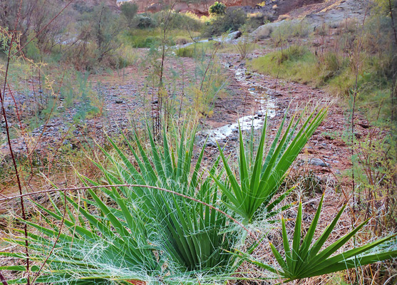
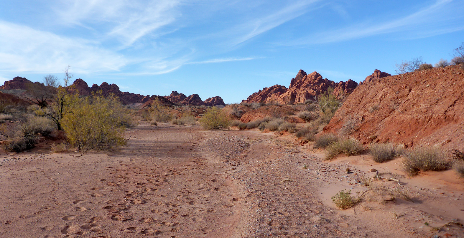
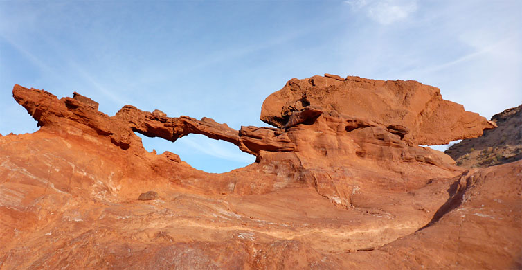
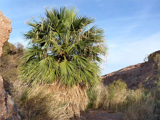
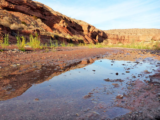
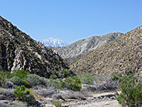
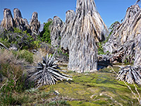
The 2.5 mile route to Charlies Spring is one of Valley of Fire State Park's unmarked, unmaintained trails, descending the generally wide drainage of Valley of Fire Wash to a desert oasis - a permanent spring surrounded by lush vegetation including a few California fan palms, and sustaining a short section of flowing stream. Along the way, the wash descends a minor pour-off into some shallow narrows, the streambed, usually dry at this point, bordered by attractive, overhanging walls of deep red sandstone, eroded and weathered. Elsewhere, the wash is filled with many wildflowers and flowering bushes, and the hike is varied in scenery as well as being very lightly used, and relatively easy.
A 6.2 mile loop can be made by continuing a little further down the canyon through less homogenous rocks of the Moenave, Kayenta and Chinle formations, then following an old track northwards a short distance and returning cross-country, mostly along a minor wash, across desert flats that are a favored location for the rare Las Vegas bearpoppy.
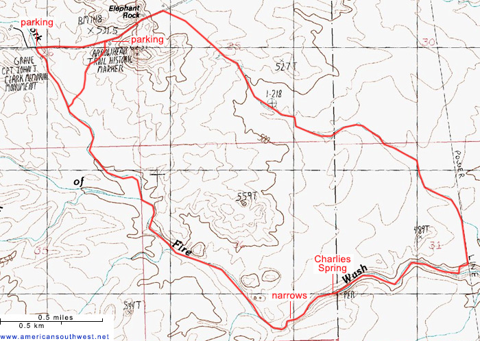
The hike starts along the main road through the state park, 0.75 miles west of the east entrance station.
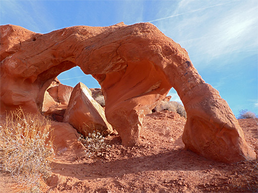
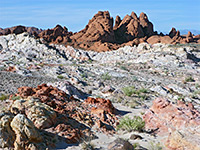
One option for parking is on the north side of the highway just west of the crossing of Valley of Fire Wash, at the entrance to a short track to a service building, while an alternative start point is feet 2,000 feet east at the Arrowhead Trail Historical Marker, a slightly elevated site giving good views south over the wash and its red rock surroundings, towards the dark peaks of the Muddy Mountains. From here, a minor tributary winds its way southwestwards, soon joining the main drainage, this around 50 feet wide and sandy-floored, bordered by low earthen banks. This is the North Fork of Valley of Fire Wash (the upstream section is Fire Canyon Wash) and it meets the main fork, even wider, 0.7 miles south. To the east is a sizeable hill of Aztec sandstone containing several small arches, worth exploring for a while. One other point of interest nearby, along the wash just south of the road, is the grave of Captain John J Clark, who died here in the summer of 1915, probably due to lack of water.
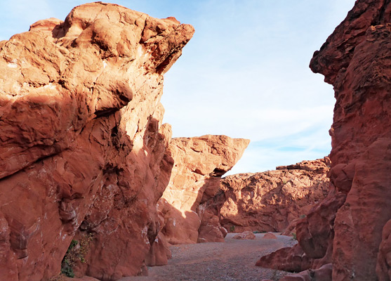
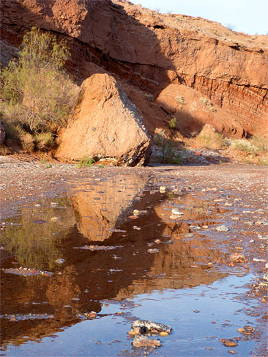
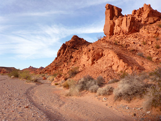
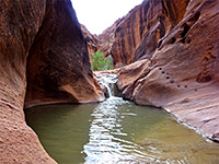
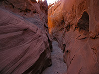
The floor of the main wash is a little stonier than the North Fork, making for easier walking. Grey mounds on the north side soon give way to more Aztec sandstone cliffs, becoming quite tall, while along the dry creek bed are several big blocks of conglomerate rock, fallen from the cliff tops. Beyond the cliffs, the wash narrows abruptly, after dropping about 15 feet over a ledge, easily climbed, into a narrow, red rock passageway, the walls of which overhang in some places; it stays quite narrow for a quarter of a mile, bending to the northeast, and gradually widens as the rocks change color from red to greyish green, and Charlies Spring comes into view, at the center of a dense patch of bushes and undergrowth, with one large palm tree by the water and several smaller ones close by. The stream and its shallow pools extend a quarter of a mile down the canyon, sometimes further.
The stream is the usual turnaround point for one-way hikes; for the loop, the canyon is followed a little further, round a couple of bends and past a purplish outcrop of the Chinle Formation on the north side, up to a 4WD track (paralleling some powerlines) which crosses from north to south, now beyond the state park boundary, into Lake Mead NRA. The track allows an easy exit of the canyon, to the north, for a quarter mile, to another, smaller drainage, which provides a route northwestwards across barren alkali desert for around 2 miles, within sight of the Elephant Rock parking lot along the highway. The loop is completed by a short cross-country walk to the road, then alongside on verges back to the start point.
A 6.2 mile loop can be made by continuing a little further down the canyon through less homogenous rocks of the Moenave, Kayenta and Chinle formations, then following an old track northwards a short distance and returning cross-country, mostly along a minor wash, across desert flats that are a favored location for the rare Las Vegas bearpoppy.
The hike starts along the main road through the state park, 0.75 miles west of the east entrance station.
Location
One option for parking is on the north side of the highway just west of the crossing of Valley of Fire Wash, at the entrance to a short track to a service building, while an alternative start point is feet 2,000 feet east at the Arrowhead Trail Historical Marker, a slightly elevated site giving good views south over the wash and its red rock surroundings, towards the dark peaks of the Muddy Mountains. From here, a minor tributary winds its way southwestwards, soon joining the main drainage, this around 50 feet wide and sandy-floored, bordered by low earthen banks. This is the North Fork of Valley of Fire Wash (the upstream section is Fire Canyon Wash) and it meets the main fork, even wider, 0.7 miles south. To the east is a sizeable hill of Aztec sandstone containing several small arches, worth exploring for a while. One other point of interest nearby, along the wash just south of the road, is the grave of Captain John J Clark, who died here in the summer of 1915, probably due to lack of water.
Valley of Fire Wash
The floor of the main wash is a little stonier than the North Fork, making for easier walking. Grey mounds on the north side soon give way to more Aztec sandstone cliffs, becoming quite tall, while along the dry creek bed are several big blocks of conglomerate rock, fallen from the cliff tops. Beyond the cliffs, the wash narrows abruptly, after dropping about 15 feet over a ledge, easily climbed, into a narrow, red rock passageway, the walls of which overhang in some places; it stays quite narrow for a quarter of a mile, bending to the northeast, and gradually widens as the rocks change color from red to greyish green, and Charlies Spring comes into view, at the center of a dense patch of bushes and undergrowth, with one large palm tree by the water and several smaller ones close by. The stream and its shallow pools extend a quarter of a mile down the canyon, sometimes further.
Return Route
The stream is the usual turnaround point for one-way hikes; for the loop, the canyon is followed a little further, round a couple of bends and past a purplish outcrop of the Chinle Formation on the north side, up to a 4WD track (paralleling some powerlines) which crosses from north to south, now beyond the state park boundary, into Lake Mead NRA. The track allows an easy exit of the canyon, to the north, for a quarter mile, to another, smaller drainage, which provides a route northwestwards across barren alkali desert for around 2 miles, within sight of the Elephant Rock parking lot along the highway. The loop is completed by a short cross-country walk to the road, then alongside on verges back to the start point.
Topo Map
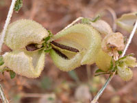
Charlies Spring Wildflowers
More wildflowers in the park
 Desert twinbugs |
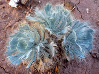 Las Vegas bearpoppy |
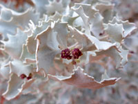 Desert holly |
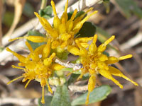 Alkali goldenbush |
More wildflowers in the park
Charlies Spring Trail - Similar Hikes
All Contents © Copyright The American Southwest | Comments and Questions | Contribute | Affiliate Marketing Disclosure | Site Map