Highlights:
Amazing volcanic formations - tall, pinkish white cones made of pumice and tuff, lining the edge of a remote valley (Peralta Canyon). Narrow ravines wind between the pinnacles, and the ground is scattered with shiny pieces of obsidian. Two hiking trails
Nearby town:
Santa Fe, 35 miles
Management:
Location:
Seasons:
All year, though currently closed
Rating (1-5):
★★★★★

Kasha-Katuwe Tent Rocks is part of the New Mexico Highlights itinerary
Update, 2024: Kasha-Katuwe Tent Rocks National Monument finally reopens in November 2024, after being closed for over four years due to COVID. Reservations are now required for entry.
The Tent Rocks were a little known BLM site before their elevation to national monument status in January 2001, but now the area has improved access and facilities, and sees a steady stream of visitors. Kasha-Katuwe is a Keresan phrase meaning 'white cliffs', Keres being the traditional language of the pueblo tribes of northern New Mexico.
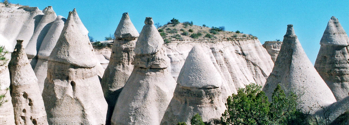
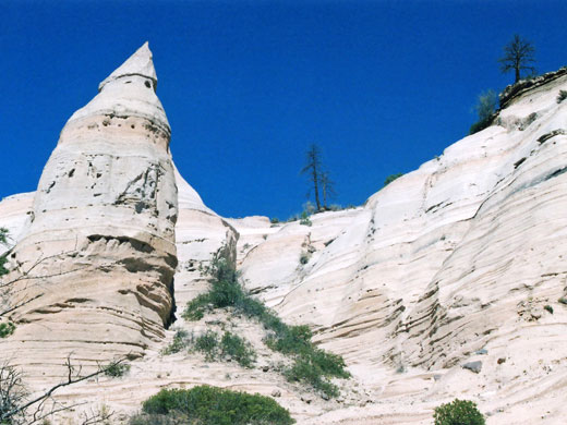
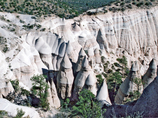
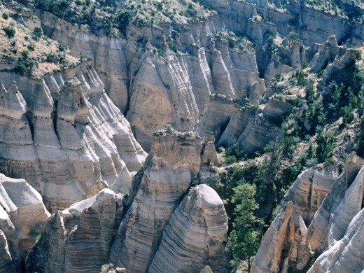
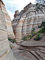
The teepee-like formations cover a small area but are quite remarkable, unique in the Southwest - hundreds of white, pinkish or grey spires, sharply conical in shape, lacking any covering vegetation, that occur in several groups on the east side of Peralta Canyon, on the Pajarito Plateau 40 miles west of Santa Fe.
The Tent Rocks were a little known BLM site before their elevation to national monument status in January 2001, but now the area has improved access and facilities, and sees a steady stream of visitors. Kasha-Katuwe is a Keresan phrase meaning 'white cliffs', Keres being the traditional language of the pueblo tribes of northern New Mexico.
The teepee-like formations cover a small area but are quite remarkable, unique in the Southwest - hundreds of white, pinkish or grey spires, sharply conical in shape, lacking any covering vegetation, that occur in several groups on the east side of Peralta Canyon, on the Pajarito Plateau 40 miles west of Santa Fe.
Kasha-Katuwe Tent Rocks Table of Contents
Photographs
14 views of the Kasha-Katuwe Tent Rocks.
Geology of the Tent Rocks
The rocks were formed by erosion of thick layers of pumice and tuff, and since the overlying sandstone strata are more resistant to erosion, residual pieces form caprocks over the ash, which, being so soft, erodes rapidly downwards, creating the tall spires. If a cap rock is dislodged, the spire quickly (in geological timescales) weathers away, though new ones gradually form further up the hillside. The tuff is a remnant of explosive volcanic eruptions of between 6 and 7 million years ago, as are pieces of obsidian, a translucent, brown/black volcanic glass known locally as Apache Tears, which can be found scattered over the washes and cliffs of the monument and especially around the river in the main valley, though collecting samples is not allowed.
Tent Rocks Approach Route
The national monument is somewhat isolated but well signposted, starting from exits 259 (NM 22) or 264 (NM 16) of interstate 25 between Albuquerque and Santa Fe. Both roads are relatively busy, and converge at Pena Blanca after which NM 22 is narrower, passing through several sleepy settlements. The highway turns north in front of the 4.5 mile wide, 250 feet high Cochiti Dam across the Rio Grande - a rather incongruous sight in the otherwise natural, unspoilt valley, this was completed in 1975 and now contains the 7 mile long Cochiti Lake, popular for fishing and boating. The main road bends back to the southwest into Pueblo de Cochiti, the main village in the 53,779 acre Cochiti Indian Reservation.
Road from Cochiti Pueblo
The pueblo has a few facilities including a store and gas station, and is a welcoming place, with opportunities to view the life and history of the native peoples. The one main regulation is a ban on photography and all forms of recording, even drawing and painting. The last 5 miles of the route to the tent rocks is along BIA 92 (later FR 266) - once a bumpy gravel track, this was paved in 2010 as far as the rocks. Although the track continues through large areas of public BLM land in the Santa Fe National Forest and the Jemez Mountains, the country surrounding the national monument is privately owned, so various signs warn of no trespassing and other land use regulations. In the monument, the main activity is hiking along one of the two maintained trails. As of 2009, dogs are not permitted.
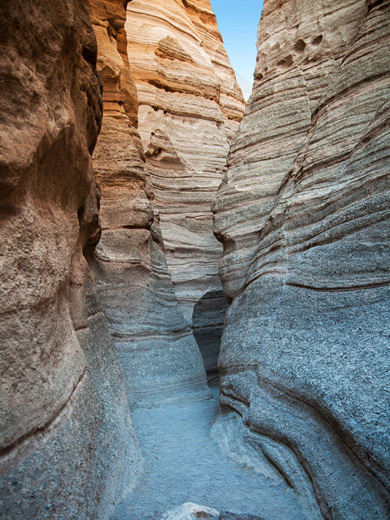
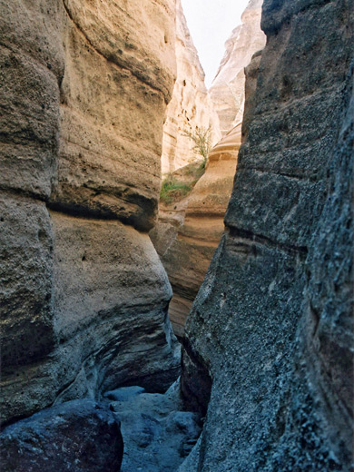
Trails of Kasha-Katuwe Tent Rocks
The 1.2 mile Cave Loop Trail around a side valley and the 1.5 mile (one-way) Slot Canyon Trail, through a narrow ravine and up to the plateau
Kasha-Katuwe Tent Rocks - Nearby Places
- Bandelier National Monument (90 miles) - ancient dwellings in a volcanic canyon
- Petroglyph National Monument (55 miles) - thousands of petroglyphs carved on volcanic boulders
- Santa Fe (45 miles) - the historic state capitol of New Mexico
Kasha-Katuwe Tent Rocks - Similar Places
- Valley of Fire State Park, Nevada - eroded rock formations and slot canyons
All Contents © Copyright The American Southwest | Comments and Questions | Contribute | Affiliate Marketing Disclosure | Site Map