A'a and Lava's Edge Trails, Sunset Crater Volcano National Monument
Arizona > Sunset Crater Volcano National Monument > A'a and Lava's Edge Trails
A'a and Lava's Edge Trails
Two short paths, one a constructed loop across a patch of a'a lava, the other a more primitive route through sparse pine woods along the south edge of the lava, close to the park road
Length: 0.25 mile loop (A'a), 1.8 miles one way (Lava's Edge)
Elevation change: level, 30 feet
Difficulty: Easy
Type: Loop, one-way
Usage: High, medium
Season: All year
Trailhead: Pullout along the main road, Hwy 395
Rating (1-5): ★★★★★
Elevation change: level, 30 feet
Difficulty: Easy
Type: Loop, one-way
Usage: High, medium
Season: All year
Trailhead: Pullout along the main road, Hwy 395
Rating (1-5): ★★★★★

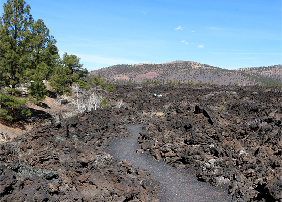
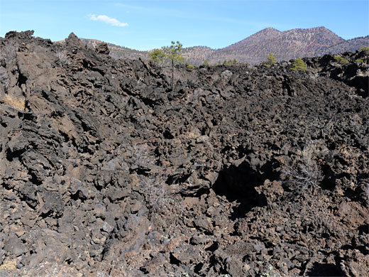
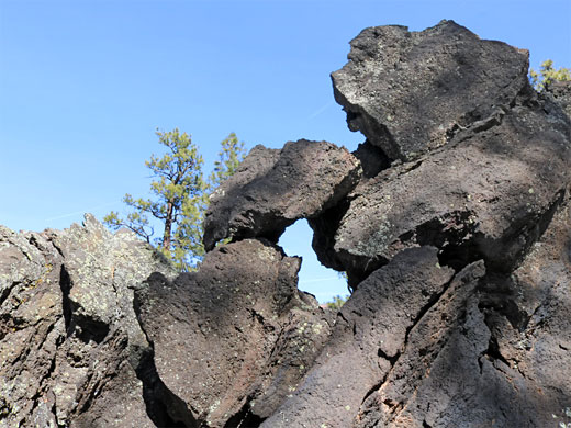
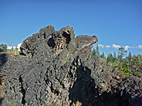
The A'a and Lava's Edge Trails are two short paths in Sunset Crater Volcano National Monument, starting from the same point; the former is a constructed loop through the jagged rocks of the Bonito Lava Flow, past pinnacles and cavities, the other a more primitive path that runs along the south edge of the flow, mostly staying close to the park road.
The A'a Trail, a 0.3 mile circuit, is usually quite busy, while the Lava's Edge Trail, much less used, is 1.6 miles one-way though its latter section moves away from the lava, through the pine woods and meets the road again beside a forest service campground, outside the national monument, so one could turn back after about a mile having seen all the volcanic features.
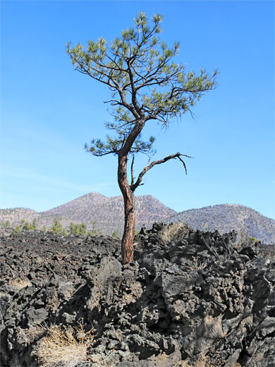
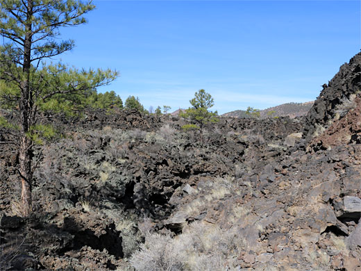
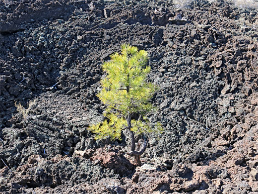
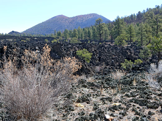
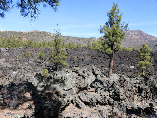
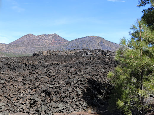
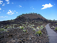
Overall the scenery is similar on both routes; close-up views of lava, and across to the nearby volcanic peaks including Sunset Crater to the east, Lenox Crater to the south and O'Leary Peak to the north. The vegetation is rather limited, as expected; mostly large ponderosa pines, plus bushes and scattered wildflowers. Both trails can be hiked in around an hour.
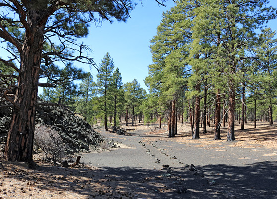
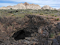
The two paths begin from the same pullout, on the north side of the road, 1.3 miles from the visitor center, and opposite a third route, to Lenox Crater. The A'a Trail heads north about 250 feet into the lava, crossing a low basin and turning back at the base of a lava ridge, all the while surrounded by the rough lava field. The Lava's Edge Trail runs westwards from the parking area and for over half a mile follows the narrow, lightly wooded corridor between the lava and the road. The lava often rises above the path, by ten feet or more, forming ridges, spires and the occasional arch. The pine trees are large and well separated, mingling with plenty of dead wood, some partially burnt in wildfires. The trail then curves away from the road, as it exits the national monument, the boundary marked by a sign, continuing to follow the edge of the lava but now not so close, as the deposits become lower in relief. The path briefly re-enters the monument before moving away from the lava for the last time, crossing open woodland and soon passing the edge of the USFS campground, ending at the main road just opposite the Sunset Crater visitor center.
The A'a Trail, a 0.3 mile circuit, is usually quite busy, while the Lava's Edge Trail, much less used, is 1.6 miles one-way though its latter section moves away from the lava, through the pine woods and meets the road again beside a forest service campground, outside the national monument, so one could turn back after about a mile having seen all the volcanic features.
Overall the scenery is similar on both routes; close-up views of lava, and across to the nearby volcanic peaks including Sunset Crater to the east, Lenox Crater to the south and O'Leary Peak to the north. The vegetation is rather limited, as expected; mostly large ponderosa pines, plus bushes and scattered wildflowers. Both trails can be hiked in around an hour.
The Trails
The two paths begin from the same pullout, on the north side of the road, 1.3 miles from the visitor center, and opposite a third route, to Lenox Crater. The A'a Trail heads north about 250 feet into the lava, crossing a low basin and turning back at the base of a lava ridge, all the while surrounded by the rough lava field. The Lava's Edge Trail runs westwards from the parking area and for over half a mile follows the narrow, lightly wooded corridor between the lava and the road. The lava often rises above the path, by ten feet or more, forming ridges, spires and the occasional arch. The pine trees are large and well separated, mingling with plenty of dead wood, some partially burnt in wildfires. The trail then curves away from the road, as it exits the national monument, the boundary marked by a sign, continuing to follow the edge of the lava but now not so close, as the deposits become lower in relief. The path briefly re-enters the monument before moving away from the lava for the last time, crossing open woodland and soon passing the edge of the USFS campground, ending at the main road just opposite the Sunset Crater visitor center.
A'a and Lava's Edge Trails - Similar Hikes
All Contents © Copyright The American Southwest | Comments and Questions | Contribute | Affiliate Marketing Disclosure | Site Map