Highlights:
Lava flows, lava tubes, craters, fissures and cinder cones, alongside Hat Creek in north California, near Lassen Volcanic National Park. Two developed sites are Subway Cave and the Spattercone Trail
Nearby town:
Susanville, 52 miles
Management:
USFS - part of Lassen National Forest
Location:
40.669, -121.442 (Spattercone Trail) 40.685, -121.419 (Subway Cave)
Seasons:
May to October; area is covered by snow in winter
Rating (1-5):
★★★★★

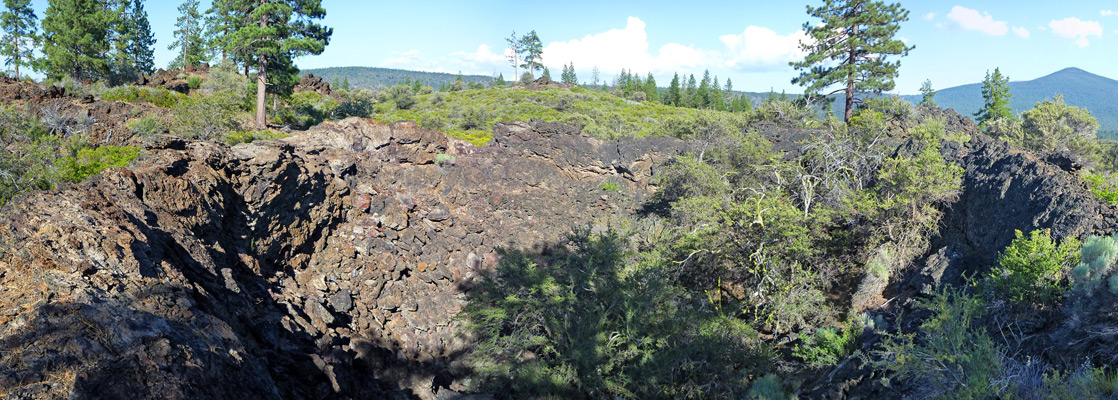
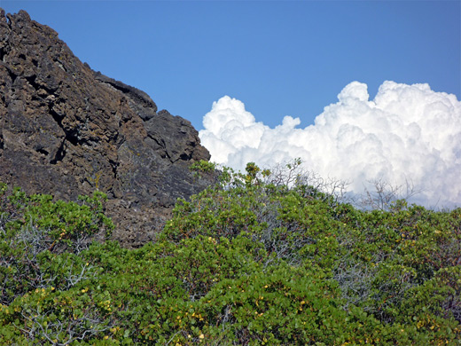
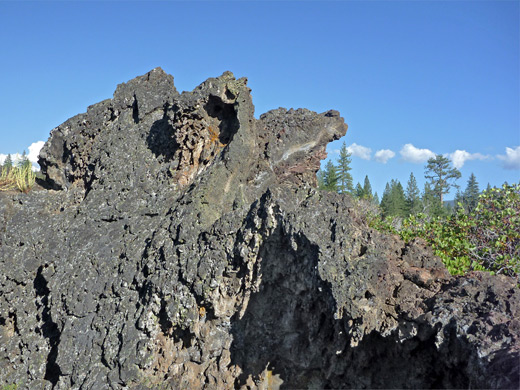
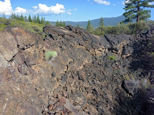
The second largest deposits of ancient lava in California (after Lava Beds National Monument) are found just north of Lassen Volcanic National Park; a black, jagged, mostly treeless expanse stretching for over 20 miles alongside Hat Creek and Hwy 89. Features include cinder cones, lava tubes and small craters, and although the majority is trailless wilderness, part of Lassen National Forest, the USFS have developed two sites, both near the small town of Old Station, either side of the 89-44 junction. One is a short but fascinating lava tube (Subway Cave), characterised by particularly smooth walls and a neat oval cross-section, and the other is the Spatter Cone area, where a 1.7 mile loop trail visits several craters, cave entrances, fissures and other, small scale formations.
Both sites have a USFS campground close by, and there are several other forest campgrounds further north, also within sight of the lava field, while free camping is also possible, along the many tracks branching off the highway. The visible results of the volcanic activity in this region date from around 20,000 years ago though the area is still geologically active, associated with a faultline that is causing Hat Creek Valley to deepen, relative to a steep escarpment (Hat Creek Ridge) on the east side.
Both sites have a USFS campground close by, and there are several other forest campgrounds further north, also within sight of the lava field, while free camping is also possible, along the many tracks branching off the highway. The visible results of the volcanic activity in this region date from around 20,000 years ago though the area is still geologically active, associated with a faultline that is causing Hat Creek Valley to deepen, relative to a steep escarpment (Hat Creek Ridge) on the east side.
Hat Creek Table of Contents
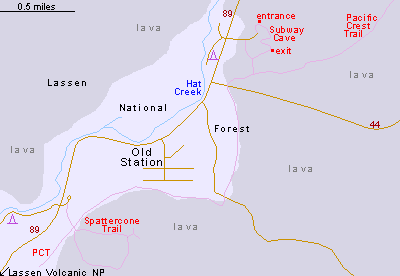
Subway Cave
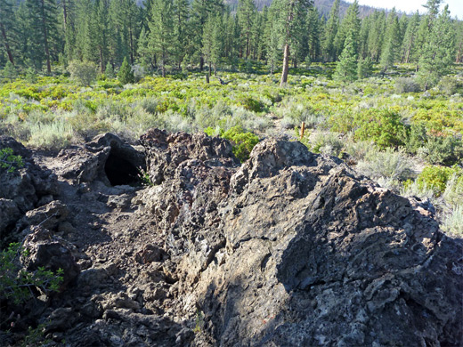
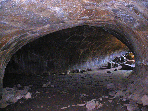
Subway Cave is the most visited location in the Hat Creek area, and may be reached by a side road just north of the highway 89-44 junction, ending at a parking area with interpretive notices, rest rooms and picnic tables. The surrounding land is completely covered by lava, here sparsely wooded, with many of the trees burnt in a recent wildfire. A very short walk leads to the cave entrance, where steps enable an easy descent to the floor. The passage extends both ways; on the left the cave has a rather low ceiling and is soon blocked by a fence, but the main section is to the right. The walkable part is only about a quarter of a mile, but this is more than long enough to be completely dark for some distance in the middle, and here are found two short branches, joining at a large central chamber. The roof of the cave is smooth apart from small lavacicles, where lava dripped slowly down before cooling, while the floor is generally flat, formed of solidified lava ripples. The return to the trailhead is via a trail above ground, running on top of the cave, which forms a low ridge, winding across the surrounding lava.
Spatter Cones
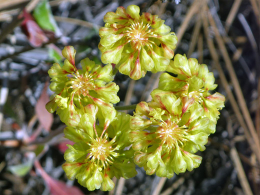
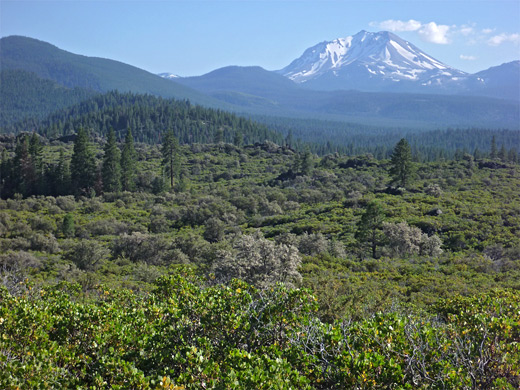
The Spatter Cones trailhead is also well equipped; a large parking area with drinking water, trail brochures, rest rooms and information about the local geology. The path traverses a narrow band of tall, well separated ponderosa and Jeffrey pine trees, crosses the Pacific Crest Trail then begins a 1.5 mile loop across an overgrown lava field, along which are 17 numbered stops corresponding to entries in the trail guide. Not all are interesting but some are, including lava mounds with hexagonal jointing, two good sized spatter cones enclosed by rings of colorful, weathered rocks, a vertical lava vent (fenced off for safety), and a smaller crater (Spatter Tube) drained by a tiny lava cave. The trail also has long distance views across the open surroundings towards several much larger volcanic summits, highest being Lassen Peak, 12 miles south.
Hat Creek - Nearby Places
- McArthur-Burney Falls Memorial State Park (28 miles) - beautiful elongated waterfall, and a forested lake
- Lassen Volcanic National Park (13 miles) - spectacular geothermal and volcanic features
Hat Creek - Similar Places
- El Malpais National Monument, New Mexico - great expanse of twisted lava and many other volcanic formations
- Lava Beds National Monument, California - hundreds of lava caves, plus craters and cinder cones
All Contents © Copyright The American Southwest | Comments and Questions | Contribute | Affiliate Marketing Disclosure | Site Map