Lenox Crater Trail, Sunset Crater Volcano National Monument
Arizona > Sunset Crater Volcano National Monument > Lenox Crater Trail
Lenox Crater Trail
Short, easy loop through sparse ponderosa pine woodland, over slopes of red and black ash, to the rim of a shallow crater at the summit of a cinder cone. Gives excellent views of the surrounding volcanoes and mountains
Length: 1.2 miles, loop
Elevation change: 300 feet
Difficulty: Easy
Type: Loop
Usage: High
Season: Spring, summer, fall
Trailhead: Pullout along the main road, Hwy 395
Rating (1-5): ★★★★★
Elevation change: 300 feet
Difficulty: Easy
Type: Loop
Usage: High
Season: Spring, summer, fall
Trailhead: Pullout along the main road, Hwy 395
Rating (1-5): ★★★★★

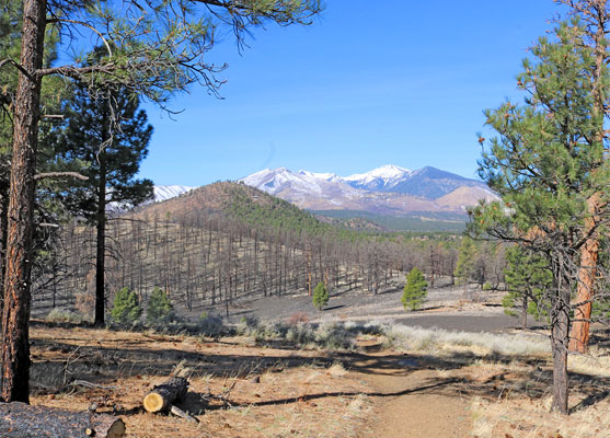
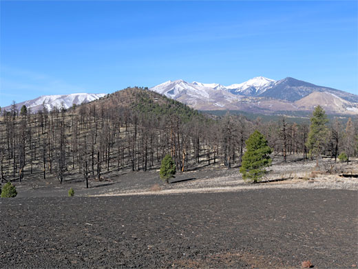
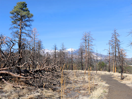
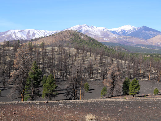
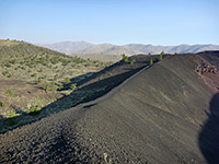
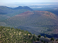
Like all paths in Sunset Crater Volcano National Monument, the Lenox Crater Trail is short, easy and popular. Starting from a pullout along the park road, Hwy 395, the 1.2 mile loop climbs through sparse ponderosa pine woodland to the rim of a shallow crater at the summit of a cinder cone, the ground now mostly treeless, giving excellent views of other nearby volcanoes including Sunset Crater and O'Leary Peak, and west towards the much higher San Francisco Peaks.
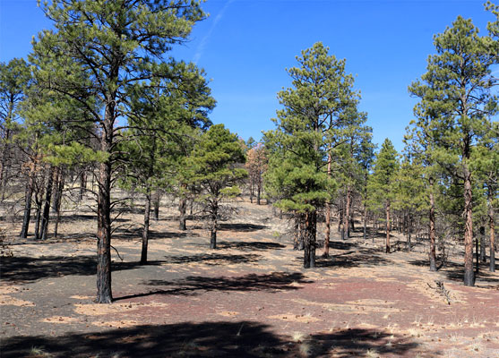
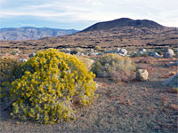
From the summit, the path follows the rim a short distance then descends the east side of the cone back to the road. The surface along the majority of the route is red and black ash, with little undergrowth, though a good selection of wildflowers are blooming in the summer.
The roadside pullout is mostly used for the A'a and Lava's Edge trails, on the north side of the road; the Lenox Crater Trail starts on the south side and is not obviously signed. An alternative start point is the main parking lot, 1,000 feet down the road, used primarily for the Lava Flow Trail, from where a short path connects to the route up Lenox Crater.
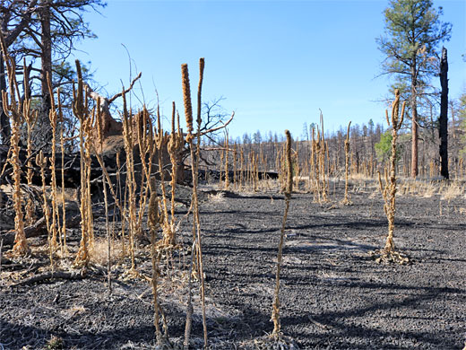
The roadside path to Lenox Crater enters open ponderosa pine forest, damaged in a recent wildfire, and has a constant incline from the start, though is not too steep, heading generally west towards the San Francisco Peaks, which soon come into full view. The trail bends south, now over nearly treeless terrain, as the surface changes from relatively firm ash to loose cinders. It passes a designated viewpoint, of the peaks, accompanied by two notices, then soon after turns a corner and descends the east face of the crater, through even more scattered trees, generally rather drier and sunnier than the north side. In the lower reaches nearly all trees are dead, from the wildfire. Just before reaching the road again is a junction, with the connecting path to the Lava Flow parking.
From the summit, the path follows the rim a short distance then descends the east side of the cone back to the road. The surface along the majority of the route is red and black ash, with little undergrowth, though a good selection of wildflowers are blooming in the summer.
Lenox Crater Trailhead
The roadside pullout is mostly used for the A'a and Lava's Edge trails, on the north side of the road; the Lenox Crater Trail starts on the south side and is not obviously signed. An alternative start point is the main parking lot, 1,000 feet down the road, used primarily for the Lava Flow Trail, from where a short path connects to the route up Lenox Crater.
The Trail
The roadside path to Lenox Crater enters open ponderosa pine forest, damaged in a recent wildfire, and has a constant incline from the start, though is not too steep, heading generally west towards the San Francisco Peaks, which soon come into full view. The trail bends south, now over nearly treeless terrain, as the surface changes from relatively firm ash to loose cinders. It passes a designated viewpoint, of the peaks, accompanied by two notices, then soon after turns a corner and descends the east face of the crater, through even more scattered trees, generally rather drier and sunnier than the north side. In the lower reaches nearly all trees are dead, from the wildfire. Just before reaching the road again is a junction, with the connecting path to the Lava Flow parking.
Lenox Crater Wildflower
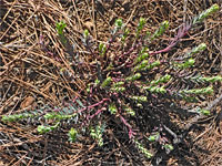 Woodland spurge |
Lenox Crater Trail - Similar Hikes
All Contents © Copyright The American Southwest | Comments and Questions | Contribute | Affiliate Marketing Disclosure | Site Map