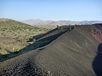
Big Tubes
Selection of easily-explored volcanic features: two lava caves, several collapses from other lava tubes, a lava trench and a crater
Length: 3 miles
Elevation change: 200 feet
Difficulty: Easy
Type: Loop
Usage: Medium
Season: Spring to fall
Trailhead: End of a short side road off Hwy 53
Rating (1-5): ★★★★★
Elevation change: 200 feet
Difficulty: Easy
Type: Loop
Usage: Medium
Season: Spring to fall
Trailhead: End of a short side road off Hwy 53
Rating (1-5): ★★★★★

At El Calderon, visitors to El Malpais National Monument can explore a variety of volcanic features in a compact area along an easy 3 mile loop trail, including two lava caves, several collapses from other lava tubes, a lava trench and a crater, from where most of the surrounding lava originated, some 115,000 years ago. The landscape is not as spectacular as the other noted region in this part of the national monument (Big Tubes), but El Calderon is much easier to reach, being less than half a mile from NM 53 on an improved gravel track, which forks south off the highway 2.5 miles east of the NPS information center.
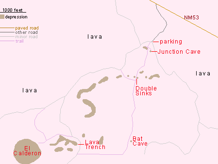
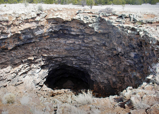
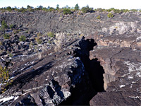
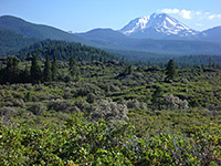
The gravel road ends at a parking area from where a dirt track continues south towards the high country of Cerritos de Jaspe in the adjacent El Malpais National Conservation Area; 4WD vehicles are recommended, and free primitive camping is allowed en route. The surroundings are fairly level, a mixture of grassland and pine/aspen forest, plus plenty of basalt lava though most is overgrown and indistinct; only a few cave openings, trenches and the crater interrupt the general flatness. The first site along the path, just a few minute's walk from the parking lot, is Junction Cave - quite an extensive lava tube (quarter of a mile long) with one branch, but the passages are not so pretty, lacking any ice formations and with a floor of broken boulders, changing to smooth mud near the end as the ceiling becomes lower. Next are the Double Sinks, two adjacent, 80 foot deep sinkholes formed by collapse of a lava tube, both guarded by vertical sides above overhanging walls so climbing down is not possible. Other caved-in sections of the tube can be seen by walking off trail to the west or east. Half a mile south of the sinks, the trail passes Bat Cave, a smaller lava tunnel that is home to at least four species of bats. Entry is forbidden all year. The land hereabouts is clear of trees, allowing long views eastwards, all across the El Malpais lava flow to the cream-colored sandstone bluffs on the far side.
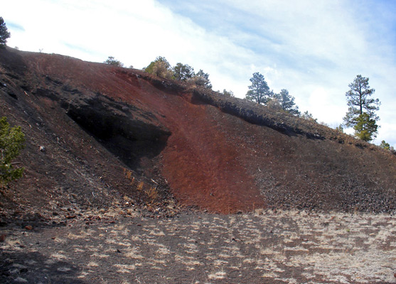
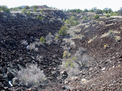
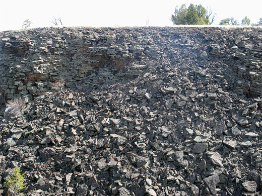
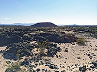
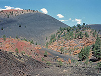
After the bat cave, the path turns due west and runs alongside the national monument boundary fence, up a gentle incline, to an intersection with a disused track. Turning right, this soon passes by the end of Lava Trench, which is a boulder-filled, V-shaped ravine created by fast moving lava that didn't flow long or deep enough to form a tube. The walls of the trench are made of many thin layers from different lava flows, similar in appearance to thin-bedded sandstone. The track follows the rim of the trench a short distance until the loop path branches off, heading west towards the source of the lava, at El Calderon crater, 1,000 feet across and 200 feet deep, reached by a short spur trail. Large pines grow on the floor of the crater in the middle of the cone, much taller than trees of the same species on the rim since more water collects here, and the inside of the crater is more sheltered from the wind. In fact the tops of all trees in the crater are at about the same level, whether on the floor, along the sloping sides or on the rim. From El Calderon, the loop trail is completed by a 1.3 mile walk northwards, mostly along Cerritos de Jaspe Road, through forested land without passing anything else of interest.
El Calderon Access
The gravel road ends at a parking area from where a dirt track continues south towards the high country of Cerritos de Jaspe in the adjacent El Malpais National Conservation Area; 4WD vehicles are recommended, and free primitive camping is allowed en route. The surroundings are fairly level, a mixture of grassland and pine/aspen forest, plus plenty of basalt lava though most is overgrown and indistinct; only a few cave openings, trenches and the crater interrupt the general flatness. The first site along the path, just a few minute's walk from the parking lot, is Junction Cave - quite an extensive lava tube (quarter of a mile long) with one branch, but the passages are not so pretty, lacking any ice formations and with a floor of broken boulders, changing to smooth mud near the end as the ceiling becomes lower. Next are the Double Sinks, two adjacent, 80 foot deep sinkholes formed by collapse of a lava tube, both guarded by vertical sides above overhanging walls so climbing down is not possible. Other caved-in sections of the tube can be seen by walking off trail to the west or east. Half a mile south of the sinks, the trail passes Bat Cave, a smaller lava tunnel that is home to at least four species of bats. Entry is forbidden all year. The land hereabouts is clear of trees, allowing long views eastwards, all across the El Malpais lava flow to the cream-colored sandstone bluffs on the far side.
The Trail
After the bat cave, the path turns due west and runs alongside the national monument boundary fence, up a gentle incline, to an intersection with a disused track. Turning right, this soon passes by the end of Lava Trench, which is a boulder-filled, V-shaped ravine created by fast moving lava that didn't flow long or deep enough to form a tube. The walls of the trench are made of many thin layers from different lava flows, similar in appearance to thin-bedded sandstone. The track follows the rim of the trench a short distance until the loop path branches off, heading west towards the source of the lava, at El Calderon crater, 1,000 feet across and 200 feet deep, reached by a short spur trail. Large pines grow on the floor of the crater in the middle of the cone, much taller than trees of the same species on the rim since more water collects here, and the inside of the crater is more sheltered from the wind. In fact the tops of all trees in the crater are at about the same level, whether on the floor, along the sloping sides or on the rim. From El Calderon, the loop trail is completed by a 1.3 mile walk northwards, mostly along Cerritos de Jaspe Road, through forested land without passing anything else of interest.

Nearby Trails
El Calderon - Similar Hikes
All Contents © Copyright The American Southwest | Comments and Questions | Contribute | Affiliate Marketing Disclosure | Site Map