Lava Falls Trail, El Malpais National Monument
New Mexico > El Malpais National Monument > Lava Falls Trail

Lava Falls Trail
Cairned route across the edge of a relatively young lava flow near the southern tip of the national monument, past a variety of volcanic features including a small lava fall
Length: 1 mile (loop)
Elevation change: 50 feet
Difficulty: Easy
Type: Cairned loop
Usage: Low to medium
Season: All year, though affected by snow in the winter
Trailhead: End of a 0.8 track west of Hwy 117
Rating (1-5): ★★★★★
Elevation change: 50 feet
Difficulty: Easy
Type: Cairned loop
Usage: Low to medium
Season: All year, though affected by snow in the winter
Trailhead: End of a 0.8 track west of Hwy 117
Rating (1-5): ★★★★★

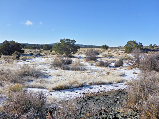
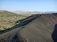
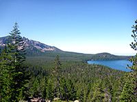
The Lava Falls Trail is the shortest of the four hiking paths in El Malpais National Monument; a one mile loop across the pahoehoe lava from McCartys Crater, the most recently active volcano in the area, last erupting around 3,000 years ago. This location is nearly at the southern tip of the monument, in a generally flat region though just over a mile from a long line of sandstone cliffs to the east, part of the Cebolla Wilderness.
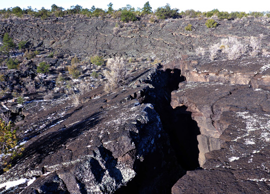
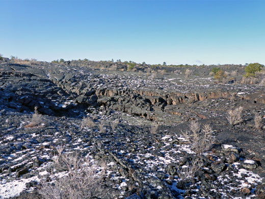
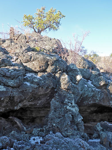
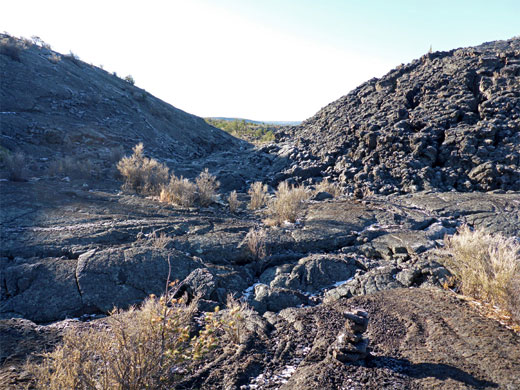
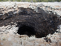
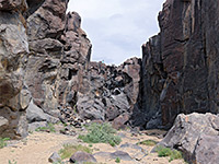
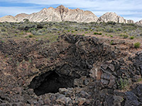
From the trailhead, at the end of a gravel spur road off Hwy 117, the cairned route loops across low relief terrain of ridges, gullies and plateaus, passing narrow fissures, shallow sinkholes, squeeze-ups and stunted pinyon pines, plus two more notable sites, a natural amphitheater formed by a circular inflation ridge enclosing a shallow basin, and the lava fall itself, a solidified pour-off where lava once flowed over a four foot-high ledge.
The scenery is for the most part comparable to all other parts of the monument, just less vegetated, and it only takes half an hour for a leisurely walk along the trail. The low relief means there are few long distance views, and the surroundings tend to look similar in all directions. Because of the remote location, the path is visited rather less often than other areas further north, closer to Interstate 40.
Lava Falls is the southernmost named feature in the national moment, though the National Conservation Area continues beyond, and here is found the southern end of the Chain of Craters Backcountry Byway. The trailhead is reached by a level, 0.8 mile unpaved road that winds through sparse trees to a secluded parking area, potentially suitable as an overnight primitive campsite, since there are no notices to say otherwise.
Counter-clockwise is the suggested direction for the loop, and while there is at first no sign of any volcanic activity, the lava very soon comes into view, and the terrain underfoot changes abruptly from earth to black basalt. The remainder of the route is marked with closely-spaced cairns, sometimes only ten paces apart. Nine points of interest are identified by signs and described in an illustrated guide available at the start. The path rises slightly, passes an elongated sinkhole on the right and another on the left, all surrounded by many smaller depressions, then runs along a hollow below a ridge, an area with a few larger trees, and onto the lava fall, stop number 4. Just beyond is a short spur into the amphitheater, enclosed by a curving ridge, approximately at the halfway point of the loop. The return is southeastwards, close to another long ridge, and later between two large sunken patches.
From the trailhead, at the end of a gravel spur road off Hwy 117, the cairned route loops across low relief terrain of ridges, gullies and plateaus, passing narrow fissures, shallow sinkholes, squeeze-ups and stunted pinyon pines, plus two more notable sites, a natural amphitheater formed by a circular inflation ridge enclosing a shallow basin, and the lava fall itself, a solidified pour-off where lava once flowed over a four foot-high ledge.
The scenery is for the most part comparable to all other parts of the monument, just less vegetated, and it only takes half an hour for a leisurely walk along the trail. The low relief means there are few long distance views, and the surroundings tend to look similar in all directions. Because of the remote location, the path is visited rather less often than other areas further north, closer to Interstate 40.
Lava Falls Location
Lava Falls is the southernmost named feature in the national moment, though the National Conservation Area continues beyond, and here is found the southern end of the Chain of Craters Backcountry Byway. The trailhead is reached by a level, 0.8 mile unpaved road that winds through sparse trees to a secluded parking area, potentially suitable as an overnight primitive campsite, since there are no notices to say otherwise.
The Trail
Counter-clockwise is the suggested direction for the loop, and while there is at first no sign of any volcanic activity, the lava very soon comes into view, and the terrain underfoot changes abruptly from earth to black basalt. The remainder of the route is marked with closely-spaced cairns, sometimes only ten paces apart. Nine points of interest are identified by signs and described in an illustrated guide available at the start. The path rises slightly, passes an elongated sinkhole on the right and another on the left, all surrounded by many smaller depressions, then runs along a hollow below a ridge, an area with a few larger trees, and onto the lava fall, stop number 4. Just beyond is a short spur into the amphitheater, enclosed by a curving ridge, approximately at the halfway point of the loop. The return is southeastwards, close to another long ridge, and later between two large sunken patches.
Nearby Trails
Lava Falls Trail - Similar Hikes
All Contents © Copyright The American Southwest | Comments and Questions | Contribute | Affiliate Marketing Disclosure | Site Map