Sentinel Meadows, Yellowstone National Park
Wyoming > Yellowstone National Park > The Southwest > Hiking > Sentinel Meadows
Sentinel Meadows
Relatively quick hike to an unspoilt backcountry thermal region, containing geyser cones and a selection of hot pools of varying sizes. A good chance of spotting bison en route. Off trail exploration needed for close-up views of the features
Length: 2.2 miles
Elevation change: 40 feet
Difficulty: Easy
Type: One way
Usage: Low
Season: Summer, fall
Trailhead: End of the north section of Fountain Flats Road
Rating (1-5): ★★★★★
Elevation change: 40 feet
Difficulty: Easy
Type: One way
Usage: Low
Season: Summer, fall
Trailhead: End of the north section of Fountain Flats Road
Rating (1-5): ★★★★★

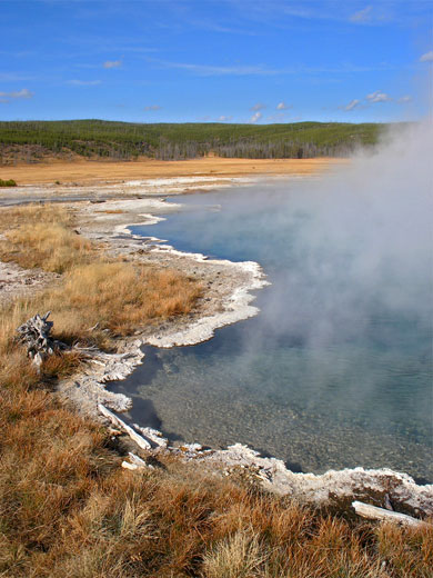
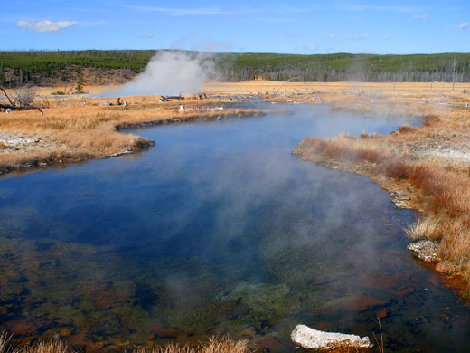
Yellowstone National Park's Lower Geyser Basin includes several lesser-known groups of thermal features, away from the popular sites along the Grand Loop Road, and perhaps the most interesting is located in Sentinel Meadows, 2 miles west of the Firehole River at the edge of the Fountain Flats. Scattered over the level, moist grassland are several large white geyser cones each with a bubbling spring on top, together with many other hot pools, some surrounded by a large expanse of deposited terraces and sinter formations.
Although the lightly-used trail to the meadows skirts the edge of the valley, allowing only rather distant views of the features, they can be seen close up by careful off-trail hiking, over ground that is often marshy, crossed by small streams and has some areas with hidden hot vents, so like all such hiking in Yellowstone, anyone who leaves the path does so at their own risk.
Thermal features in the Sentinel Meadows basin (mp4; 2:06 min; 18 mb).
The Sentinel Meadows Trail begins along the Fountain Flats Road (also known as Freight Road), which follows the Firehole River past lush grasslands, popular with elk and bison. After 2 miles, a car park and gate mark the end of the vehicle-accessible part of the road, though it does continue (unpaved) for several miles south, eventually rejoining the main highway at Midway Geyser Basin; past the gate, the route is open only to foot, horse and cycle traffic.
From the parking area, the Fountain Flats Road soon crosses the Firehole River, via a steel bridge built right next to a pretty hot spring (Ojo Caliente); this produces quite a large volume of water, which flows into the river along several run-off channels, colored bright yellow by deposited sulfur. Steam plumes rising to the south indicate the location of many other nearby springs along the Firehole (part of the River Group of geysers), but the Sentinel Meadows Trail heads west, over open grassland - a refreshing change from the dense woodland that encloses most backcountry paths in Yellowstone. The horizon to the north is formed by low hills marking the edge of Madison Plateau, while the land also slopes up a few hundred feet to the south. The narrow path crosses a stream (Fairy Creek), climbs slightly over a low ridge bearing burnt pine trunks and a few small new trees, then descends back to the grassland.
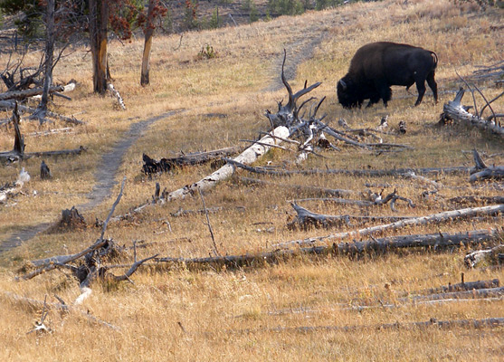
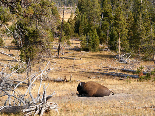
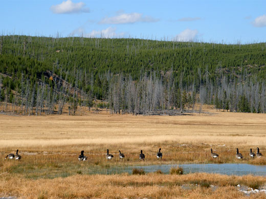
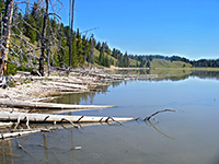
After a second stream crossing (Sentinel Creek), the meadow widens, and steam clouds from the springs ahead first come into view. The trail veers southwards, leading up a small hill past scattered trees and bushes, then winds along the south side of the valley, staying slightly above the floor, and not approaching close to any of the springs, which are mostly towards the middle of the meadows, a quarter mile or more from the path. All this area is prime bison country, and there are usually many animals in view, both at their wallows in the sandy ground near the trail, and grazing in the distant grassland. Two miles from the start, the route turns southeast, leaves the meadows and begins a gentle climb up a shallow ravine, where it enters a patch of lodgepole pine woodland, crosses over a divide and later rejoins the Fountain Flats Road near Goose Lake.
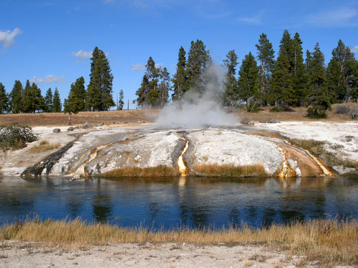
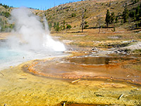
Ojo Caliente - hot spring draining into the Firehole River via several sulfur-lined run-off channels
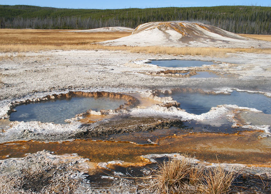
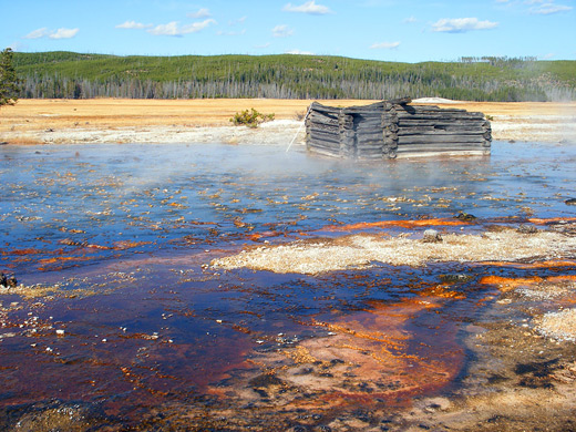
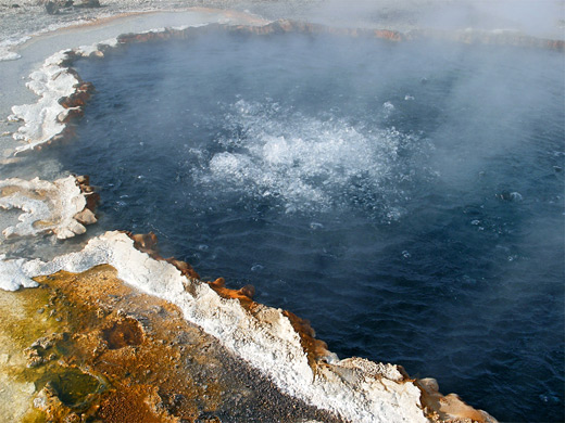
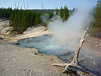
The most famous thermal feature in Sentinel Meadows, and also the furthest west, is Red Terrace Spring - a deep hot pool that has created a large area of deposited sinter terraces, colored bluish-red by the cyanobacteria that live in the water. In the 1880s this remote pool was used for bathing and washing clothes, acquiring the original name of Queens Laundry, and the remains of a two-room log bath house still stand, now completely enclosed by the terraces. The spring is located 1/4 mile northwest of the point where the trail enters the southeast-trending ravine, reached by a walk over level ground that starts off quite firm then becomes soft and wet as the spring approaches. The first thermal pool encountered is Dumbbell Spring, a very deep, sheer-sided pool of brownish-blue water through which large bubbles slowly rise. The rather hotter, more active but equally deep Red Terrace Spring is just beyond, its sizeable run-off spreading out northwestwards over the intricate terraces, gradually consuming the log cabin, and becoming less colorful further down the slope as the water temperature decreases. The waters recollect in a warm pool near the middle of the valley, a popular place for birds and other wildlife to gather. Various bleached animal bones on the terraces hint at the dangers posed by this unstable area.
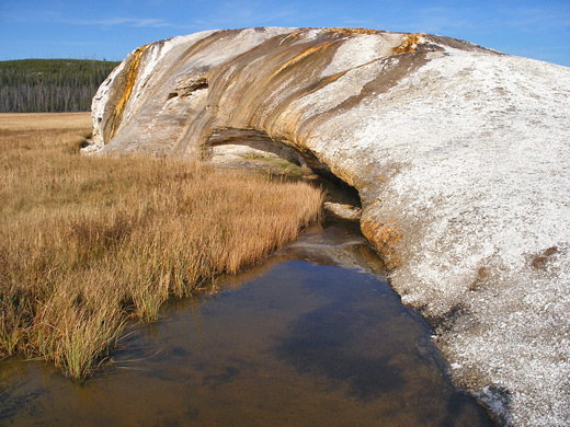
Flat Top Cone is a wide, shallow geyser cone on the north side of the meadows, half a mile from Red Terrace Spring, but separated from it by Sentinel Creek and its marshy surroundings. The similar but taller Steep Cone is easier to reach, by walking east also for half a mile, though still over quite boggy terrain. The cone rises about 20 feet above the meadow and produces enough water to sustain quite a large stream, emerging from beneath an overhanging cliff on the west edge. Orange/brown rivulets flow down all sides of the otherwise pure white cone, creating quite a pretty scene.
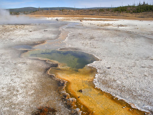
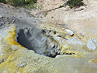
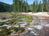
There are other smaller pools nearby including a pair of quite active, sinter-lined springs known as The Bulgers, while one more large feature sits a little way east - this is Mound Spring, at the center of a 500 foot diameter circle of white deposits. The pool contains very hot, clear, constantly bubbling water, and vents along two branched, yellow-orange channels. Several more steaming pools are found nearby, of which one (Green Finger Pool) also has a particularly colorful exit stream, and after inspecting these, the path can be rejoined by walking southeast for a few hundred feet; the Fountain Flats trailhead is then 1.3 miles away.
Although the lightly-used trail to the meadows skirts the edge of the valley, allowing only rather distant views of the features, they can be seen close up by careful off-trail hiking, over ground that is often marshy, crossed by small streams and has some areas with hidden hot vents, so like all such hiking in Yellowstone, anyone who leaves the path does so at their own risk.
Video
Thermal features in the Sentinel Meadows basin (mp4; 2:06 min; 18 mb).
Sentinel Meadows Trailhead
The Sentinel Meadows Trail begins along the Fountain Flats Road (also known as Freight Road), which follows the Firehole River past lush grasslands, popular with elk and bison. After 2 miles, a car park and gate mark the end of the vehicle-accessible part of the road, though it does continue (unpaved) for several miles south, eventually rejoining the main highway at Midway Geyser Basin; past the gate, the route is open only to foot, horse and cycle traffic.
The Trail
From the parking area, the Fountain Flats Road soon crosses the Firehole River, via a steel bridge built right next to a pretty hot spring (Ojo Caliente); this produces quite a large volume of water, which flows into the river along several run-off channels, colored bright yellow by deposited sulfur. Steam plumes rising to the south indicate the location of many other nearby springs along the Firehole (part of the River Group of geysers), but the Sentinel Meadows Trail heads west, over open grassland - a refreshing change from the dense woodland that encloses most backcountry paths in Yellowstone. The horizon to the north is formed by low hills marking the edge of Madison Plateau, while the land also slopes up a few hundred feet to the south. The narrow path crosses a stream (Fairy Creek), climbs slightly over a low ridge bearing burnt pine trunks and a few small new trees, then descends back to the grassland.
Bison
After a second stream crossing (Sentinel Creek), the meadow widens, and steam clouds from the springs ahead first come into view. The trail veers southwards, leading up a small hill past scattered trees and bushes, then winds along the south side of the valley, staying slightly above the floor, and not approaching close to any of the springs, which are mostly towards the middle of the meadows, a quarter mile or more from the path. All this area is prime bison country, and there are usually many animals in view, both at their wallows in the sandy ground near the trail, and grazing in the distant grassland. Two miles from the start, the route turns southeast, leaves the meadows and begins a gentle climb up a shallow ravine, where it enters a patch of lodgepole pine woodland, crosses over a divide and later rejoins the Fountain Flats Road near Goose Lake.
Ojo Caliente - hot spring draining into the Firehole River via several sulfur-lined run-off channels
Red Terrace Spring
The most famous thermal feature in Sentinel Meadows, and also the furthest west, is Red Terrace Spring - a deep hot pool that has created a large area of deposited sinter terraces, colored bluish-red by the cyanobacteria that live in the water. In the 1880s this remote pool was used for bathing and washing clothes, acquiring the original name of Queens Laundry, and the remains of a two-room log bath house still stand, now completely enclosed by the terraces. The spring is located 1/4 mile northwest of the point where the trail enters the southeast-trending ravine, reached by a walk over level ground that starts off quite firm then becomes soft and wet as the spring approaches. The first thermal pool encountered is Dumbbell Spring, a very deep, sheer-sided pool of brownish-blue water through which large bubbles slowly rise. The rather hotter, more active but equally deep Red Terrace Spring is just beyond, its sizeable run-off spreading out northwestwards over the intricate terraces, gradually consuming the log cabin, and becoming less colorful further down the slope as the water temperature decreases. The waters recollect in a warm pool near the middle of the valley, a popular place for birds and other wildlife to gather. Various bleached animal bones on the terraces hint at the dangers posed by this unstable area.
Other Hot Springs in Sentinel Meadows
Flat Top Cone is a wide, shallow geyser cone on the north side of the meadows, half a mile from Red Terrace Spring, but separated from it by Sentinel Creek and its marshy surroundings. The similar but taller Steep Cone is easier to reach, by walking east also for half a mile, though still over quite boggy terrain. The cone rises about 20 feet above the meadow and produces enough water to sustain quite a large stream, emerging from beneath an overhanging cliff on the west edge. Orange/brown rivulets flow down all sides of the otherwise pure white cone, creating quite a pretty scene.
Mound Spring and The Bulgers
There are other smaller pools nearby including a pair of quite active, sinter-lined springs known as The Bulgers, while one more large feature sits a little way east - this is Mound Spring, at the center of a 500 foot diameter circle of white deposits. The pool contains very hot, clear, constantly bubbling water, and vents along two branched, yellow-orange channels. Several more steaming pools are found nearby, of which one (Green Finger Pool) also has a particularly colorful exit stream, and after inspecting these, the path can be rejoined by walking southeast for a few hundred feet; the Fountain Flats trailhead is then 1.3 miles away.
Sentinel Meadows - Similar Hikes
All Contents © Copyright The American Southwest | Comments and Questions | Contribute | Affiliate Marketing Disclosure | Site Map