Mallard Lake Trail, Yellowstone National Park
Wyoming > Yellowstone National Park > The Southwest > Hiking > Mallard Lake Trail
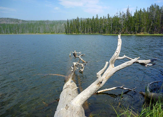
Mallard Lake
Relatively popular path that climbs a shallow, partly wooded ravine, crosses a ridge and descends through thicker woodland to peaceful Mallard Lake. Several large hot springs are viewable just off-trail near the start, some right beside the Firehole River
Length: 3 miles
Elevation change: 660 feet
Difficulty: Easy to moderate
Type: One way
Usage: Medium
Season: Summer, fall
Trailhead: Near the east parking lot at Old Faithful
Rating (1-5): ★★★★★
Elevation change: 660 feet
Difficulty: Easy to moderate
Type: One way
Usage: Medium
Season: Summer, fall
Trailhead: Near the east parking lot at Old Faithful
Rating (1-5): ★★★★★

Mallard may not be one of Yellowstone National Park's most scenic lakes, but the 3 mile hike to the south shore is quite popular, partly because the trail begins right next to Old Faithful, and is the only extended backcountry path in this busy area. Besides the lake, also of interest are two small, little-known thermal areas near the trailhead, one right beside the Firehole River, and both viewable by a short cross-country walk.
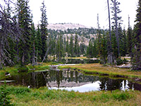
The path climbs fairly gently for most of the way, along a shallow, partly wooded ravine containing abundant summer flowers, up to a high point on a more densely forested ridge, then drops down slightly to the lake, which is about a third of a mile across, ringed by long grass and trees, and lies at the edge of a vast, trailless section of the Central Plateau. The route is maintained as a ski trail in winter, and forms part of a 11 mile loop, together with the Mallard Creek Trail (4 miles), the Powerline Trail (1.5 miles) adjacent to the highway, and the main Upper Geyser Basin Trail (2.5 miles).
Mallard Lake Trail topographic map, trail map for Yellowstone National Park.
16 views along the Mallard Lake Trail, plants along the trail.
Hot springs near the Firehole River (mp4; 0:34 min; 15 mb).
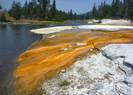
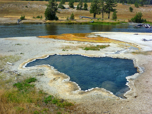
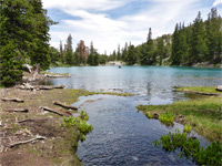
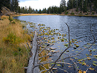
The path to Mallard Lake is signed when approaching the main (east) parking lot at Old Faithful, and begins beside a group of wooden cabins (employee residences) east of Old Faithful Lodge, initially running through a thin strip of woodland and crossing the Firehole River on a sturdy wooden bridge. Upstream, following a fainter trail, is a small thermal area with four large hot springs and several smaller; one produces a pretty, banded run-off channel colored orange and yellow by algae, and another bubbles quite forcefully. A few more steaming pools can be seen on the far side of the river, while the highway bridge is visible not far ahead. The proper path doesn't see the pools, however, instead turning away from the river into tall, cool, old-growth ponderosa pine forest. A short off-trail walk on the north side leads to a tributary stream and a second thermal area, also containing some big pools, all of which are deeply entrenched, their cloudy, greyish waters bubbling several feet below ground level. The path may be rejoined by crossing the stream and walking uphill southeastwards - rising quite high above the basin, which is partly visible from the trail through gaps in the trees.
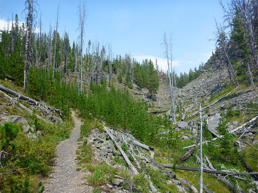
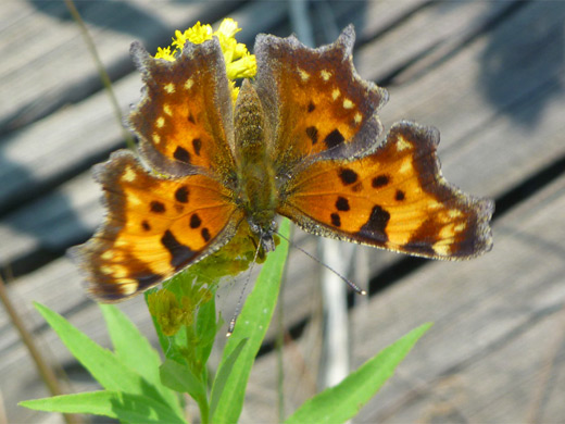
There are no more hot springs ahead, as the old-growth woodland gives way to smaller, post-1988 trees, and a rocky ravine comes close on the left side; the path drops down to a footbridge over the unnamed stream flowing down the ravine, in the middle of an area with many wildflowers. The next mile or so is also lightly wooded, and the trail mostly follows a shallow, moist, grassy valley containing many more flowers including lupine, Indian paintbrush, harebell, gentian, aster, yarrow and yampa.
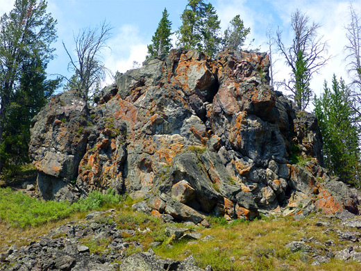
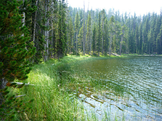
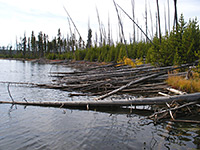
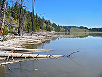
The trail climbs higher above the creek for a while, comes back down and rises again towards the mouth of a bigger ravine, the walls of which soon close in on both sides and the land slopes up more steeply to the head of the valley, near which are some dark, convoluted volcanic rocks partly covered with red lichen. Wild strawberries grow hereabouts. The path now re-enters the woods, skirting the edge of a flat meadow, rising a little, leveling out again, passing over a small ridge and arriving at the junction with the 4 mile Mallard Creek Trail. Mallard Lake is 0.2 miles further north, down a little slope, where the path ends. The lake is bordered intact forest on the near side and burnt trees opposite, with a thin strip of long grass along the water's edge and low hills all around.
The path climbs fairly gently for most of the way, along a shallow, partly wooded ravine containing abundant summer flowers, up to a high point on a more densely forested ridge, then drops down slightly to the lake, which is about a third of a mile across, ringed by long grass and trees, and lies at the edge of a vast, trailless section of the Central Plateau. The route is maintained as a ski trail in winter, and forms part of a 11 mile loop, together with the Mallard Creek Trail (4 miles), the Powerline Trail (1.5 miles) adjacent to the highway, and the main Upper Geyser Basin Trail (2.5 miles).
Maps
Mallard Lake Trail topographic map, trail map for Yellowstone National Park.
Photographs
16 views along the Mallard Lake Trail, plants along the trail.
Video
Hot springs near the Firehole River (mp4; 0:34 min; 15 mb).
Thermal Areas by the Firehole River
The path to Mallard Lake is signed when approaching the main (east) parking lot at Old Faithful, and begins beside a group of wooden cabins (employee residences) east of Old Faithful Lodge, initially running through a thin strip of woodland and crossing the Firehole River on a sturdy wooden bridge. Upstream, following a fainter trail, is a small thermal area with four large hot springs and several smaller; one produces a pretty, banded run-off channel colored orange and yellow by algae, and another bubbles quite forcefully. A few more steaming pools can be seen on the far side of the river, while the highway bridge is visible not far ahead. The proper path doesn't see the pools, however, instead turning away from the river into tall, cool, old-growth ponderosa pine forest. A short off-trail walk on the north side leads to a tributary stream and a second thermal area, also containing some big pools, all of which are deeply entrenched, their cloudy, greyish waters bubbling several feet below ground level. The path may be rejoined by crossing the stream and walking uphill southeastwards - rising quite high above the basin, which is partly visible from the trail through gaps in the trees.
Wildflowers
There are no more hot springs ahead, as the old-growth woodland gives way to smaller, post-1988 trees, and a rocky ravine comes close on the left side; the path drops down to a footbridge over the unnamed stream flowing down the ravine, in the middle of an area with many wildflowers. The next mile or so is also lightly wooded, and the trail mostly follows a shallow, moist, grassy valley containing many more flowers including lupine, Indian paintbrush, harebell, gentian, aster, yarrow and yampa.
Trail to Mallard Lake
The trail climbs higher above the creek for a while, comes back down and rises again towards the mouth of a bigger ravine, the walls of which soon close in on both sides and the land slopes up more steeply to the head of the valley, near which are some dark, convoluted volcanic rocks partly covered with red lichen. Wild strawberries grow hereabouts. The path now re-enters the woods, skirting the edge of a flat meadow, rising a little, leveling out again, passing over a small ridge and arriving at the junction with the 4 mile Mallard Creek Trail. Mallard Lake is 0.2 miles further north, down a little slope, where the path ends. The lake is bordered intact forest on the near side and burnt trees opposite, with a thin strip of long grass along the water's edge and low hills all around.
Mallard Lake - Similar Hikes
All Contents © Copyright The American Southwest | Comments and Questions | Contribute | Affiliate Marketing Disclosure | Site Map