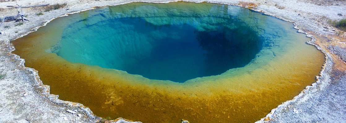
Lower Geyser Basin, Yellowstone National Park
Wyoming > Yellowstone National Park > The Southwest > Lower Geyser Basin
Highlights:
The second largest geyser basin in Yellowstone National Park - the Fountain area, Sentinel Meadows, Firehole Lake and nearby geysers, the River and Quagmire Groups, Morning Mist Springs and the Firehole River

The many thermal features of Yellowstone's Lower Geyser Basin are spread out over an area 5 by 2 miles on both sides of the Firehole River - mostly on open meadow land though several groups are found in the hills that border the flats to the east and west. The main highway passes by the major site (the Fountain Paint Pots and nearby geysers), and a side road leads to many more, while several trails reach the more remote groups.
Lower Geyser Basin Table of Contents
- Lower Geyser Basin map
- Photographs
- Videos
- Sentinel Meadows
- Tours of the geyser basins
- The River Group
- The Quagmire Group
- The Fountain Group
- Firehole Lake Drive
- Trails of the Lower Geyser Basin
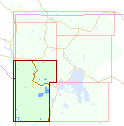
Map
Map of the Lower Geyser Basin, showing all roads, trails and named thermal features.
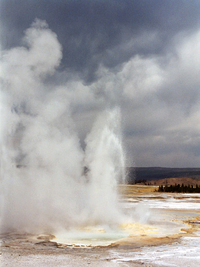
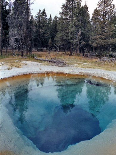
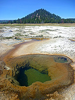
Photographs
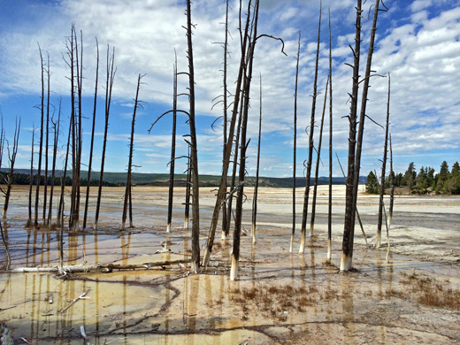
Lower Geyser Basin, Morning Mist Springs, Sentinel Meadows.
Videos
Morning Mist Springs, Sentinel Meadows.
Sentinel Meadows
Starting in the northwest, the collection furthest from the highway is at Sentinel Meadows, a marshy area along Sentinel Creek which joins the Firehole River near the north edge of the basin. A spur road - the Fountain Flats Drive - leads to a car park, a gravel track crosses the river via a steel foot bridge, then a 2.2 mile trail forks west (straight on being across the flats towards Midway Geyser Basin) and follows the south edge of the meadows, which have plentiful geyser cones and several large pools, one of which, 'Queens Laundry' (aka Red Terrace Spring), was once used by early visitors for bathing, as its temperature was relatively low in contrast to most hot pools at Yellowstone that are much too hot, with temperatures in the range 150 to 200°F. Nearby is the remains of a primitive log cabin, constructed in 1881. Fountain Flats Drive is a good place for wildlife viewing, since bison and elk often congregate in the meadows just to the west.
Tours of the Geyser Basins
Explore the geysers and waterfalls, starting from Jackson or West Yellowstone.
The River Group
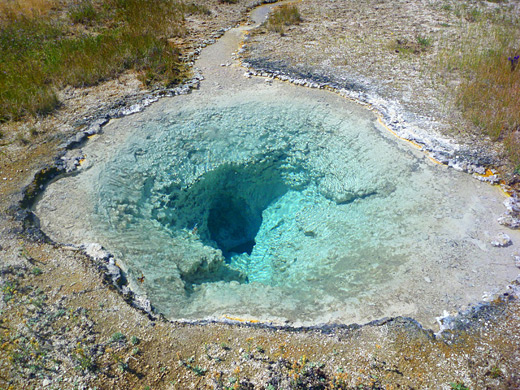
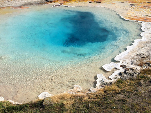
Just before the main trail crosses the Firehole River, a lesser, unmaintained path leads southeast beside the waters into quite a large active area, the River Group. This has several hundred springs ranging from lukewarm, brownish pools to large, vigorous cauldrons, extending for over 2 miles. Named features include turquoise-blue Azure Spring, Fortress Geyser, Mound Geyser, Ojo Caliente, Sand Geyser, and Diadem Spring, this latter being another deep blue pool in a area known as Pocket Basin that also contains many mud pots. The River Group is potentially dangerous as it has no official trails, fences or boardwalks, and some of the ground is unstable, yet the place is relatively easily accessed being just 1/4 mile from a paved road. One of the pools here, 178°F Cavern Spring, is among the 20 or so in Yellowstone National Park that have caused deaths of people who have either jumped or fallen in.
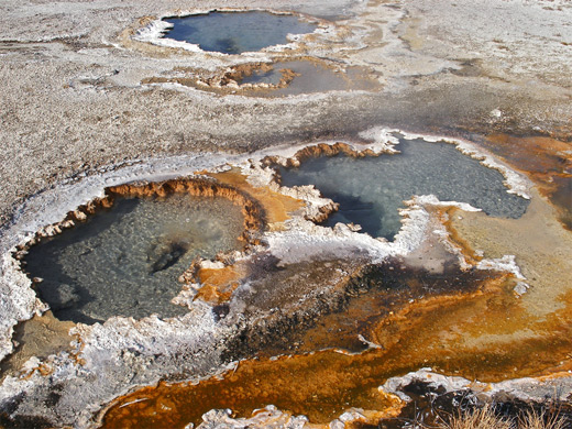
The Quagmire Group
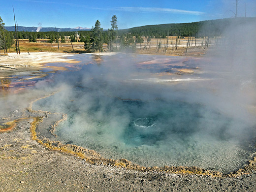
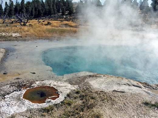
One mile south of the Fountain Flats Road is the starting point for the Mary Mountain Trail, a long backcountry route leading to Hayden Valley. The first mile winds through the Porcupine Hills and close to Morning Mist Springs, a collection of heated pools in a meadow beside Nez Perce Creek. In a valley on the south side of the hills, 0.5 miles from the trail, is the lesser known Quagmire Group - more pools, some large and deep, filled by water in a rich shade of blue, though none seem to have official names. The hillsides above have a number of noisy sulphur vents and this whole area is quite interesting, and not often visited, though again, some care is needed when exploring. Further east, there is more thermal activity at the far end of Culex Basin.
The Fountain Group
The most visited thermal area in the Lower Geyser Basin is the Fountain Group, at the edge of Fountain Flats on the west side of the road. From the parking area, 0.5 miles of boardwalk trails pass a sizeable assortment of geysers and springs at the edge of quite a large barren region of deposited minerals and very little vegetation. One pleasing area is the Fountain Paint Pots, where many small vents bubble noisily through thick, clayish mud of varying colors and consistencies. Just south of here is one of the most colorful pools in this area, 193°F Silex Spring, and other beautiful blue pools nearby include Celestine Pool (another to have claimed a life) and Leather Pool. The various geysers along the trail are medium sized and erupt quite regularly; there will usually be at least one of the following in action: Bellefontaine, Clepsydra, Fountain, Jelly, Jet, Mask, Morning, Spasm, Sub and Twig. Clepsydra Geyser is perhaps the best.
Firehole Lake Drive
A two mile, one-way side road loops through more thermals southeast of the Fountain Group, based around Tangled Creek and White Creek, two east side tributaries of the Firehole River. Along here is Hot Lake, probably the biggest warm pool in Yellowstone, which together with nearby Firehole Lake is surrounded by numerous small geysers and springs, all of which generate a lot of steam. A mile southwest is Great Fountain Geyser, one of the largest in the park, that erupts 2 or 3 times a day, reaching up to 150 feet, and lasting for up to an hour. This is one of only six to have its activity regularly predicted, with timings posted at the Old Faithful Visitor Center. Nearby is White Dome Geyser, an irregular but beautiful erupter that throws water and steam through an impressive pinkish-white cone, 20 feet high. The smaller Pink Cone Geyser, on the far side of Tangled Creek, has a similar distinctive cone and alluring color.
Hiking in the Lower Geyser Basin
All trails in the Lower Geyser Basin
Featured Trails
Morning Mist Springs and the Quagmire Group
★★★★★
★★★★★
2.5 miles, 250 feet (loop)
Loop hike, partly off trail, to two backcountry thermal areas of the Lower Geyser Basin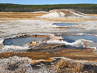
Sentinel Meadows
★★★★★
★★★★★
2.2 miles, 40 feet
At the north edge of the Lower Geyser Basin, Sentinel Meadows offers a quick hike to a backcountry thermal region, containing geyser cones and a selection of hot pools of varying sizesAll Contents © Copyright The American Southwest | Comments and Questions | Contribute | Affiliate Marketing Disclosure | Site Map