South Mountain
Hike to the southernmost major peak of the La Sal Mountains, initially along paths up either of two adjacent valleys (Doe Canyon and Pole Canyon), then off-trail up stony slopes to the summit
Length: 4.9 miles, via Doe Canyon, or 10.8 miles, round trip via both canyons
Elevation change: 2,700 feet
Difficulty: Strenuous
Type: One-way, or partial loop
Usage: Low
Season: Spring and summer
Trailhead: La Sal Pass Road, 3.1 miles from Hwy 46. 4WD vehicles can drive closer, along FR0128
Rating (1-5): ★★★★★
Elevation change: 2,700 feet
Difficulty: Strenuous
Type: One-way, or partial loop
Usage: Low
Season: Spring and summer
Trailhead: La Sal Pass Road, 3.1 miles from Hwy 46. 4WD vehicles can drive closer, along FR0128
Rating (1-5): ★★★★★

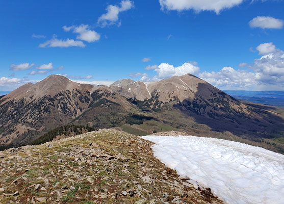
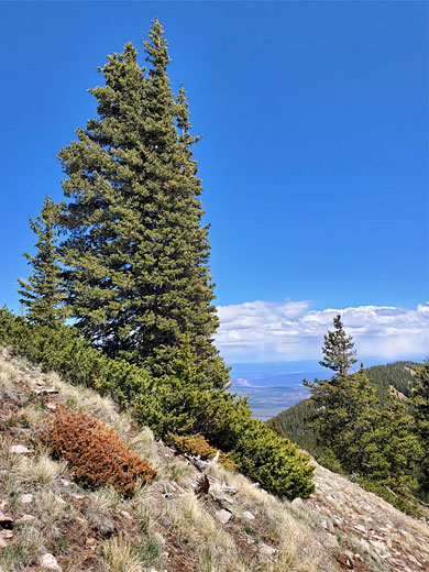
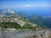
11,817 foot South Mountain is the tallest point in the southern group of peaks of the La Sal Mountains, separated from the higher, central portion (Mt Tukuhnikivatz and Mt Peale) by La Sal Pass, at 10,133 feet. The mountain has a relatively small area of bare rock, scree and tundra across its upper reaches; otherwise the slopes are covered by pine/aspen woodland, and the scenery is a little less dramatic than the bigger peaks to the north, but is still a fine hiking destination.
An unpaved track climbs the eastern side of South Mountain, to the pass, and along here are several possible start points for a hike to the summit. The shortest is from the pass itself, all off-trail - 1.5 miles, steeply up to an unnamed, lesser peak, down to a saddle then up again. Another option, starting 1.8 miles back along the road, at the Beaver Lake/Medicine Lake trailhead, is via a path that climbs a lengthy ridge, followed by an off-trail scramble up the south face of the mountain, mostly over open terrain with patches of boulders. The hike distance here is 3.3 miles.
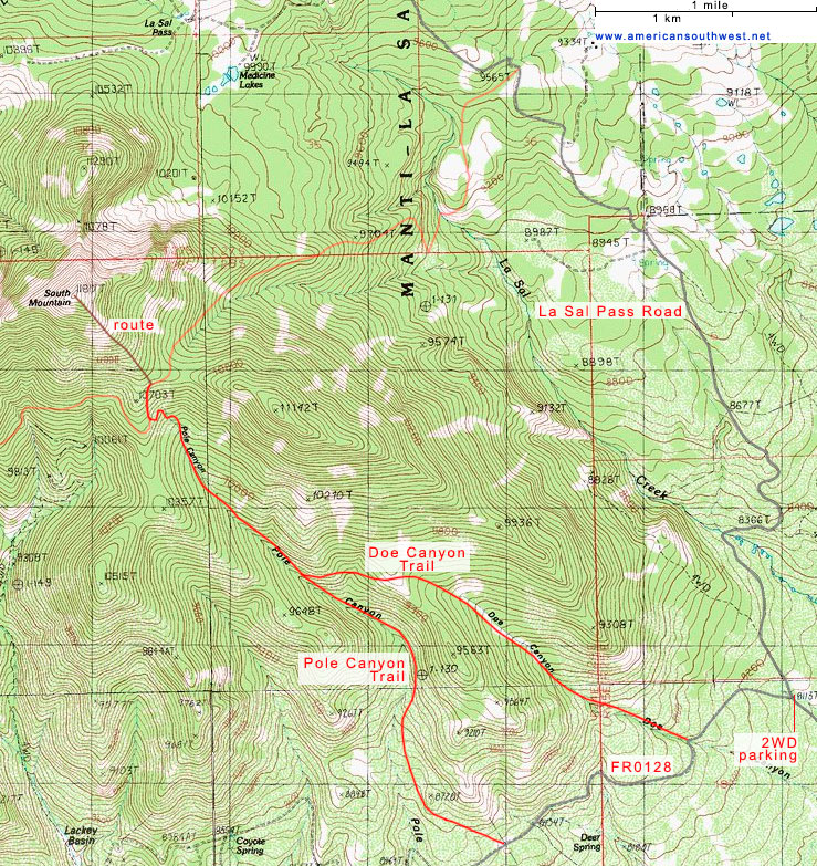
Both these options are suitable for high clearance vehicles; for regular cars and RVs, a better start point is near the lower end of La Sal Pass Road, taking trails up either of two adjacent valleys - Doe Canyon or Pole Canyon, later intersecting the path from Beaver Lake/Medicine Lake, and continuing up the slopes to the summit, as before. This is the hike described below; encountering varied scenery of woodland, meadows, streams, rocky slopes and tundra. The shortest distance here, via Doe Canyon, is 4.9 miles one way, climbing 2,700 feet, while a partial loop, returning all along Pole Canyon, is 10.8 miles round trip.
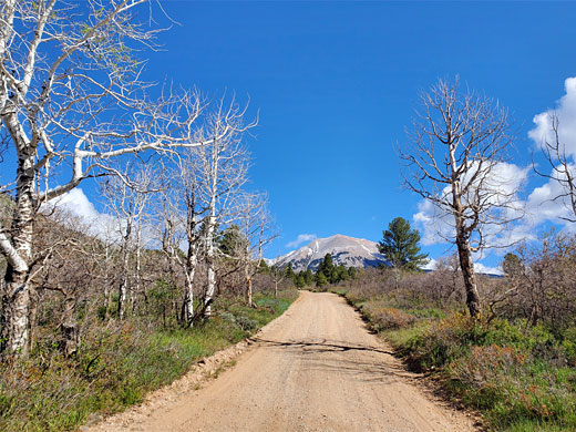
La Sal Pass Road starts 1.9 miles along FR 208, which forks northeast off Hwy 146, 3.5 miles east of La Sal village. For the first few miles the surface is wide, smooth gravel. The first junction, after 1.2 miles, is with a lesser track (FR0128) accessing the Doe Canyon and Pole Canyon trailheads; higher clearance vehicles can drive along here, whilst others have to park at the junction, past which La Sal Pass Road soon crosses La Sal Creek, potentially impassable during times of high water flow, then starts to climb more steeply, passing the Beaver Lake/Medicine Lake trailhead after 4.6 miles and reaching the pass after 6.4 miles.
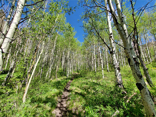
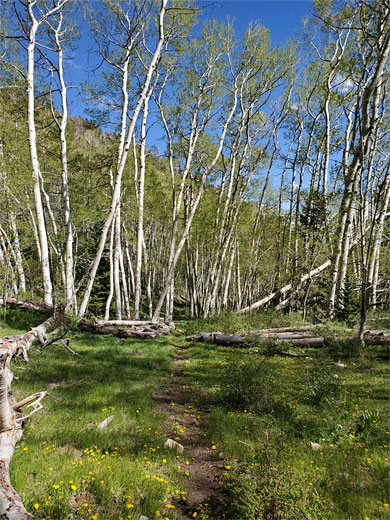
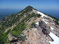
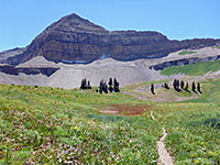
From the junction with La Sal Pass Road, FR0128 climbs gently across partly wooded slopes, reaching the Doe Canyon trailhead after 0.6 miles, where the trees are more dense. The narrow, lightly-used path leads up a dry aspen valley, initially quite open, later becoming more enclosed and shadier. The lower end of a scree chute is passed on the right, as the gradient steepens, and later is a large patch of burnt trees, from a 2020 wildfire. All this area seems rather dry, limiting the wildflowers. The path climbs to the head of the canyon, up to a large stony meadow, on a ridge above the adjacent drainage of Pole Canyon, giving good views south across the lowlands and north to an intermediate summit, Peak 11142. Ahead, the path becomes indistinct and hard to follow in places. It crosses to the far side of the meadow and re-enters wooded terrain, now rather more overgrown than before, and with quite a few fallen trees. The path heads due west, across a shallow basin, into a less densely wooded area, and down a little to a junction beside the streamway in Pole Canyon.
The Pole Canyon Trail climbs steadily up the valley, mostly on the east side, through woodland and small meadows. Some sections are quite faint, especially in the grassier areas. Towards the upper end of the canyon it crosses a stream and ascends the east-facing slope to another junction, in a patch of aspen. Turning right, the path traverses the open slopes a short distance then enters extensive, dark, pinewoods, on route to the Medicine Lake trailhead along La Sal Pass Road.
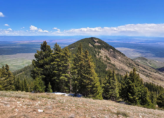
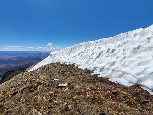
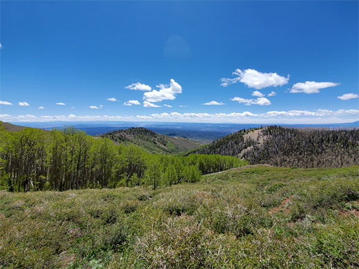
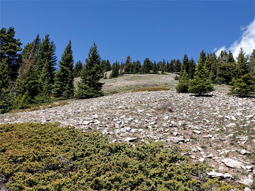
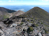
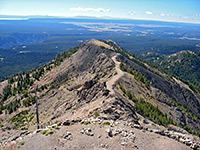
From the open area near the trail junction, the summit of South Mountain is 0.7 miles away and 1,150 feet higher. There is no path nor any set route, just a steady walk northwestwards up the mountain sides, over grass and scree and through patches of pines. The upper reaches are rockier, as the profile of the peak gradually narrows, up to the flattish summit, on which snow typically persists well into June. Views are of course very extensive, across other parts of the La Sals and towards several distant ranges - the Abajo and Henry mountains to the west and the San Juan range to the east, nearly 100 miles away. In the foreground are several subsidiary summits, the largest Peak 11142.
The alternative return route is via the full length of Pole Canyon - past the Doe Canyon junction, the path continues descending at the same rate, on the west side for a while then back to the east, eventually passing through a gate/fence and leaving the vicinity of the streamway, traversing bushier slopes with far fewer trees, curving more to the east and meeting the road, FR0128, at the Pole Canyon trailhead. It is then 1.2 miles to Doe Canyon and 1.8 miles to La Sal Pass Road.
An unpaved track climbs the eastern side of South Mountain, to the pass, and along here are several possible start points for a hike to the summit. The shortest is from the pass itself, all off-trail - 1.5 miles, steeply up to an unnamed, lesser peak, down to a saddle then up again. Another option, starting 1.8 miles back along the road, at the Beaver Lake/Medicine Lake trailhead, is via a path that climbs a lengthy ridge, followed by an off-trail scramble up the south face of the mountain, mostly over open terrain with patches of boulders. The hike distance here is 3.3 miles.
Both these options are suitable for high clearance vehicles; for regular cars and RVs, a better start point is near the lower end of La Sal Pass Road, taking trails up either of two adjacent valleys - Doe Canyon or Pole Canyon, later intersecting the path from Beaver Lake/Medicine Lake, and continuing up the slopes to the summit, as before. This is the hike described below; encountering varied scenery of woodland, meadows, streams, rocky slopes and tundra. The shortest distance here, via Doe Canyon, is 4.9 miles one way, climbing 2,700 feet, while a partial loop, returning all along Pole Canyon, is 10.8 miles round trip.

La Sal Pass Road
La Sal Pass Road starts 1.9 miles along FR 208, which forks northeast off Hwy 146, 3.5 miles east of La Sal village. For the first few miles the surface is wide, smooth gravel. The first junction, after 1.2 miles, is with a lesser track (FR0128) accessing the Doe Canyon and Pole Canyon trailheads; higher clearance vehicles can drive along here, whilst others have to park at the junction, past which La Sal Pass Road soon crosses La Sal Creek, potentially impassable during times of high water flow, then starts to climb more steeply, passing the Beaver Lake/Medicine Lake trailhead after 4.6 miles and reaching the pass after 6.4 miles.
Doe Canyon
From the junction with La Sal Pass Road, FR0128 climbs gently across partly wooded slopes, reaching the Doe Canyon trailhead after 0.6 miles, where the trees are more dense. The narrow, lightly-used path leads up a dry aspen valley, initially quite open, later becoming more enclosed and shadier. The lower end of a scree chute is passed on the right, as the gradient steepens, and later is a large patch of burnt trees, from a 2020 wildfire. All this area seems rather dry, limiting the wildflowers. The path climbs to the head of the canyon, up to a large stony meadow, on a ridge above the adjacent drainage of Pole Canyon, giving good views south across the lowlands and north to an intermediate summit, Peak 11142. Ahead, the path becomes indistinct and hard to follow in places. It crosses to the far side of the meadow and re-enters wooded terrain, now rather more overgrown than before, and with quite a few fallen trees. The path heads due west, across a shallow basin, into a less densely wooded area, and down a little to a junction beside the streamway in Pole Canyon.
Pole Canyon
The Pole Canyon Trail climbs steadily up the valley, mostly on the east side, through woodland and small meadows. Some sections are quite faint, especially in the grassier areas. Towards the upper end of the canyon it crosses a stream and ascends the east-facing slope to another junction, in a patch of aspen. Turning right, the path traverses the open slopes a short distance then enters extensive, dark, pinewoods, on route to the Medicine Lake trailhead along La Sal Pass Road.

To the Summit
From the open area near the trail junction, the summit of South Mountain is 0.7 miles away and 1,150 feet higher. There is no path nor any set route, just a steady walk northwestwards up the mountain sides, over grass and scree and through patches of pines. The upper reaches are rockier, as the profile of the peak gradually narrows, up to the flattish summit, on which snow typically persists well into June. Views are of course very extensive, across other parts of the La Sals and towards several distant ranges - the Abajo and Henry mountains to the west and the San Juan range to the east, nearly 100 miles away. In the foreground are several subsidiary summits, the largest Peak 11142.
Return Route
The alternative return route is via the full length of Pole Canyon - past the Doe Canyon junction, the path continues descending at the same rate, on the west side for a while then back to the east, eventually passing through a gate/fence and leaving the vicinity of the streamway, traversing bushier slopes with far fewer trees, curving more to the east and meeting the road, FR0128, at the Pole Canyon trailhead. It is then 1.2 miles to Doe Canyon and 1.8 miles to La Sal Pass Road.
Map of South Mountain
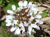
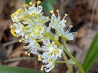
South Mountain Wildflowers
More plants along the trail
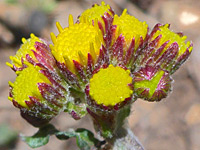 Splitleaf groundsel |
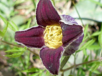 Sugarbowls |
 Alpine pennycress |
 Foothill death camas |
More plants along the trail
South Mountain - Similar Hikes
All Contents © Copyright The American Southwest | Comments and Questions | Contribute | Affiliate Marketing Disclosure | Site Map