Slaughter Canyon Cave Trail, Carlsbad Caverns National Park
New Mexico > Carlsbad Caverns National Park > Slaughter Canyon Cave Trail
Slaughter Canyon Cave Trail
Short but steep path up the side of a Chihuahuan Desert ravine, past a variety of plant species, to the entrance of a backcountry cavern - which is locked; guided tours are sometimes available
Length: 0.4 miles
Elevation change: 500 feet
Difficulty: Easy
Type: One way
Usage: Low
Season: All year
Trailhead: At the end of Gartersnake Road, 40 miles from the national park visitor center
Rating (1-5): ★★★★★
Elevation change: 500 feet
Difficulty: Easy
Type: One way
Usage: Low
Season: All year
Trailhead: At the end of Gartersnake Road, 40 miles from the national park visitor center
Rating (1-5): ★★★★★

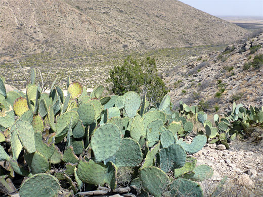
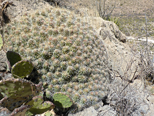
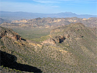
Away from the famous show caves, the extensive backcountry of Carlsbad Caverns National Park is crossed by a network of trails, all very little used, along canyons and ridges, through a landscape that looks somewhat barren from a distance, almost completely lacking any trees, yet is filled with a wide variety of Chihuahuan Desert plants including a number of rare cactus species.
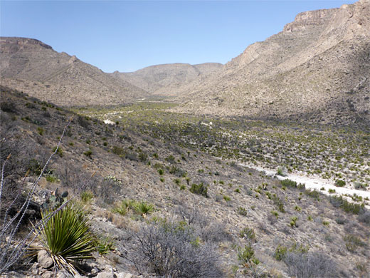
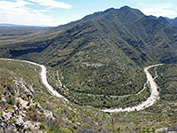
There are various other caves in the backcountry, none generally open to the public though a few may be seen on guided tours, such as Slaughter Canyon Cave, previously known as New Cave, 500 feet up near the mouth of Slaughter Canyon, one of the two largest ravines in the park, along with Rattlesnake Canyon. On the opposite side of the canyon are at least two other caverns, Ogle Cave and Rainbow Cave.
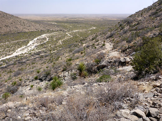
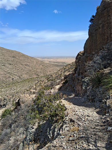
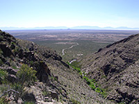
Slaughter Canyon is one of the few backcountry caves to which tours are offered, though availability is sporadic, due to staffing issues; when offered, the tours, rated strenuous, last 5.5 hours, of which 2.5 hours is spent in the cave; the remainder includes walking up and down the half mile trail to the entrance, which is worthwhile even if the cave is closed since it offers grand views of the canyon and the great plains to the south, and passes a good selection of the desert plants.
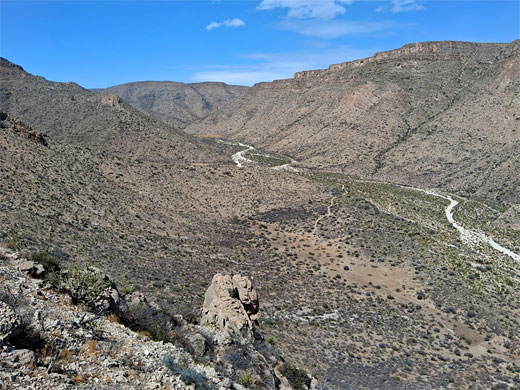
The cave trail can be combined with a much longer path all along the canyon floor, the Slaughter Canyon Trail, which after 5 miles links with the Guadalupe Ridge Trail, up in the high country.
The canyon and the cave are named not for some deadly historic incident, instead after pioneer settler Charles Slaughter, who raised cattle in the vicinity in the 1880s.
Map of Carlsbad Caverns National Park.
The driving route to Slaughter Canyon leaves US 180, 5.4 miles south of the main national park turn-off, crossing flat, dusty ranchland for 11 miles, and is paved up to the park boundary, then gravel for the final mile to the trailhead parking area, which is equipped with restrooms, benches and noticeboard. It or other places along the track may be suitable for primitive camping. There are multiple junctions along the way, most signed to the cave. The route is along Washington Ranch Road, then Collwell Ranch Road and finally Gartersnake Road.
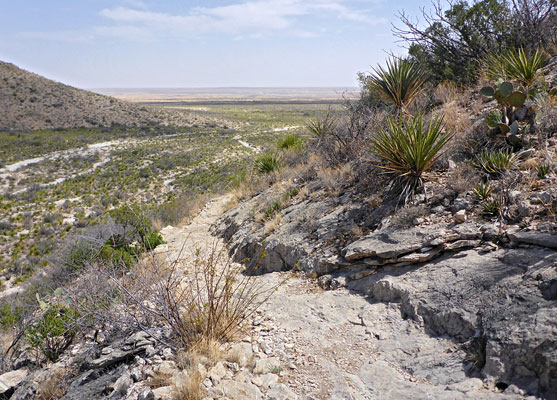
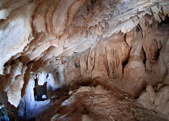
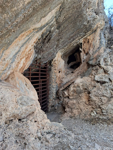
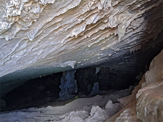
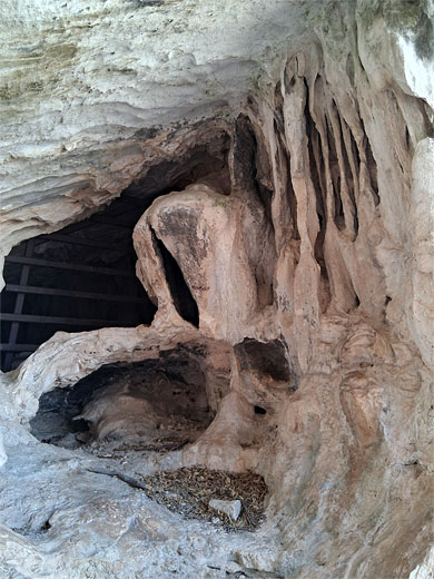
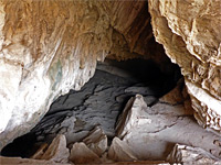
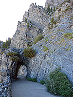
The two Slaughter Canyon trails depart from the far side of the parking lot; that to the cave starts climbing right away, at a constant incline, not too steep. It rounds a corner, cuts back and crosses a rocky drainage then curves round another sloping ridgeline, through many large boulders, and soon reaches the cave entrance, in an alcove. Notices along the way caution against leaving the trail. The main entrance to the cave, about 8 feet tall, is closed by a large grill and locked door, while a smaller entrance up to one side is also securely closed. A reasonable amount of the mouth of the cave can be seen, including the flat slanted ceiling, sprinkled with tiny stalactites and draperies, and a larger group of formations to one side.
There are various other caves in the backcountry, none generally open to the public though a few may be seen on guided tours, such as Slaughter Canyon Cave, previously known as New Cave, 500 feet up near the mouth of Slaughter Canyon, one of the two largest ravines in the park, along with Rattlesnake Canyon. On the opposite side of the canyon are at least two other caverns, Ogle Cave and Rainbow Cave.
Slaughter Canyon is one of the few backcountry caves to which tours are offered, though availability is sporadic, due to staffing issues; when offered, the tours, rated strenuous, last 5.5 hours, of which 2.5 hours is spent in the cave; the remainder includes walking up and down the half mile trail to the entrance, which is worthwhile even if the cave is closed since it offers grand views of the canyon and the great plains to the south, and passes a good selection of the desert plants.
The cave trail can be combined with a much longer path all along the canyon floor, the Slaughter Canyon Trail, which after 5 miles links with the Guadalupe Ridge Trail, up in the high country.
The canyon and the cave are named not for some deadly historic incident, instead after pioneer settler Charles Slaughter, who raised cattle in the vicinity in the 1880s.
Location
Map of Carlsbad Caverns National Park.
Road to the Trailhead
The driving route to Slaughter Canyon leaves US 180, 5.4 miles south of the main national park turn-off, crossing flat, dusty ranchland for 11 miles, and is paved up to the park boundary, then gravel for the final mile to the trailhead parking area, which is equipped with restrooms, benches and noticeboard. It or other places along the track may be suitable for primitive camping. There are multiple junctions along the way, most signed to the cave. The route is along Washington Ranch Road, then Collwell Ranch Road and finally Gartersnake Road.
The Trail
The two Slaughter Canyon trails depart from the far side of the parking lot; that to the cave starts climbing right away, at a constant incline, not too steep. It rounds a corner, cuts back and crosses a rocky drainage then curves round another sloping ridgeline, through many large boulders, and soon reaches the cave entrance, in an alcove. Notices along the way caution against leaving the trail. The main entrance to the cave, about 8 feet tall, is closed by a large grill and locked door, while a smaller entrance up to one side is also securely closed. A reasonable amount of the mouth of the cave can be seen, including the flat slanted ceiling, sprinkled with tiny stalactites and draperies, and a larger group of formations to one side.
Slaughter Canyon Cave Trail - Similar Hikes
All Contents © Copyright The American Southwest | Comments and Questions | Contribute | Affiliate Marketing Disclosure | Site Map