Cave Trail
Short path that climbs a moderately steep slope to the entrance of a 600 foot-long cave containing a variety of limestone formations, explorable without need for a permit
Length: 0.5 miles
Elevation change: 400 feet
Difficulty: Easy, just a little steep
Type: One way
Usage: Medium
Season: All year
Trailhead: Pull out along the park road
Rating (1-5): ★★★★★
Elevation change: 400 feet
Difficulty: Easy, just a little steep
Type: One way
Usage: Medium
Season: All year
Trailhead: Pull out along the park road
Rating (1-5): ★★★★★

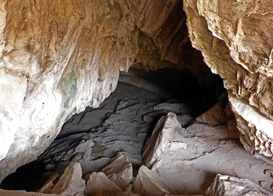
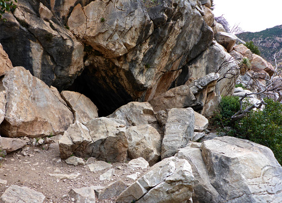
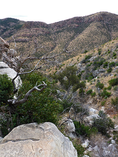
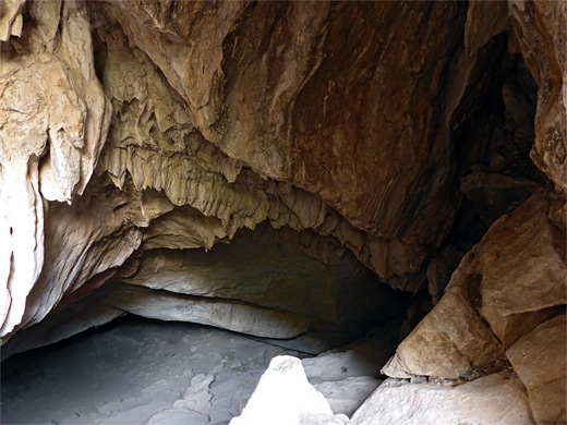
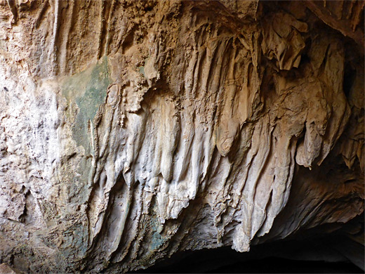
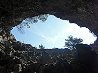
The Cave Trail climbs 400 feet over half a mile to the entrance of a 600 foot-long limestone cavern, overlooking a minor ravine on the south side of Montezuma Peak, part of an area that was added to Coronado National Memorial after a boundary expansion in 1978. The cave is relatively large, up to 70 feet in width and 20 feet in height, and is notable for being one of the very few undeveloped and easily accessed caves in southern Arizona. After a scramble down a slope of large boulders at the entrance, the rest of the journey is fairly straightforward, along level passageways, and the cavern contains a variety of interesting formations including a few large stalagmites, some helicites, a couple of rimstone dams and at least one column. No permit or reservations are required for entry.
Historically, it is thought that Coronado Cave was used as a shelter by ancient peoples, up to 8,000 years ago, and the site is known to have been visited more recently by the Apache and by European pioneers. Like nearly all caves it is home to a population of bats, of several different species.
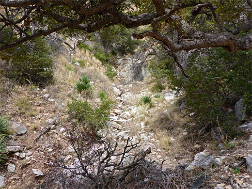
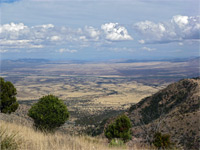
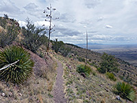
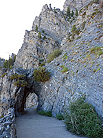
The trail begins from a pull-out beside the road along the floor of Montezuma Canyon, a quarter of a mile west of the visitor center. It crosses a usually dry creek bed, switchbacks up an open slope and traverses westwards, moving above a tributary drainage, which leads to the cave. A couple more switchbacks are followed by a straight section, quite steep, and then a short descent to the partially wooded creek bed. The path ends a short distance further at the base of a flight of steps climbing to the entrance, the walls above which are adorned with ancient flowstone formations. Inside, the best features are beyond the halfway point, after the cave briefly narrows before widening again.
Historically, it is thought that Coronado Cave was used as a shelter by ancient peoples, up to 8,000 years ago, and the site is known to have been visited more recently by the Apache and by European pioneers. Like nearly all caves it is home to a population of bats, of several different species.
Trail to the Cave
The trail begins from a pull-out beside the road along the floor of Montezuma Canyon, a quarter of a mile west of the visitor center. It crosses a usually dry creek bed, switchbacks up an open slope and traverses westwards, moving above a tributary drainage, which leads to the cave. A couple more switchbacks are followed by a straight section, quite steep, and then a short descent to the partially wooded creek bed. The path ends a short distance further at the base of a flight of steps climbing to the entrance, the walls above which are adorned with ancient flowstone formations. Inside, the best features are beyond the halfway point, after the cave briefly narrows before widening again.
Cave Trail - Similar Hikes
All Contents © Copyright The American Southwest | Comments and Questions | Contribute | Affiliate Marketing Disclosure | Site Map