Joe's Canyon Trail, Coronado National Memorial
Arizona > Coronado National Memorial > Joe's Canyon Trail
Joe's Canyon Trail
Enjoyable trail that climbs a sheltered ravine on the south side of Montezuma Canyon, then follows a treeless ridge towards Coronado Peak, giving excellent views all the way
Length: 3 miles
Elevation change: 1,340 feet
Difficulty: Moderate; steep towards the lower end
Type: One way
Usage: Low
Season: All year
Trailhead: Parking area at the visitor center. Also accessible from Montezuma Pass
Rating (1-5): ★★★★★
Elevation change: 1,340 feet
Difficulty: Moderate; steep towards the lower end
Type: One way
Usage: Low
Season: All year
Trailhead: Parking area at the visitor center. Also accessible from Montezuma Pass
Rating (1-5): ★★★★★

The longest and perhaps the best of the six hikes in Cororado National Memorial is Joe's Canyon Trail, a 3 mile route that climbs a steep, south-side tributary of Montezuma Canyon up to the windswept Smugglers Ridge above, and follows this northwestwards, now ascending much more gently, and ending beside the park road at Montezuma Pass.
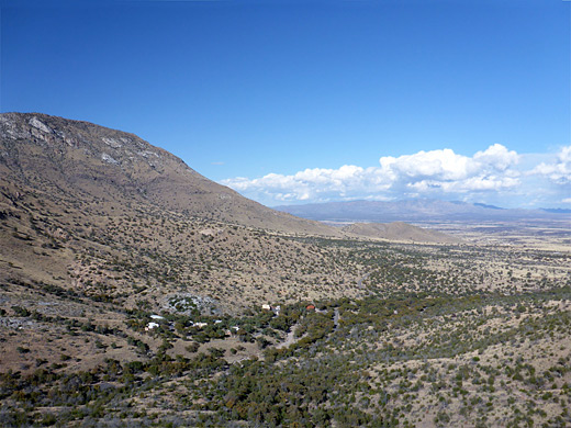
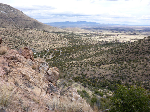
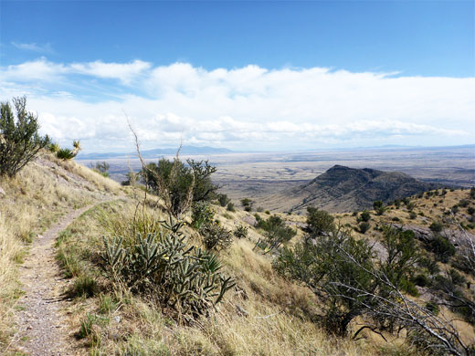
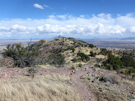
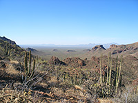
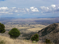
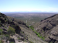
About two thirds of the hike is along the ridgetop, which offers fantastic views all around, including the higher peaks of the Huachuca Mountains to the north, and the vast plains of Mexico to the south; wide-open scenery that contrasts with the more enclosed and overgrown environment of the ravine at the start of the route.
The path is not much used, perhaps because it begins and ends along the road rather than leading to some remote destination, and since the views along the upper reaches are similar to those from Montezuma Pass and also from the top of Coronado Peak, which is reached by a much shorter walk, just 0.4 miles. A car shuttle would enable a one-way hike along Joe's Canyon Trail, preferably in the downhill direction, from west to east, while for a round trip, since walking on the road is not recommended due to the narrow carriageway and lack of verges in some places, it is best to return the same way. Another option is the free NPS shuttle, which departs from the visitor center at 8.30 am, Thursday through Sunday, fall to early summer.
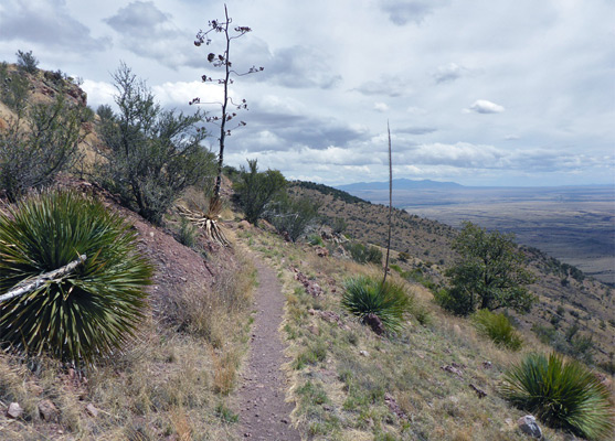
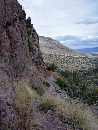
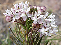
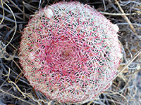
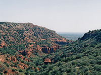
The trail starts, in the east, just opposite the visitor center, and it has a gentle gradient at first, crossing a mostly treeless slope with plenty of wildflowers in summer, while moving towards the steeper ground along the south side of Montezuma Canyon. The land becomes more wooded as the path crosses a wash, with flowing water during wetter seasons, and climbs via four comparatively gentle switchbacks, returning close to the creekbed in a rocky area, lacking trees. The next section rises some more and runs along the base of a cliff, where plants include pineapple milkweed, then rounds a corner and enters the shallower, upper part of the ravine, still several hundred feet below the ridgeline. The slopes at either side are sparsely covered with the colorful Arizona rainbow cactus, which produces large pink flowers in the summertime.
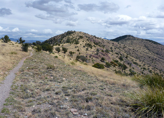
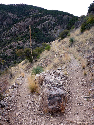
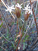
The path follows close to the streambed, past some alligator juniper trees, crosses to the south side and rises via a few more zigzags to a saddle on the ridgeline, where all of the vast lands to the south come into view for the first time. The trail bends round to the northwest, following the crest - initially just below to the west, right on top for a while then a little below to the east. The sparse vegetation includes scattered bushes, and clumps of cane cholla, adorned with bright yellow fruits for of most of the year. A junction just after a descent from a minor summit marks the start of the Yaqui Ridge Trail, which slopes down to a boundary post along the international border. Joe's Canyon Trail continues towards Coronado Peak, running beneath the steep east face, past a notice warning against trying to climb to the summit from here. The last section, nearly level, is below some minor cliffs, before an intersection with the Coronado Peak summit path, close to the road at Montezuma Pass.
About two thirds of the hike is along the ridgetop, which offers fantastic views all around, including the higher peaks of the Huachuca Mountains to the north, and the vast plains of Mexico to the south; wide-open scenery that contrasts with the more enclosed and overgrown environment of the ravine at the start of the route.
The path is not much used, perhaps because it begins and ends along the road rather than leading to some remote destination, and since the views along the upper reaches are similar to those from Montezuma Pass and also from the top of Coronado Peak, which is reached by a much shorter walk, just 0.4 miles. A car shuttle would enable a one-way hike along Joe's Canyon Trail, preferably in the downhill direction, from west to east, while for a round trip, since walking on the road is not recommended due to the narrow carriageway and lack of verges in some places, it is best to return the same way. Another option is the free NPS shuttle, which departs from the visitor center at 8.30 am, Thursday through Sunday, fall to early summer.
Joe's Canyon
The trail starts, in the east, just opposite the visitor center, and it has a gentle gradient at first, crossing a mostly treeless slope with plenty of wildflowers in summer, while moving towards the steeper ground along the south side of Montezuma Canyon. The land becomes more wooded as the path crosses a wash, with flowing water during wetter seasons, and climbs via four comparatively gentle switchbacks, returning close to the creekbed in a rocky area, lacking trees. The next section rises some more and runs along the base of a cliff, where plants include pineapple milkweed, then rounds a corner and enters the shallower, upper part of the ravine, still several hundred feet below the ridgeline. The slopes at either side are sparsely covered with the colorful Arizona rainbow cactus, which produces large pink flowers in the summertime.
Smugglers Ridge
The path follows close to the streambed, past some alligator juniper trees, crosses to the south side and rises via a few more zigzags to a saddle on the ridgeline, where all of the vast lands to the south come into view for the first time. The trail bends round to the northwest, following the crest - initially just below to the west, right on top for a while then a little below to the east. The sparse vegetation includes scattered bushes, and clumps of cane cholla, adorned with bright yellow fruits for of most of the year. A junction just after a descent from a minor summit marks the start of the Yaqui Ridge Trail, which slopes down to a boundary post along the international border. Joe's Canyon Trail continues towards Coronado Peak, running beneath the steep east face, past a notice warning against trying to climb to the summit from here. The last section, nearly level, is below some minor cliffs, before an intersection with the Coronado Peak summit path, close to the road at Montezuma Pass.
Joe's Canyon Trail - Similar Hikes
All Contents © Copyright The American Southwest | Comments and Questions | Contribute | Affiliate Marketing Disclosure | Site Map