Highlights:
The Rocky Mountains of central Colorado, from the San Juan area in the southwest to Rocky Mountain National Park in the northeast. Includes the Great Sand Dunes, Black Canyon, Maroon Bells, Pikes Peak and Garden of the Gods
Type:
Loop, beginning at Denver
Length:
1,225 miles, 1,970 km
Duration:
10 days minimum; 14 days or more with optional side trips
Seasons:
June to October, since some of the higher elevation roads are closed by snow at other times
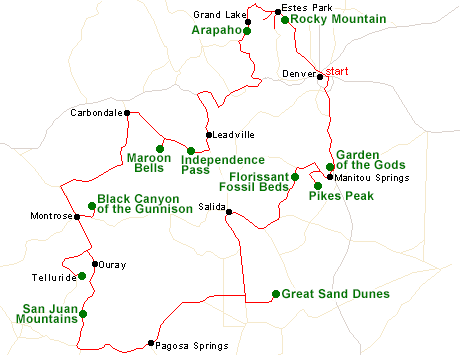
Map of the Colorado Rockies Itinerary
Please refer to the disclosure notice for information about the affiliate (commissionable) links on this page.
Day 1 - Denver to Manitou Springs, 80 miles
I-25 provides a quick route out of Denver, south to Colorado Springs and Garden of the Gods, featuring a spectacular group of eroded red and white sandstone formations. The park has a good selection of trails, and is also popular with rock climbers. Manitou Springs provides a more peaceful alternative to lodging in the nearby city. An optional side trip is along the road to the summit of 14,264 foot Mount Evans.
Day 2 - Manitou Springs to Salida, 150 miles
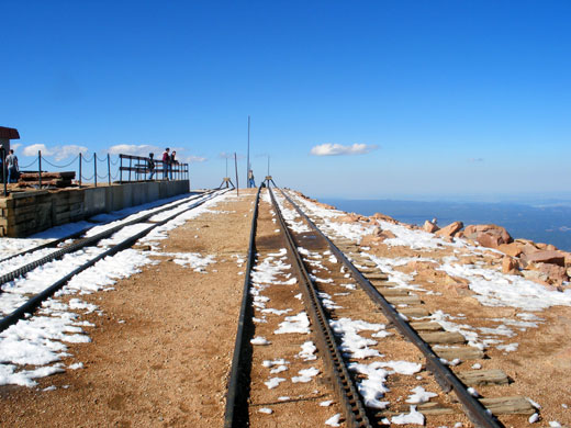
A little way west of Manitou Springs is Pikes Peak, whose 14,110 foot summit can be reached by a 19 mile scenic drive or a cog railway. After climbing further into the mountains, US 24 reaches Florissant Fossil Beds National Monument, where several short trails lead to an old homestead, fossil excavation sites and huge petrified sequoia stumps. The day is completed by a drive south along quiet roads to Salida.
Day 3 - Salida to Pagosa Springs, 200 miles
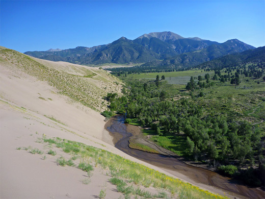
One of the longest stretches of straight road in the US leads south towards Great Sand Dunes National Park, where golden dunes rise up to 700 feet above a flat valley floor, set beneath the snow-covered Sangre de Cristo Mountains. After spending most of the day in the park, the journey west continues along US 160, to the small town of Pagosa Springs.
Day 4 - Pagosa Springs to Ouray, 130 miles
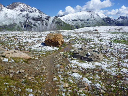
West of Pagosa Springs, US 160 next reaches Durango, terminus of a famous narrow gauge railway, and gateway town to the San Juan Mountains. The scenery gets ever more spectacular as US 550 climbs northwards, through Silverton and over Red Mountain Pass to Ouray, set in a deep box canyon.
Optional extra day: the Anasazi ruins of Mesa Verde National Park, 45 miles west of Durango
Day 5 - Ouray to Montrose, 120 miles
Telluride is a worthwhile diversion, 50 miles from Ouray along more winding mountain roads. This is a good hiking location, one popular route being the Sneffels Highline Trail above Telluride. The night is spent in Montrose, an hour's drive north.
Day 6 - Montrose to Carbondale, 140 miles
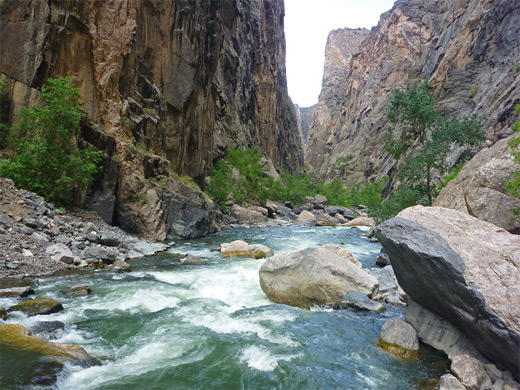
Montrose sits in a wide valley, but the mountains soon return as US 50 climbs eastwards to Black Canyon of the Gunnison National Park, containing an especially dark and sheer-walled gorge formed by the Gunnison River. Intrepid hikers may take one of the three steep trails to the canyon floor. On returning to Montrose, little-traveled roads lead up the eastern Rockies to Carbondale, beside the Roaring Fork River.
Day 7 - Carbondale to Leadville, 110 miles
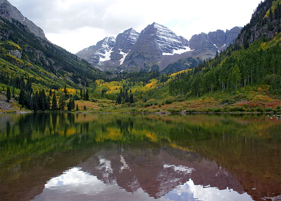
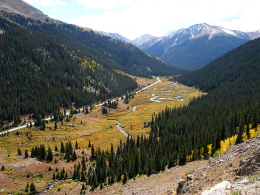
Two of the highlights of Colorado's mountains are found along the very scenic drive from Carbondale to Leadville. One is the Maroon Bells Wilderness near Aspen, where a short hike leads to the iconic image of the reddish peaks reflected in the shallow waters of Maroon Lake. The other is Independence Pass through the Sawatch Range, which provides beautiful views in all directions.
Optional extra day: longer hikes in the Maroon Bells Wilderness
Day 8 - Glenwood Springs to Grand Lake, 150 miles
A two and a half hour drive partly on I-40 reaches Arapaho NRA and the west entrance to Rocky Mountain National Park; a suggested hike in this region is the 3 mile trail to Lulu City, along the upper reaches of the Colorado River.
Optional extra day: longer hikes in the west of Rocky Mountain NP
Hotel: Grand Lake Lodge
Day 9 - Grand Lake to Estes Park, 65 miles
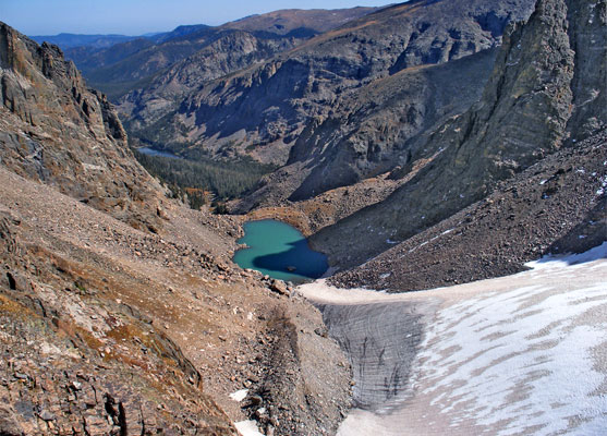
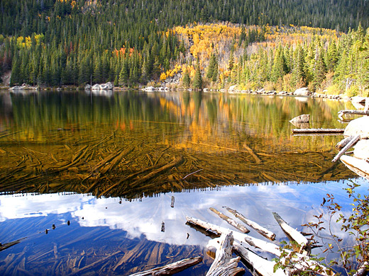
Trail Ridge Road climbs to over 12,000 feet then descends into the main (east) section of Rocky Mountain National Park; some of the best scenery, and most popular trails, are in the Bear Lake/Glacier Gorge area.
Day 10 - Estes Park to Denver, 80 miles
There is time to see more of Rocky Mountain National Park such as the areas south of Estes Park along Hwy 7, before the short drive back to Denver.
Optional extra day(s): more hiking in the east of Rocky Mountain NP
All Contents © Copyright The American Southwest | Comments and Questions | Contribute | Affiliate Marketing Disclosure | Site Map