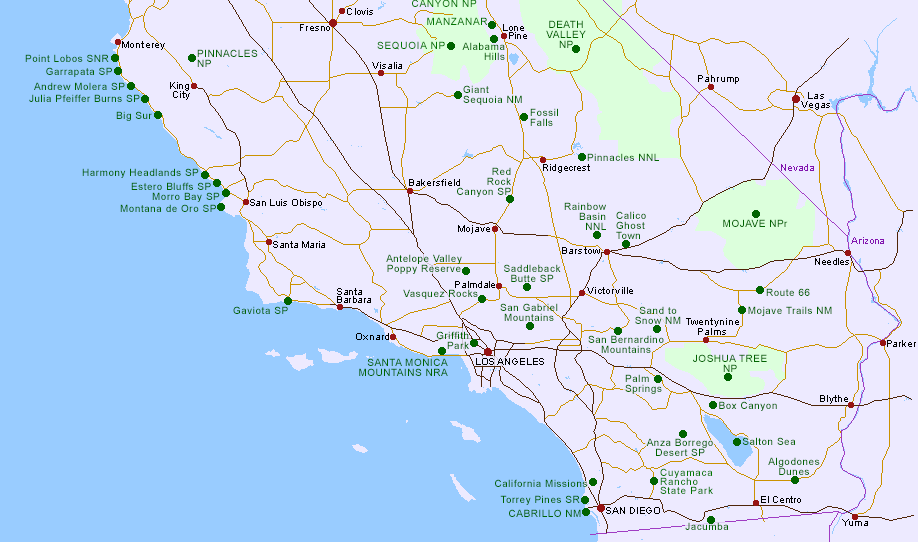
Map of South and Central California
Switch to South/Central California Hotels Map
Map of North California
Click on the green circles for descriptions of the various locations.
California Driving Distances
Combined California Map
Overview Map of the Southwest
Other state maps: Arizona, California (North), Colorado, Idaho, Nevada, New Mexico, Oregon, Utah, Texas, Wyoming
Other south/central California maps on this site, for specific places:
Anza-Borrego Desert, Big Sur, California Missions, Death Valley, Griffith Park, Giant Sequoia National Monument, Joshua Tree, Kings Canyon/Sequoia, Mojave, Mojave Trails, Montaña de Oro, Palm Springs, Pinnacles, Point Lobos, Salton Sea, Santa Monica Mountains.
PDF maps of south/central California national parks and monuments, from the NPS:
Cabrillo,
Mojave National Preserve.
 |
Delorme Southern & Central California AtlasThe Delorme southern and central California atlas has 110 maps, each covering an area 26.25 minutes of longitude by 30 minutes of latitude, from Santa Cruz south to Mexico, and including the various Pacific Ocean islands. The atlas also includes a gazetteer, and pages on parks/forests/recreation areas, wilderness areas, beaches, historic sites, campgrounds, unique natural features, golf courses and more. Buy from amazon.com Affiliate disclosure |
All Contents © Copyright The American Southwest | Comments and Questions | Contribute | Affiliate Marketing Disclosure | Site Map