Colorado Map
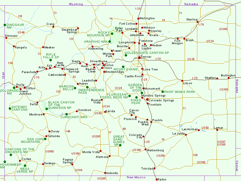
Click on the green circles for descriptions of the national parks, national monuments and other scenic areas in Colorado
Colorado Driving Distances
Overview Map of the Southwest
Other state maps: Arizona, California (North), California (South and Central), Idaho, Nevada, New Mexico, Oregon, Texas, Utah, Wyoming
Maps of specific places in Colorado: Arapaho National Recreation Area, Colorado National Monument, Curecanti National Recreation Area, Florissant Fossil Beds National Monument, Garden of the Gods, Great Sand Dunes National Park, Independence Pass, Maroon Bells, Mesa Verde National Park, Pikes Peak, Rifle Falls State Park, Rocky Mountain National Park

Delorme Colorado Atlas
The excellent Delorme topographic atlas of Colorado contains 90 pages of maps, with the western two thirds of the state covered at a scale of 1:160,000 (1 inch to 2.5 miles), and the more featureless eastern third - east of Denver, Colorado Springs and interstate 25 - at half scale, 1:320,000. The contour interval is 300 feet for the west section. 11 pages of supporting information include sections on BLM public lands, state parks, scenic drives, unique natural features, hiking trails and hunting/fishing areas.
Buy from amazon.com
Affiliate disclosure
All Contents © Copyright The American Southwest | Comments and Questions | Contribute | Affiliate Marketing Disclosure | Site Map