| COLORADO | Index | Maps | Driving Distances | Introduction | National Parks | Weather | Photographs | QTVR | Hotels |
Map of Colorado National Monument | |
Sites in Colorado NPS Units Black Canyon Colorado Florissant Fossil Beds Great Sand Dunes Mesa Verde Rocky Mountain Other Places Arapaho NRA Garden of the Gods Independence Pass Maroon Bells Pikes Peak Rifle Falls SP San Juan Mountains Colorado Site Map Site Search Photograph Search |
Colorado National Monument > Map![]() 
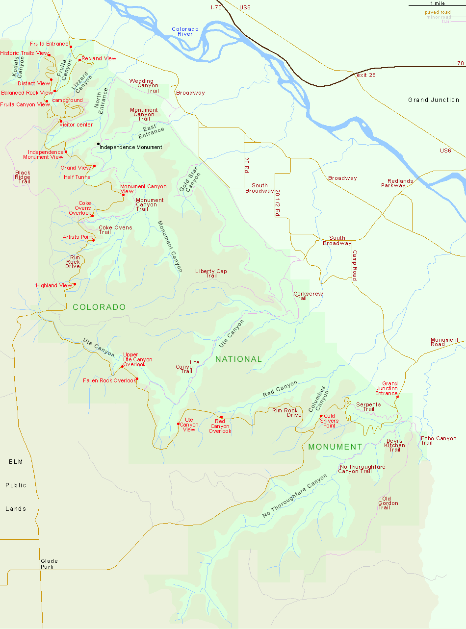
Colorado National Monument has two entrances, linked by a paved, 22 mile road (Rim Rock Drive). In the north, the monument is reached by driving 2.5 miles south from Fruita, beginning at junction 19 of interstate 70. The southern entrance is 5 miles from the center of Grand Junction via Broadway (Hwy 340) and Monument Road. |
| Back to Top | |
Arizona | California | Colorado | Nevada | New Mexico | Oregon | Texas | Utah | Wyoming | Slot Canyons | Travelogue | SOUTHWEST |
|