Home
|
Categories
|
National Parks
|
Hotels
|
Site Map
|
Photographs
|
QTVR
|
Whats New?
|
More...
CALIFORNIA
Index
|
Introduction
|
Photographs
|
QTVR
|
Driving Distances
|
Map
|
Weather
|
Hotels
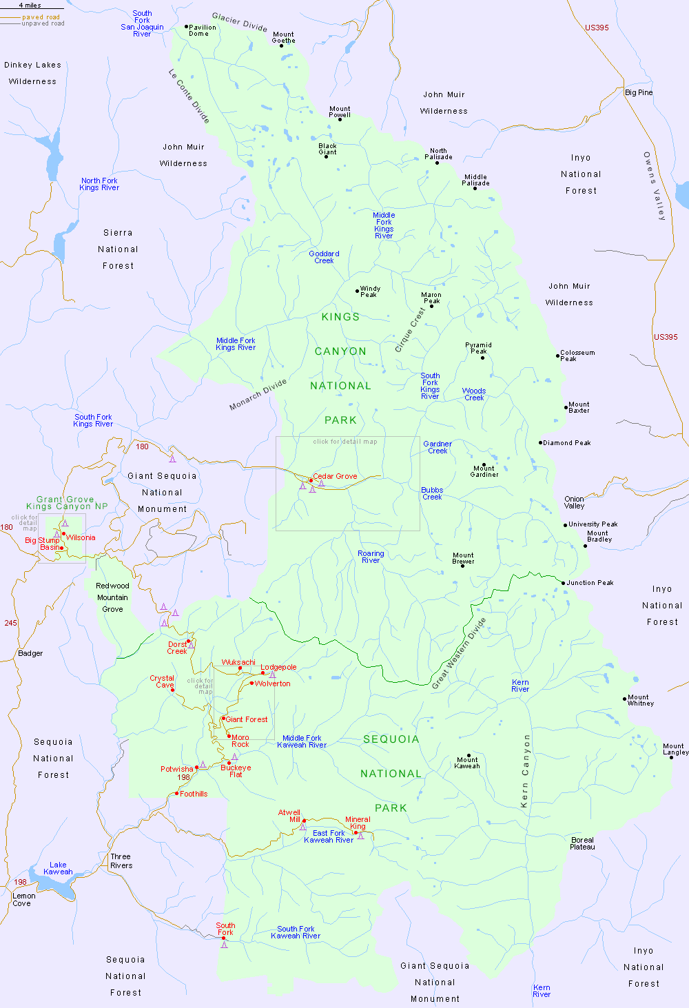
Map of Kings Canyon and Sequoia National Parks
Sites in California
NPS Units
Cabrillo
Death Valley
Devils Postpile
Golden Gate
Joshua Tree
Kings Canyon
Lassen Volcanic
Lava Beds
Mojave
Muir Woods
Pinnacles
Point Reyes
Redwood
Sequoia
Yosemite
Other Places
Anza Borrego Desert
Big Basin Redwoods
Big Sur
Bodie SHP
Calaveras Big Trees
California Missions
Humboldt Redwoods
Lake Tahoe
Palm Springs
Point Lobos
More Locations...
Algodones Dunes
Andrew Molera SP
Big Pine Lakes
Box Canyon
Calico Ghost Town
Donner Memorial SP
Garrapata SP
Giant Sequoia NM
Griffith Park
Hot Creek
Humboldt Lagoons
Indian Canyons
Jacumba Natural Area
Jedediah Smith Redwoods
Julia Pfeiffer Burns SP
Mammoth Lakes
Mono Lake
Mount Shasta
Pinnacles NNL
Prairie Creek Redwoods
Rainbow Basin NNL
Red Rock Canyon SP
Route 66
Saddleback Butte SP
Salton Sea
San Gabriel Mountains
Torrey Pines
Trinidad State Beach
Vasquez Rocks
California Site Map
Site Search
Photograph Search
Kings Canyon National Park
/
Sequoia National Park
> Map
Detailed map for Cedar Grove/Kings Canyon
Detailed map for Giant Forest
Detailed map for Grant Grove
PDF format maps of Kings Canyon and Sequoia National Parks, from the National Park Service:
Area map
(100 kb)
Detail map
(1.3 mb)
Back to Top
Arizona
|
California
|
Colorado
|
Nevada
|
New Mexico
|
Texas
|
Utah
|
Wyoming
|
Slot Canyons
|
Travelogue
|
SOUTHWEST
All contents ©
copyright
John Crossley |
Comments and questions