American Southwest
Home | Categories | National Parks | Hotels | Site Map | Photographs | QTVR | Whats New? | More...
CALIFORNIA
Index | Introduction | Photographs | QTVR | Driving Distances | Map | Weather | Hotels


Map of Palm Springs

Sites in California

NPS Units
Cabrillo
Death Valley
Devils Postpile
Golden Gate
Joshua Tree
Kings Canyon
Lassen Volcanic
Lava Beds
Mojave
Muir Woods
Pinnacles
Point Reyes
Redwood
Sequoia
Yosemite

Other Places
Anza Borrego Desert
Big Basin Redwoods
Big Sur
Bodie SHP
California Missions
Humboldt Redwoods
Lake Tahoe
Palm Springs
Point Lobos

California Site Map

Site Search


Palm Springs > Map

Map of Palm Springs

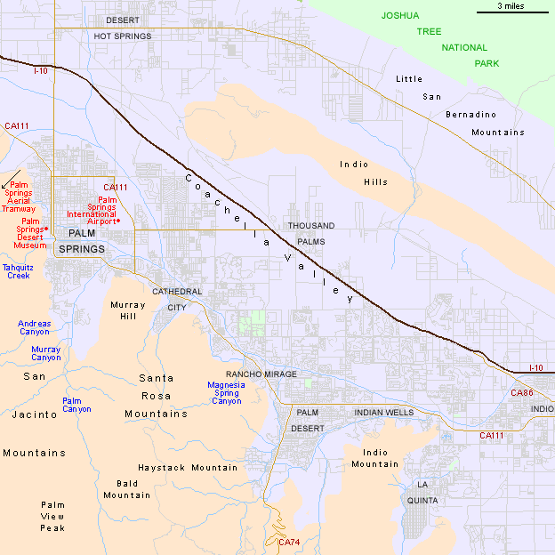
Although close to interstate 10, Palm Springs is separated from it by the wide, sandy flats of the usually dry Whitewater River, and a few miles of desert. Instead, the main route through town is CA 111, which starts from I-10 exit 112, passes through Palm Springs and the other main towns of the Coachella Valley (Cathedral City, Rancho Mirage, Palm Desert, Indian Wells and Indio), before rejoining I-10 at exit 144. The high San Jacinto and Santa Rosa Mountains restrict access to Palm Springs from the south to only one road - CA 74, the Pine Palms Highway - which climbs to 5,000 feet before descending into the San Jacinto Valley.


Back to Top

All contents © copyright John Crossley | Comments and questions
Arizona California Colorado Nevada New Mexico Texas Utah Wyoming Slot Canyons Travelogue