Sites in California
NPS Units
Cabrillo
Death Valley
Golden Gate
Joshua Tree
Kings Canyon
Lassen Volcanic
Lava Beds
Mojave
Muir Woods
Pinnacles
Point Reyes
Redwood
Sequoia
Yosemite
Other Places
Anza Borrego Desert
Big Basin Redwoods
Big Sur
Bodie SHP
California Missions
Humboldt Redwoods
Lake Tahoe
Palm Springs
Point Lobos
California Site Map
Site Search

 |
 |
Joshua Tree National Park > Map
Switch to Joshua Tree Hiking Map
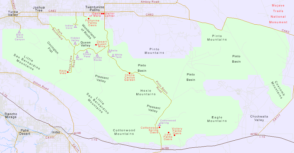
PDF format map of Joshua Tree National Park, from the National Park Service (436 kb).
For hiking, driving and sight-seeing, the best topological map of Joshua Tree National Park is from Trails Illustrated (National Geographic), covering the area at a scale of 1:80,000 and with contours at intervals of 40 foot (northwest section) or 80 foot (south and east sections). The park's 20 or so maintained trails are marked together with many of the unmaintained routes, plus all the backroads, campsites, oases, and many other points of interest. Mileages are given for the roads and major trails. Additional information covers the climate, backcountry use regulations and wilderness ethics.
Buy from amazon.com

Satellite Photo/Map: View above Joshua Tree National Park:
|