Highlights:
Colorful petrified logs, strewn over a wooded mesa north of the Escalante River, viewable by two loop trails totaling 1.75 miles. The park also contains a campground and part of a reservoir
Nearby town:
Bryce Canyon, 45 miles
Management:
Location:
Seasons:
All year
Rating (1-5):
★★★★★
Weather:

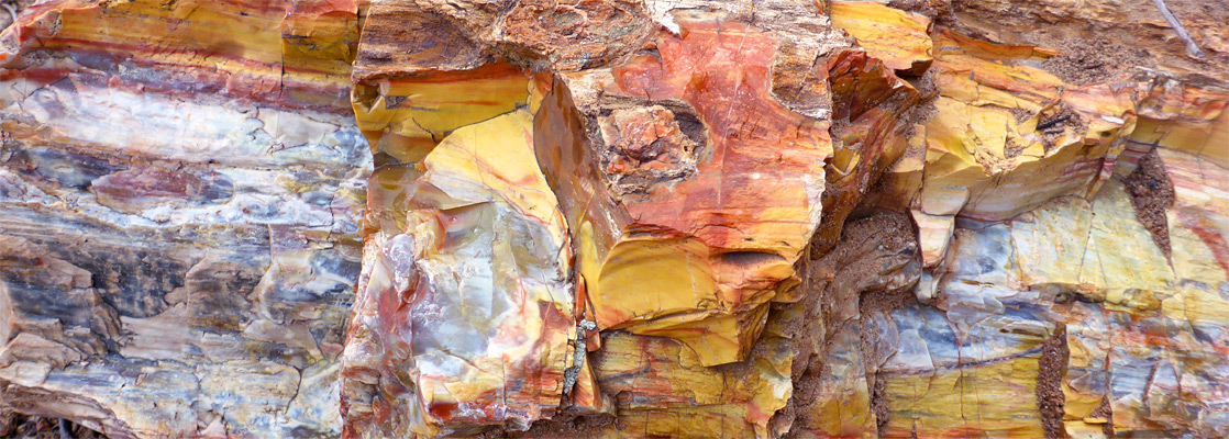
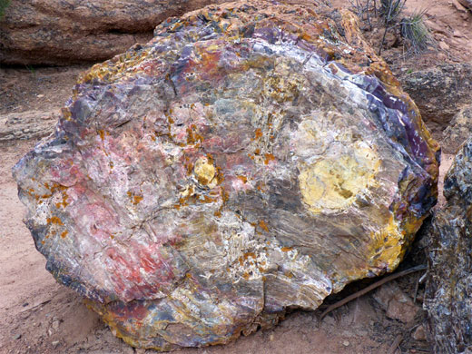
Outcrops of petrified wood are scattered over a large area of southeast Utah and on into northern Arizona, including the most famous deposits at Petrified Forest National Park; all occur in the Chinle Formation, a colorful mix of sandstone and mudstone from the Upper Triassic epoch.
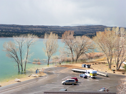
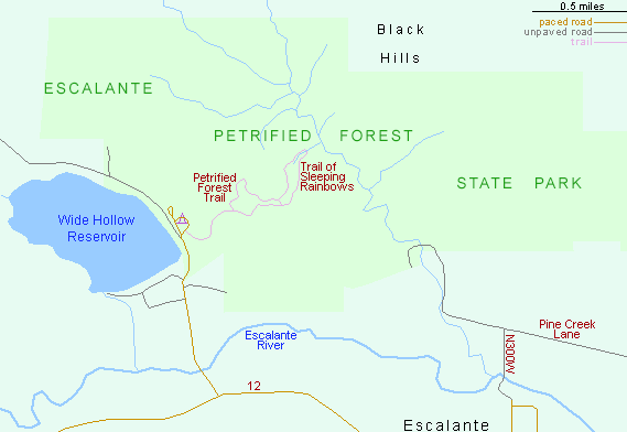
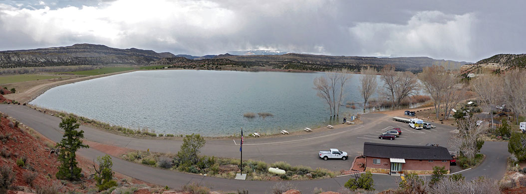
A sizeable area is found near Escalante, spread over the edge of the plateau just northwest of town, and this has been protected since 1963 as a state park, which also includes a 22 site campsite, and part of the shoreline of the cottonwood tree-lined Wide Hollow Reservoir - a noted birdwatching location.
Two short, linked loop trails wind past many of the fossilized specimens, and a pleasant hour can be spent wandering amongst the brightly-colored rocks, in addition to which the area is also noted for Fremont Indian relics, 1,000 year old petroglyphs and fossilized dinosaur bones.
Escalante Petrified Forest Table of Contents
Map of Escalante Petrified Forest State Park
Photographs
14 views of the state park.
Escalante Tours
The State Park
Escalante Petrified Forest State Park is well signposted and is reached by a side road just outside town, forking off scenic highway 12; this crosses an agriculturalized valley heading towards a line of low cliffs, beneath which are the campground and administration buildings, all close to the edge of the reservoir - built in 1954, this has become an important wetland bird habitat, a rare occurence in southern Utah. Fishing, boating and swimming are permitted; paddle boards, kayaks and canoes may be rented. The entrance fee (2024) is $10 per vehicle.
Trails of the Escalante Petrified Forest
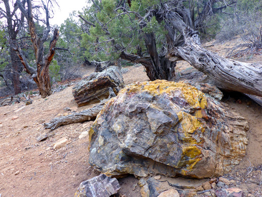
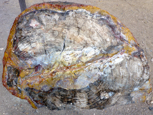
The one mile, well maintained Petrified Forest Trail climbs steeply by 250 feet, up the slope behind the camping area and along a little ravine to the pine and juniper-covered plateau above, where it forks, at the start of a loop. Right (east) is the recommended direction to continue, across flat land dotted with basalt boulders, past a few small petrified logs, while numbered signs reference other points of interest. The plateau is home to various wildflowers, mostly species in the borage family. Towards the far side of the mesa, the 0.75 mile Trail of Sleeping Rainbows branches off, signed 'very steep'; named after the native Fremont Indian description of this region, this rather more impressive trail passes many more petrified wood pieces, larger and more colorful. The trail descends by 200 feet, down one narrowish ravine and up another, passing dozens of logs up to 15 feet long and 5 feet wide, mixed with the basalt boulders. The fossils are still not in general quite as brightly colored as those of the national park in Arizona but are still very pretty; larger and more mineralized than the other deposits in the Escalante region, such as along Wolverine Creek. Both parks have similar cautionary tales about the ill fortune that befalls those who illegally remove samples, with a collection of letters sent from remorseful visitors. The northernmost part of the Trail of Sleeping Rainbows reaches the brink of a pour-off, overlooking a grassy valley in the middle of the state park, after which the route soon returns to the top of the plateau, and ends at a second junction with the Petrified Forest Trail, which continues west, passing rather more petrified logs than on the outwards section, back to the junction near the start, overlooking the reservoir.
Escalante Petrified Forest - Nearby Places
- Bryce Canyon National Park (46 miles) - delicately sculptured orange and pink rocks
- Escalante and Boulder - two small towns linked by UT 12
- Lower Calf Creek Falls (18 miles) - 126 foot cascade close to UT 12
Escalante Petrified Forest - Similar Places
- Fossil Forest, New Mexico - hoodoos and petrified wood in the San Juan Basin
- Petrified Forest National Park, Arizona - brilliantly colored fossilized logs and varied desert scenery
All Contents © Copyright The American Southwest | Comments and Questions | Contribute | Affiliate Marketing Disclosure | Site Map