Rim Overlook/Navajo Knobs Trail, Capitol Reef National Park
Utah > Capitol Reef National Park > Hiking > Rim Overlook/Navajo Knobs Trail
Rim Overlook/Navajo Knobs
The longest trail in the park, climbing a sloping bench of Kayenta sandstone on the north side of the Fremont River to a spectacular cliff-edge viewpoint, then ascending further, round two sides of a wide basin, to the top of a Navajo sandstone dome, for even better views
Length: 2.4 miles, 4.9 miles
Elevation change: 1,050 feet, 1,600 feet
Difficulty: Moderate - steep only at the end, but relatively long, and exposed
Type: One way
Usage: Medium, low
Season: Fall, winter, spring
Trailhead: Parking area along Hwy 24
Rating (1-5): ★★★★★
Elevation change: 1,050 feet, 1,600 feet
Difficulty: Moderate - steep only at the end, but relatively long, and exposed
Type: One way
Usage: Medium, low
Season: Fall, winter, spring
Trailhead: Parking area along Hwy 24
Rating (1-5): ★★★★★

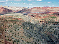
The Rim Overlook/Navajo Knobs Trail is the longest maintained hiking path in Capitol Reef National Park, at 4.9 miles, and has the greatest elevation gain, 1,600 feet, nearly all of which is achieved gradually, without any particularly steep sections, since the path ascends at a constant gradient of around 15%, the same angle as the strata in the reef. The route follows the reddish Kayenta sandstone layer nearly all of this distance, along the north side of the Fremont River valley, climbing to the overlaying Navajo sandstone right at the end, at the summit of a minor dome which gives a 360 degree view across the park.
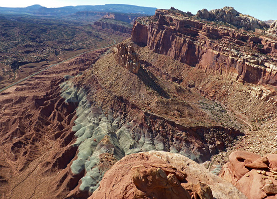
Half way along, the trail passes an intermediate viewpoint, Rim Overlook, 1,000 feet above Fruita, Sulphur Creek and the river, and this is the turnaround point for the majority of hikers, though it is well worth continuing at least another 0.4 miles, to a similar though slightly better overlook; after here the path detours around two sides of a wide basin, initially fairly level, before ascending more steeply to the final summit.
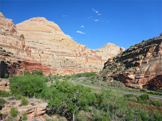
There is no shade along the whole trail, and no water, so the hike is best avoided during the hot summer months. The trailhead is shared with that for the shorter and much more popular path to Hickman Bridge.
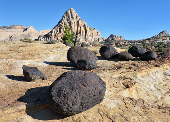
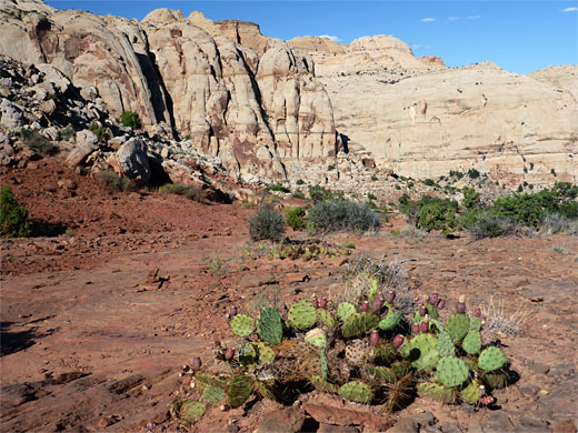
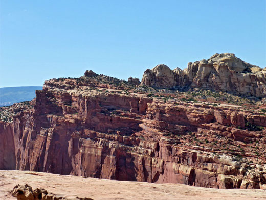
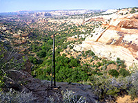
From the parking area, in the shade of cottonwood trees beside the Fremont River, the path runs beneath a short line of cliffs, through a recent rockfall that has prompted the NPS to install notices warning hikers not to linger in the vicinity, in case of more collapses. The path rounds a corner, climbs to the top of the cliffs and traverses a small basin to a junction, where the Hickman Bridge Trail continues west while the Rim Overlook route is briefly north, over a brow and across a drainage just above a little drop-off, before also turning west and beginning a long, steady ascent up sloping benches of Kayenta sandstone. The route runs for a while close to the rim of the deepening drainage, in view of the other trail, before moving away across several minor gullies and then back for the last time, to Hickman Bridge Overlook, a viewpoint 500 feet from the bridge and a little way above it. Shortly before is another photogenic place, looking towards the distinctive peak of Pectol's Pyramid, nicely framed by a group of dark volcanic boulders resting on a light-colored sandstone slab.
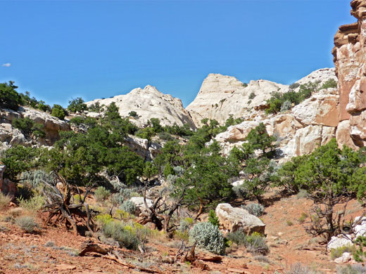
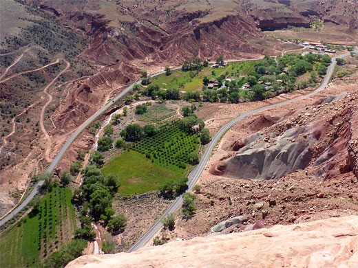
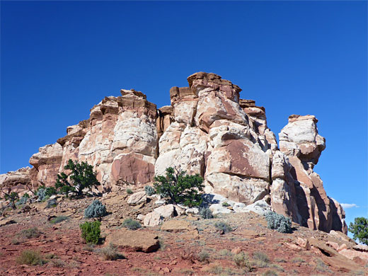
The path next veers towards the high cliffs in the north to cross a wider drainage, the first of four such diversions. The next is reached after a longer straight section, and the third after a shorter walk, as dramatic white peaks come into view ahead. The next climb leads to a shorter ravine and then the Rim Overlook viewpoint, indicated by a sign. This point is directly above the orchards at Fruita, and opposite the start of the scenic drive.
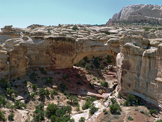
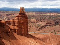
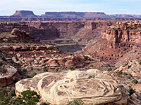
The continuation path, a little less obvious though (still) well marked by cairns, descends gently towards the floor of the next side canyon, crosses its sandy creekbed and rises over a big expanse of whitish slickrock, at the southern edge of Longleaf Flat, to a similar viewpoint, with more land visible to the west, including the jagged formation of The Castle, beside a colorful, banded outcrop of the Chinle Formation. The best views are about a quarter mile off-trail to the south, right at the edge of the cliffs, next to a communications tower. Near here is a ravine which shelters a couple of ponderosa pines, much taller than the juniper and pinyon pines which are scattered across the open slopes.
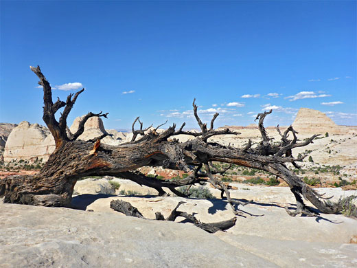
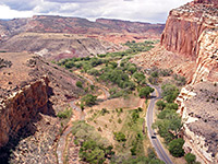
The west-facing viewpoint also overlooks the last section (1.8 miles) of the trail, which is level for a while, or slightly descending, as it heads north along the rim of the sizeable basin surrounding the Castle, crosses another dry drainage then turns west for the final, steeper climb, up 600 feet over one mile, beneath a line of curving cliffs and up to the top of the westernmost of a line of pale-colored Navajo sandstone domes, elevation 6,979 feet. On the summit, the southern panorama is similar to the last couple of overlooks, but now much more land to the north is in view. There are several other domes nearby which can also be climbed, with more effort.
Half way along, the trail passes an intermediate viewpoint, Rim Overlook, 1,000 feet above Fruita, Sulphur Creek and the river, and this is the turnaround point for the majority of hikers, though it is well worth continuing at least another 0.4 miles, to a similar though slightly better overlook; after here the path detours around two sides of a wide basin, initially fairly level, before ascending more steeply to the final summit.
There is no shade along the whole trail, and no water, so the hike is best avoided during the hot summer months. The trailhead is shared with that for the shorter and much more popular path to Hickman Bridge.
Start of the Rim Overlook Trail
From the parking area, in the shade of cottonwood trees beside the Fremont River, the path runs beneath a short line of cliffs, through a recent rockfall that has prompted the NPS to install notices warning hikers not to linger in the vicinity, in case of more collapses. The path rounds a corner, climbs to the top of the cliffs and traverses a small basin to a junction, where the Hickman Bridge Trail continues west while the Rim Overlook route is briefly north, over a brow and across a drainage just above a little drop-off, before also turning west and beginning a long, steady ascent up sloping benches of Kayenta sandstone. The route runs for a while close to the rim of the deepening drainage, in view of the other trail, before moving away across several minor gullies and then back for the last time, to Hickman Bridge Overlook, a viewpoint 500 feet from the bridge and a little way above it. Shortly before is another photogenic place, looking towards the distinctive peak of Pectol's Pyramid, nicely framed by a group of dark volcanic boulders resting on a light-colored sandstone slab.
Rim Overlook
The path next veers towards the high cliffs in the north to cross a wider drainage, the first of four such diversions. The next is reached after a longer straight section, and the third after a shorter walk, as dramatic white peaks come into view ahead. The next climb leads to a shorter ravine and then the Rim Overlook viewpoint, indicated by a sign. This point is directly above the orchards at Fruita, and opposite the start of the scenic drive.
Navajo Knobs Trail
The continuation path, a little less obvious though (still) well marked by cairns, descends gently towards the floor of the next side canyon, crosses its sandy creekbed and rises over a big expanse of whitish slickrock, at the southern edge of Longleaf Flat, to a similar viewpoint, with more land visible to the west, including the jagged formation of The Castle, beside a colorful, banded outcrop of the Chinle Formation. The best views are about a quarter mile off-trail to the south, right at the edge of the cliffs, next to a communications tower. Near here is a ravine which shelters a couple of ponderosa pines, much taller than the juniper and pinyon pines which are scattered across the open slopes.
Sandstone Domes
The west-facing viewpoint also overlooks the last section (1.8 miles) of the trail, which is level for a while, or slightly descending, as it heads north along the rim of the sizeable basin surrounding the Castle, crosses another dry drainage then turns west for the final, steeper climb, up 600 feet over one mile, beneath a line of curving cliffs and up to the top of the westernmost of a line of pale-colored Navajo sandstone domes, elevation 6,979 feet. On the summit, the southern panorama is similar to the last couple of overlooks, but now much more land to the north is in view. There are several other domes nearby which can also be climbed, with more effort.
Navajo Knobs Trail - Similar Hikes
All Contents © Copyright The American Southwest | Comments and Questions | Contribute | Affiliate Marketing Disclosure | Site Map