South Park Peak Trail, Joshua Tree National Park
California > Joshua Tree National Park > Hiking > South Park Peak
South Park Peak Trail
Loop path, just outside the park boundary, that climbs a shallow ravine to a minor summit overlooking the town of Yucca Valley; also has good views over the Black Rock Canyon area to the south
Length: 0.6 miles (round trip)
Elevation change: 230 feet
Difficulty: Easy
Type: Loop
Usage: Medium
Season: All year
Trailhead: Side road near Black Rock Canyon campground
Rating (1-5): ★★★★★
Elevation change: 230 feet
Difficulty: Easy
Type: Loop
Usage: Medium
Season: All year
Trailhead: Side road near Black Rock Canyon campground
Rating (1-5): ★★★★★

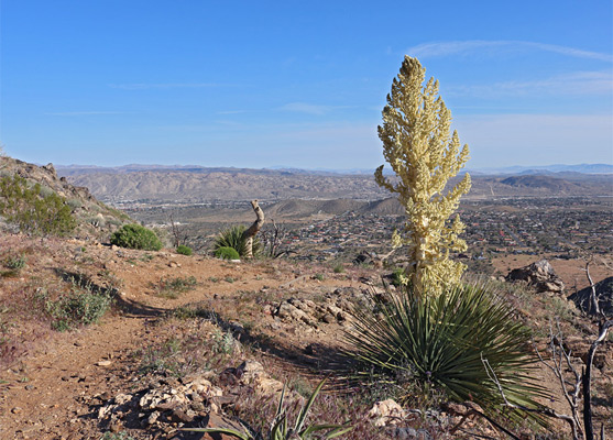
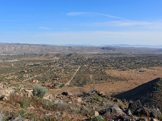
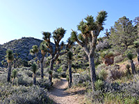
South Park Peak is a minor though relatively prominent, 4,395 foot hill at the north edge of the Little San Bernardino Mountains, just outside the northwest corner of Joshua Tree National Park, and its summit may be reached by an easy, 0.6 mile loop path which climbs 230 feet, starting at a parking area shared with the High View Trail, just within the park, which ascends to a slightly higher promontory.
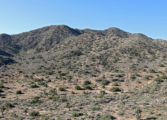
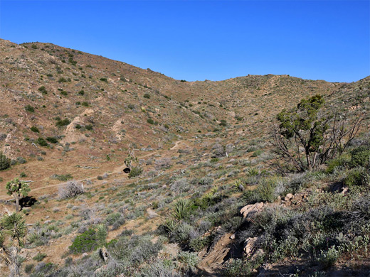
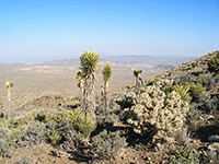
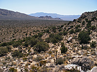
The South Park Peak Trail encounters a good variety of wildflowers, whilst crossing open slopes burnt in a recent wildfire and so lacking any large vegetation, and it also gives fine views from the summit, over Black Rock Canyon to the south, the dispersed town of Yucca Valley to the north, and across to higher mountains in most directions. Both trails can be completed in little more than one hour.
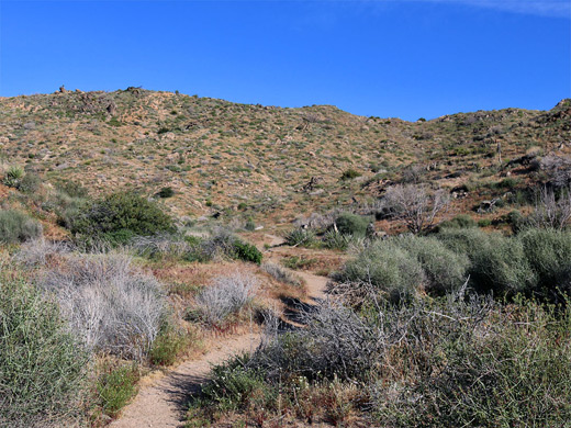
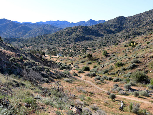
The trailhead is at the end of a half mile unpaved track from Black Rock Canyon campground. The only signposted route is the High View Trail to the south, though an arrow points the way to South Park Peak, along a path which leads northwestwards up a short, sandy-floored valley then veers right, becoming briefly sleep as it rises to a ridgetop which is followed a short distance to the summit, site of an abandoned register and a metal bench. The straight streets of Yucca Valley extend across the flat land, 1,000 feet below, and the views are wide-ranging in all directions, including the often snow-capped peaks of the San Jacinto and San Bernardino mountains. The trail continues down the opposite ridge, and quickly returns to the start. Wildflowers include a few large clusters of Mojave aster on the ridgetop and a good selection of other common species.
The South Park Peak Trail encounters a good variety of wildflowers, whilst crossing open slopes burnt in a recent wildfire and so lacking any large vegetation, and it also gives fine views from the summit, over Black Rock Canyon to the south, the dispersed town of Yucca Valley to the north, and across to higher mountains in most directions. Both trails can be completed in little more than one hour.
The Trail
The trailhead is at the end of a half mile unpaved track from Black Rock Canyon campground. The only signposted route is the High View Trail to the south, though an arrow points the way to South Park Peak, along a path which leads northwestwards up a short, sandy-floored valley then veers right, becoming briefly sleep as it rises to a ridgetop which is followed a short distance to the summit, site of an abandoned register and a metal bench. The straight streets of Yucca Valley extend across the flat land, 1,000 feet below, and the views are wide-ranging in all directions, including the often snow-capped peaks of the San Jacinto and San Bernardino mountains. The trail continues down the opposite ridge, and quickly returns to the start. Wildflowers include a few large clusters of Mojave aster on the ridgetop and a good selection of other common species.
South Park Peak Trail - Similar Hikes
All Contents © Copyright The American Southwest | Comments and Questions | Contribute | Affiliate Marketing Disclosure | Site Map