Lucky Boy Vista Loop, Joshua Tree National Park
California > Joshua Tree National Park > Hiking > Lucky Boy Vista Loop
Lucky Boy Vista Loop
Traverse of flat land with occasional Joshua trees to a viewpoint and old mine site, returning via two shallow drainages, past clumps of boulders, low cliffs and scattered pine trees
Length: 3.5 miles, or 2.9 miles with short-cut
Elevation change: 170 feet
Difficulty: Easy to moderate
Type: Loop, including short spur to viewpoint
Usage: Low
Season: All year, though very hot in summer
Trailhead: Parking area along the unpaved Desert Queen Mine Road
Rating (1-5): ★★★★★
Elevation change: 170 feet
Difficulty: Easy to moderate
Type: Loop, including short spur to viewpoint
Usage: Low
Season: All year, though very hot in summer
Trailhead: Parking area along the unpaved Desert Queen Mine Road
Rating (1-5): ★★★★★

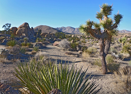
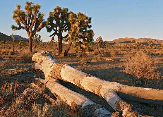
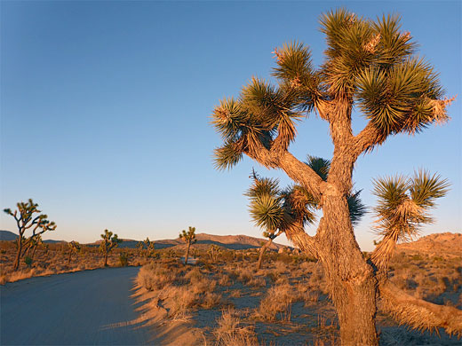
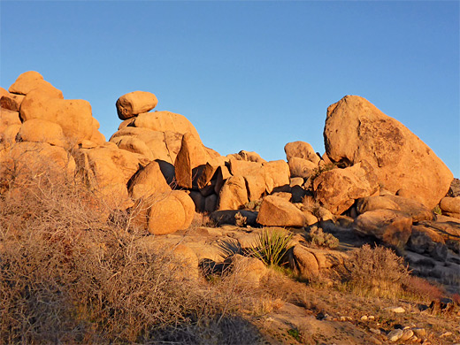
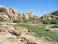
Trails along the main road through Joshua Tree National Park are often rather busy, especially the Jumbo Rocks area, around the campground, yet just a couple of miles north are two much less-used routes, reached by an unpaved but good-quality road that crosses Queen Valley, a wide basin containing many Joshua trees. One is the loop to Pine City and Desert Queen Mine, the other a 3.5 mile circuit to Lucky Boy Vista, a fine viewpoint at the edge of a plateau, looking across a large expanse of undulating, boulder-strewn terrain.
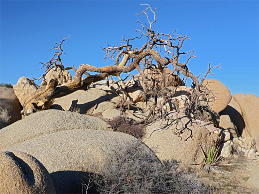
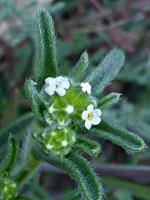
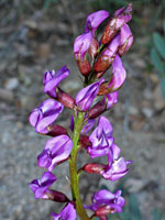
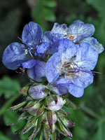
This latter route traverses flat land for a mile, past Joshua trees and monzonite outcrops, to the viewpoint, which adjoins another old mine, relics from which are limited to a few sealed shafts and spoil heaps; the return is along the floor of two shallow drainages, past more boulders, some low cliffs and occasional pine trees. This path ends by curving north and meeting the road half a mile from the trailhead, necessitating a walk back along the road, though the hike can be shortened, by 0.6 miles, via a brief off-trail walk. Besides the relative solitude, the views and the rock formations, the hike is also good for flowers and desert wildlife.
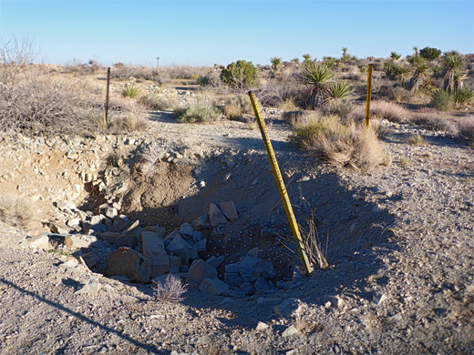
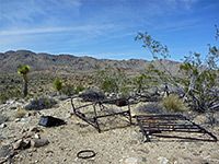
Elton Mine (or Elltun Mine), beside the viewpoint, was established in 1922 in the hope of finding gold or copper, though no useful materials were discovered, and it closed soon after the creation of the then national monument in 1936. It was also known as the Lucky Boy Claim.
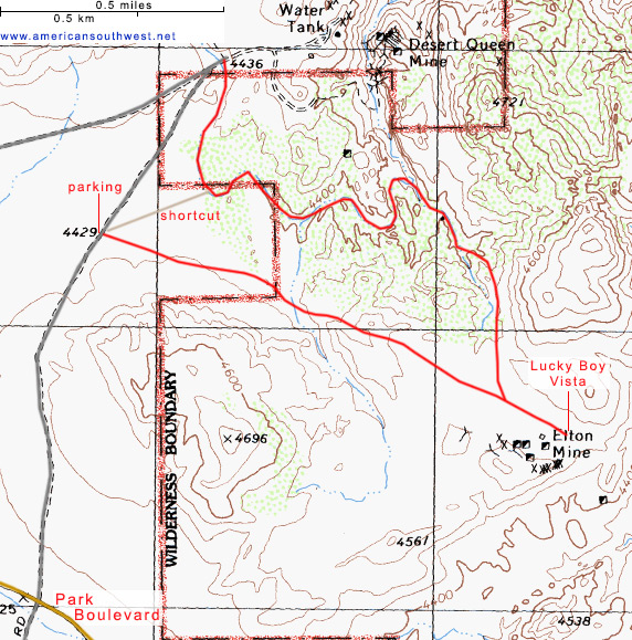
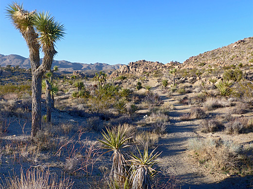
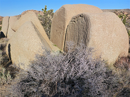
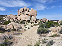
The Lucky Boy Vista trailhead is a small parking place with room for about four vehicles, 0.9 miles along the unpaved side road, which heads north, 1.6 miles west of the Jumbo Rocks campground. All around are large, evenly-spaced Joshua trees, with grey mountains to the north, and the place is very scenic around sunrise and sunset. The path is initially straight, heading southeast over open ground and through some piles of granitic rocks, including a photogenic pair of split boulders. Joshua trees become less numerous as the trail passes over a wash and rises slightly, moving just left of a low summit, then over a saddle and through an earthen flat with more yucca to a junction, where the return part of the loop is left while the vista is a quarter of a mile ahead. Elton Mine is just south; here are found the foundations of a stone building, several tailings piles and at least four mine shafts, all sealed with wire netting, but there are no standing structures or other relics. The spur ends at the viewpoint, while a fainter path continues southeast, marked by a notice stating 'Travel at Own Risk', linking with an official route near Split Rock.
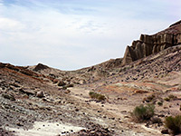
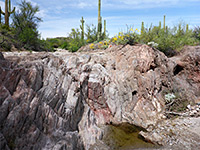
Back at the junction, the northwards path crosses a flat and drops down into a shallow ravine, following the sandy floor below piles of boulders, soon becoming somewhat enclosed. Signs indicate the way forward, as little side drainages mean this is not always obvious. The path bears left at a confluence, now going upcanyon, rounds a wide U-shaped bend, quite shady for a while, then turns right at another intersection. Rocks are plentiful, the scenery impressive. The drainage becomes shallower and curves north, meeting the road at its far end, at the trailhead for the Desert Queen Mine; the official route leads here but the Lucky Boy Vista trailhead can be reached by a short-cut, leaving the drainage as it veers north and walking over flat ground for 0.2 miles, past many cylindropuntia and grusonia cacti.
This latter route traverses flat land for a mile, past Joshua trees and monzonite outcrops, to the viewpoint, which adjoins another old mine, relics from which are limited to a few sealed shafts and spoil heaps; the return is along the floor of two shallow drainages, past more boulders, some low cliffs and occasional pine trees. This path ends by curving north and meeting the road half a mile from the trailhead, necessitating a walk back along the road, though the hike can be shortened, by 0.6 miles, via a brief off-trail walk. Besides the relative solitude, the views and the rock formations, the hike is also good for flowers and desert wildlife.
Elton Mine (or Elltun Mine), beside the viewpoint, was established in 1922 in the hope of finding gold or copper, though no useful materials were discovered, and it closed soon after the creation of the then national monument in 1936. It was also known as the Lucky Boy Claim.
Trail to Lucky Boy Vista
The Lucky Boy Vista trailhead is a small parking place with room for about four vehicles, 0.9 miles along the unpaved side road, which heads north, 1.6 miles west of the Jumbo Rocks campground. All around are large, evenly-spaced Joshua trees, with grey mountains to the north, and the place is very scenic around sunrise and sunset. The path is initially straight, heading southeast over open ground and through some piles of granitic rocks, including a photogenic pair of split boulders. Joshua trees become less numerous as the trail passes over a wash and rises slightly, moving just left of a low summit, then over a saddle and through an earthen flat with more yucca to a junction, where the return part of the loop is left while the vista is a quarter of a mile ahead. Elton Mine is just south; here are found the foundations of a stone building, several tailings piles and at least four mine shafts, all sealed with wire netting, but there are no standing structures or other relics. The spur ends at the viewpoint, while a fainter path continues southeast, marked by a notice stating 'Travel at Own Risk', linking with an official route near Split Rock.
Return Route
Back at the junction, the northwards path crosses a flat and drops down into a shallow ravine, following the sandy floor below piles of boulders, soon becoming somewhat enclosed. Signs indicate the way forward, as little side drainages mean this is not always obvious. The path bears left at a confluence, now going upcanyon, rounds a wide U-shaped bend, quite shady for a while, then turns right at another intersection. Rocks are plentiful, the scenery impressive. The drainage becomes shallower and curves north, meeting the road at its far end, at the trailhead for the Desert Queen Mine; the official route leads here but the Lucky Boy Vista trailhead can be reached by a short-cut, leaving the drainage as it veers north and walking over flat ground for 0.2 miles, past many cylindropuntia and grusonia cacti.
Lucky Boy Vista Topo Map
Lucky Boy Vista Loop - Similar Hikes
All Contents © Copyright The American Southwest | Comments and Questions | Contribute | Affiliate Marketing Disclosure | Site Map