Shark's Fin Loop
Shark's Fin is an isolated, distinctively-shaped granite rock in the Alabama Hills. The fin and other shapely formations including at least two arches may be seen along an easy loop hike
Length: 1.6 miles, round trip
Elevation change: 240 feet
Difficulty: Easy
Type: Loop, along sandy tracks
Usage: Medium
Season: All year, though possibly snow-covered in winter
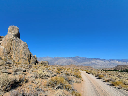
Trailhead: 0.6 miles along Movie Flat Road, 3 miles from Lone Pine
Rating (1-5): ★★★★★
Elevation change: 240 feet
Difficulty: Easy
Type: Loop, along sandy tracks
Usage: Medium
Season: All year, though possibly snow-covered in winter
Trailhead: 0.6 miles along Movie Flat Road, 3 miles from Lone Pine
Rating (1-5): ★★★★★

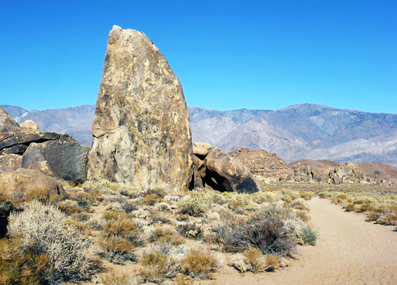
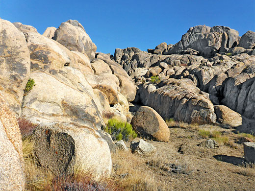
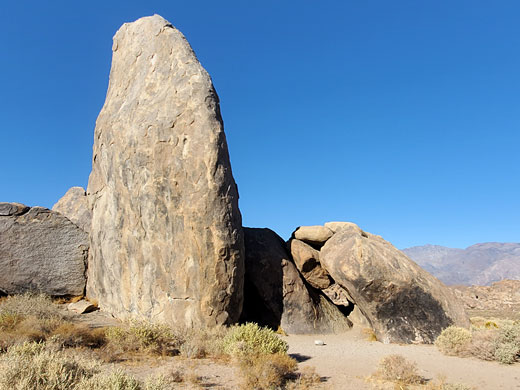
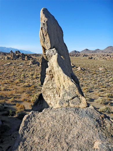
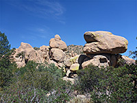
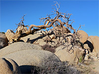
The Shark's Fin is a distinctive, isolated granite formation on the west side of Movie Flat Road in the Alabama Hills; a huge, smooth-sided boulder about 40 feet high, straight along one edge and regularly curved on the other, resembling a sail, or a fin. The rock is just 800 feet from the road, clearly visible from it, and so can be reached by just a few minutes walking, however as an alternative it can be seen along a loop hike of 1.6 miles that also passes several other groups of eroded boulders.
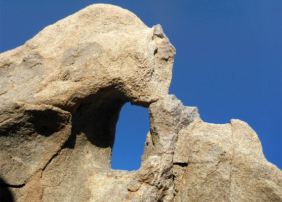
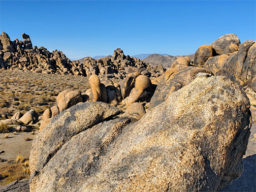
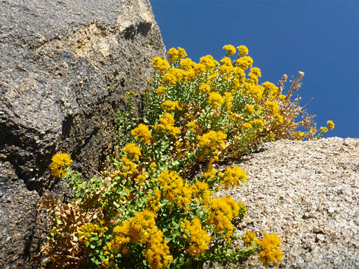
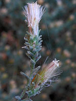
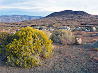
All the Shark's Fin Loop is along sandy vehicle tracks and is mostly level, with just a few slight inclines. Near the fin are two small arches, while elsewhere on the loop are numerous photogenic boulders and an assortment of wildflowers, all accompanied by spectacular views over the intervening plains towards the surrounding mountings. All of the route is also open to 4WD vehicles except for the section near the fin, which is for foot travel only - cars take a parallel track to the south.
Like all of the rocks hereabouts the fin and the boulders are composed of Alabama Hills Granite, a medium-grained formation from late Cretaceous period. The fin is large enough to be climbed, one of many locations for bouldering in the hills.
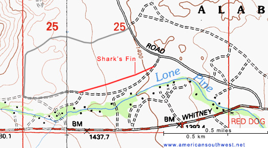
There are three possible parking places for the Shark's Fin Loop, all along Movie Flat Road; at the ends of the two tracks that form the start and end of the loop, separated by 0.2 miles of the road, or at a pull-out half way between. The actual Shark's Fin trailhead is the southernmost of these three but it is perhaps worth starting the hike at the northern track, and walking anti-clockwise, since then the fin is reached towards the end, providing a climax to the hike.
The northern track traverses open, bushy ground, rising slightly to a flat area then crossing several narrow, steep-sided washes which would, if driving, need high clearance 4WD to negotiate. Close by is a group of boulders on top of a small hill, with a much bigger rocky outcrop to the north, and just beyond is an isolated pair of flat, slanted rocks, resembling mini shark's fins. Around here a lesser track joins from the north, and soon after the main route curves to the south, on past another group of boulders separated by little ravines, and then reaching a bigger junction. Turning left, east, the track descends gently alongside the rocks to a path/track junction; the path continues a short distance to the Shark's Fin, which is adjacent to several other photogenic rocks. One rock just to the north is topped by a small arch, with a rectangular opening, while adjacent to the north edge of this rock is another arch with a narrow, slender, vertical opening.
All the Shark's Fin Loop is along sandy vehicle tracks and is mostly level, with just a few slight inclines. Near the fin are two small arches, while elsewhere on the loop are numerous photogenic boulders and an assortment of wildflowers, all accompanied by spectacular views over the intervening plains towards the surrounding mountings. All of the route is also open to 4WD vehicles except for the section near the fin, which is for foot travel only - cars take a parallel track to the south.
Like all of the rocks hereabouts the fin and the boulders are composed of Alabama Hills Granite, a medium-grained formation from late Cretaceous period. The fin is large enough to be climbed, one of many locations for bouldering in the hills.
Parking
There are three possible parking places for the Shark's Fin Loop, all along Movie Flat Road; at the ends of the two tracks that form the start and end of the loop, separated by 0.2 miles of the road, or at a pull-out half way between. The actual Shark's Fin trailhead is the southernmost of these three but it is perhaps worth starting the hike at the northern track, and walking anti-clockwise, since then the fin is reached towards the end, providing a climax to the hike.
The Hike
The northern track traverses open, bushy ground, rising slightly to a flat area then crossing several narrow, steep-sided washes which would, if driving, need high clearance 4WD to negotiate. Close by is a group of boulders on top of a small hill, with a much bigger rocky outcrop to the north, and just beyond is an isolated pair of flat, slanted rocks, resembling mini shark's fins. Around here a lesser track joins from the north, and soon after the main route curves to the south, on past another group of boulders separated by little ravines, and then reaching a bigger junction. Turning left, east, the track descends gently alongside the rocks to a path/track junction; the path continues a short distance to the Shark's Fin, which is adjacent to several other photogenic rocks. One rock just to the north is topped by a small arch, with a rectangular opening, while adjacent to the north edge of this rock is another arch with a narrow, slender, vertical opening.
Topo Map of the Shark's Fin Loop

Shark's Fin Loop - Similar Hikes
All Contents © Copyright The American Southwest | Comments and Questions | Contribute | Affiliate Marketing Disclosure | Site Map