Circle Creek Loop, City of Rocks National Reserve
Idaho > City of Rocks National Reserve > Hiking > Circle Creek Loop
Circle Creek Loop
Varied route passing granite formations, canyons, streams, grassy plains, sagebrush plateaus and forest; most is along the North Fork Circle Creek Trail, plus parts of the Creekside Towers, South Fork, Stripe Rock, Bumblie Wall and Stairways trails
Length: 8 miles
Elevation change: 1,200 feet
Difficulty: Moderate; a few steep parts
Type: Loop
Usage: Low
Season: Spring, summer, fall
Trailhead: Parking area by Bath Rock, also Parking Lot Rock and the Bread Loaves
Rating (1-5): ★★★★★
Elevation change: 1,200 feet
Difficulty: Moderate; a few steep parts
Type: Loop
Usage: Low
Season: Spring, summer, fall
Trailhead: Parking area by Bath Rock, also Parking Lot Rock and the Bread Loaves
Rating (1-5): ★★★★★

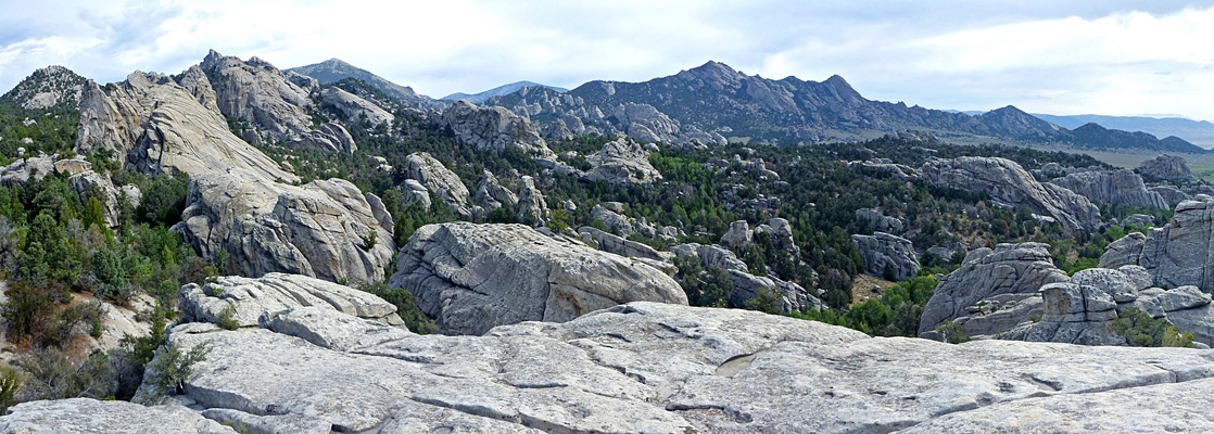
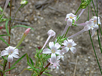
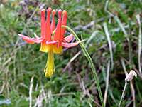
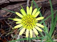
The majority of trails in City of Rocks National Reserve are very lightly traveled, and some of the shorter routes are used more by rock climbers than hikers. Away from the central region (the Inner City) containing the most spectacular rocks, the scenery is quite varied, although not much different to any other mountainous region of the Great Basin Desert, with grassy hillsides, sagebrush plateaus, patches of woodland, small streams and shallow valleys.
The best option for an extended hike, encountering all these landscapes in addition to the granite formations, is an 8 mile circuit mainly on the North Fork Circle Creek Trail, but also on parts of the Creekside Towers, South Fork, Stripe Rock, Bumblie Wall and Stairways trails. The mixed environments are home to a good selection of plants and wildlife, and once beyond the Inner City, the chance of meeting any other hikers is low. Although relatively long, the views along the trail change often so the trip is certainly enjoyable without being exceptional.
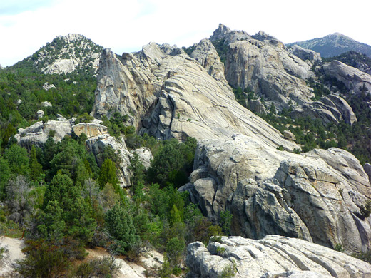
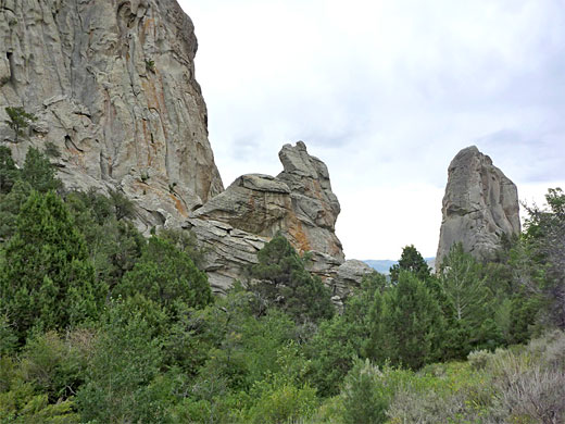
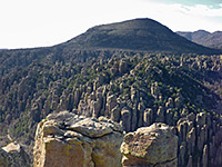
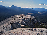
Three possible trailheads for the loop hike are Bath Rock, Parking Lot Rock and the Bread Loaves (see map), all of which have camping places nearby. The first of these is the start point for the Creekside Towers Trail, one of the most popular routes because it provides quick access to the central formations; this path begins by descending a little through mixed pine-aspen woodland to the first of many junctions, with the Stairways Trail to Bumblie Wall and various other places, and which forms the final leg of the Circle Creek loop. The Creekside Towers Trail reaches a small stream and follows it northwards, at the foot of a line of sheer cliffs. One section passes over a patch of sloping slickrock. The next junctions are left to an alternative trailhead at Parking Lot Rock, right to the South Fork Circle Creek Trail and right to several climbing locations. The main route passes over a ridge into an adjacent, deeper ravine (South Fork Circle Creek), which is lined by bigger and more impressive granite cliffs. After another intersection with a second route to Parking Lot Rock, the path continues up the longer, steepening canyon of Circle Creek, ascending to a slickrock plateau at the head of the valley, for nice views back down.
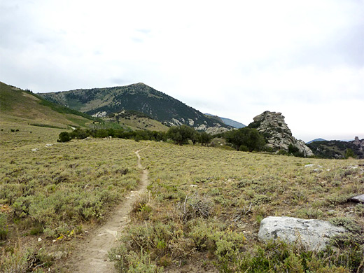
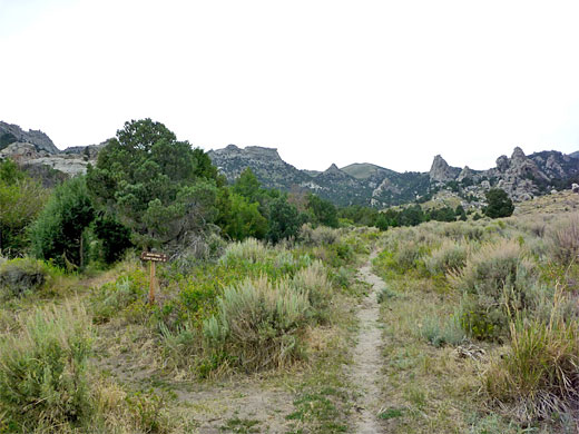
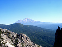
Just beyond is a sign marking the junction of the South Fork and North Fork Circle Creek trails, left being a path to the Bread Loaves, along the road. The next section, northeastwards, is more winding, leading up a lightly wooded ridge that has far-reaching views, especially eastwards, across Circle Creek Basin towards the Almo entrance of the national reserve. The ridge leads to a saddle with fence on the far side (at the edge of a private inholding) and a flat sagebrush plateau beyond, with very few exposed rocks. Walking is very easy for the next mile, over open ground on the far side of the mountain crest, as far as a junction just after a grove of dwarf aspen trees.
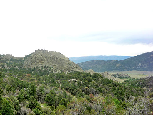
The Indian Grove Trail branches off northwards while the North Fork Circle Creek trail turns east, into the upper end of a valley - the North Fork - where the trees grow taller. The path passes another gate, out of the inholding, and begins a long, steady descent, overly gentle and winding in some parts, through rather overgrown surroundings that become somewhat enclosed by big boulders so the views are quite restricted. Lower down, the path is straighter, the ground more level and the valley wider. A small stream parallels the path, which eventually reaches a junction with the Stripe Rock Trail, just before a fence with an old vehicle track beyond.
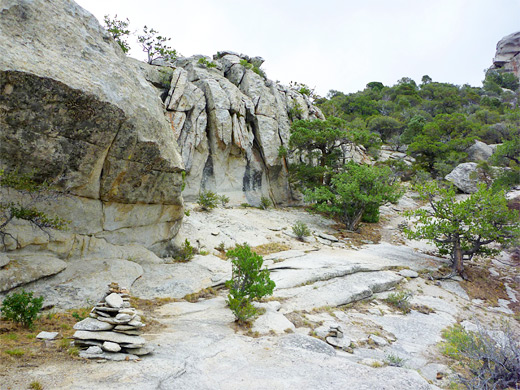
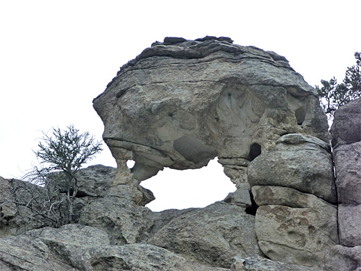
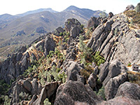
The Stripe Rock Trail forms the next part of the route, crossing the stream, climbing a little through woodland to a saddle close to the distinctive formation of Stripe Rock, then dropping down to more open ground and the next intersection. The right fork (Bumblie Wall Trail) heads towards some big rocks, bearing left and crossing a small stream (Center Creek), before climbing again to a gate on a ridgetop. It descends the far side, later moving along the base of a vertical wall to a junction; after turning right (signed to Bath Rock), then right again soon after, the path re-enters the woods, passing a junction with a spur to several rock climbing locations then reaches yet another intersection, signed Parking Lot right, Bath Rock left. This left fork (the Stairways Trail) crosses Circle Creek via a wooden bridge, climbs quite steeply up a wooded ravine beneath many shapely rocks and emerges onto a patch of slickrock with spectacular, elevated views. The junction with the Creekside Towers Trail is reached just after, a few hundred feet from the start point at Bath Rock.
The best option for an extended hike, encountering all these landscapes in addition to the granite formations, is an 8 mile circuit mainly on the North Fork Circle Creek Trail, but also on parts of the Creekside Towers, South Fork, Stripe Rock, Bumblie Wall and Stairways trails. The mixed environments are home to a good selection of plants and wildlife, and once beyond the Inner City, the chance of meeting any other hikers is low. Although relatively long, the views along the trail change often so the trip is certainly enjoyable without being exceptional.
Creekside Towers and South Fork Circle Creek Trails
Three possible trailheads for the loop hike are Bath Rock, Parking Lot Rock and the Bread Loaves (see map), all of which have camping places nearby. The first of these is the start point for the Creekside Towers Trail, one of the most popular routes because it provides quick access to the central formations; this path begins by descending a little through mixed pine-aspen woodland to the first of many junctions, with the Stairways Trail to Bumblie Wall and various other places, and which forms the final leg of the Circle Creek loop. The Creekside Towers Trail reaches a small stream and follows it northwards, at the foot of a line of sheer cliffs. One section passes over a patch of sloping slickrock. The next junctions are left to an alternative trailhead at Parking Lot Rock, right to the South Fork Circle Creek Trail and right to several climbing locations. The main route passes over a ridge into an adjacent, deeper ravine (South Fork Circle Creek), which is lined by bigger and more impressive granite cliffs. After another intersection with a second route to Parking Lot Rock, the path continues up the longer, steepening canyon of Circle Creek, ascending to a slickrock plateau at the head of the valley, for nice views back down.
North Fork Circle Creek Trail
Just beyond is a sign marking the junction of the South Fork and North Fork Circle Creek trails, left being a path to the Bread Loaves, along the road. The next section, northeastwards, is more winding, leading up a lightly wooded ridge that has far-reaching views, especially eastwards, across Circle Creek Basin towards the Almo entrance of the national reserve. The ridge leads to a saddle with fence on the far side (at the edge of a private inholding) and a flat sagebrush plateau beyond, with very few exposed rocks. Walking is very easy for the next mile, over open ground on the far side of the mountain crest, as far as a junction just after a grove of dwarf aspen trees.
Indian Grove Trail Junction
The Indian Grove Trail branches off northwards while the North Fork Circle Creek trail turns east, into the upper end of a valley - the North Fork - where the trees grow taller. The path passes another gate, out of the inholding, and begins a long, steady descent, overly gentle and winding in some parts, through rather overgrown surroundings that become somewhat enclosed by big boulders so the views are quite restricted. Lower down, the path is straighter, the ground more level and the valley wider. A small stream parallels the path, which eventually reaches a junction with the Stripe Rock Trail, just before a fence with an old vehicle track beyond.
Stripe Rock, Bumblie Wall and Stairways Trails
The Stripe Rock Trail forms the next part of the route, crossing the stream, climbing a little through woodland to a saddle close to the distinctive formation of Stripe Rock, then dropping down to more open ground and the next intersection. The right fork (Bumblie Wall Trail) heads towards some big rocks, bearing left and crossing a small stream (Center Creek), before climbing again to a gate on a ridgetop. It descends the far side, later moving along the base of a vertical wall to a junction; after turning right (signed to Bath Rock), then right again soon after, the path re-enters the woods, passing a junction with a spur to several rock climbing locations then reaches yet another intersection, signed Parking Lot right, Bath Rock left. This left fork (the Stairways Trail) crosses Circle Creek via a wooden bridge, climbs quite steeply up a wooded ravine beneath many shapely rocks and emerges onto a patch of slickrock with spectacular, elevated views. The junction with the Creekside Towers Trail is reached just after, a few hundred feet from the start point at Bath Rock.
Circle Creek Loop - Similar Hikes
All Contents © Copyright The American Southwest | Comments and Questions | Contribute | Affiliate Marketing Disclosure | Site Map