The American Southwest
Home | Parks | Trails | Plants | Canyons
Maps | Landscapes | Site Map | Whats New? |
More...
Follow americansouthwest.net on Facebook
×
General Pages
Home
Parks
Trails
Plants
Slot Canyons
Maps
Landscapes
Itineraries
Site Map
What's New?
More pages...

States
Arizona
California
Colorado
Idaho
Nevada
New Mexico
Oregon
Texas
Utah
Wyoming


ARIZONA
CALIFORNIA
COLORADO
IDAHO
NEVADA
NEW MEXICO
OREGON
TEXAS
UTAH
WYOMING
IDAHO
MAPS | PARKS | HOTELS

Map of City of Rocks National Reserve


Idaho > City of Rocks National Reserve > Map
Map of City of Rocks National Reserve

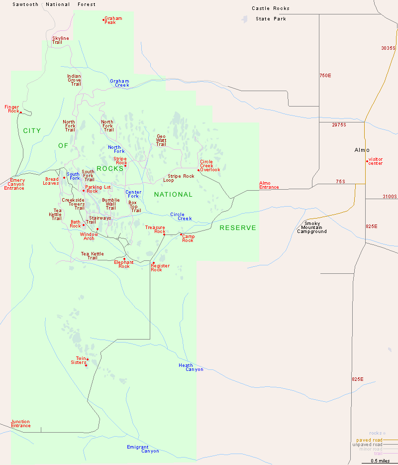
The most used approach to City of Rocks National Reserve is from the east, along Elba-Almo Road, which links with highways 77 and 81. The western approach is along Birch Creek Road, south of the small town of Oakley. This is partly unpaved but usually fine for all vehicles.

Topographic map of the Circle Creek Loop

Trail descriptions for City of Rocks

Back to Top
Arizona | California | Colorado | Idaho | Nevada | New Mexico | Oregon | Texas | Utah | Wyoming | Slot Canyons | Travelogue | SOUTHWEST

All Contents © Copyright The American Southwest | Comments and Questions | Contribute | Affiliate Marketing Disclosure | Site Map