Cochise Trail
Varied route along shallow, partly wooded ravines and open slopes, right across the crest of the Dragoon Mountains, giving excellent views of the rock formations of Cochise Stronghold
Length: 3 miles to the high point; 4.5 miles to the western trailhead
Elevation change: 1,060 feet
Difficulty: Moderate; relatively long, and much is exposed, and hot in summer
Type: One way
Usage: Low to medium
Season: All year; best in cooler seasons
Trailhead: East: end of Ironwood Road, at the far side of Cochise Stronghold campground. West: end of Stronghold Canyon Road.
Rating (1-5): ★★★★★

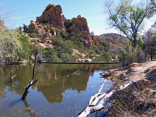
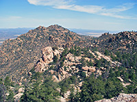
The eroded cliffs and domes of Cochise Stronghold, in the Dragoon Mountains of southeast Arizona are a popular rockclimbing destination, and are explorable by cross-country hiking, but the main way to visit this area is by the 4.5 mile Cochise Trail. Although not passing through the center of the rocks, owing to the rugged terrain, the path does come close to some lesser formations and gives fantastic views of the main area to the north, and beyond to the distant San Pedro and Sulphur Springs valleys.
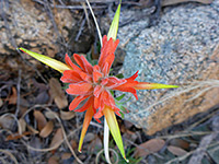
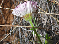
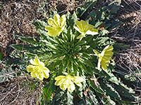
The scenery along the route is a mix of shallow, partly wooded ravines and open slopes, accompanied by a great variety of plant life, reflecting the diverse habitats of the Sonoran Desert to the west, the Chihuahuan Desert to the east and the Dragoon Mountains themselves, one of Arizona's sky islands. Also of interest are Cochise Spring, which sustains a short, pretty section of pools and flowing water, and Halfmoon Tank, a small lake formed by a concrete dam.
The trail crosses the mountains, and can be accessed from either side. The main western approach is along Stronghold Canyon Road, forking off Hwy 90 at St David, but the last few miles are rough and may require 4WD, so almost all people choose the eastern approach, Ironwood Road from Sunsites on US 191. This crosses flat grassland then enters the wooded canyon of Cochise Creek, ending at the USFS-managed Cochise Stronghold Campground, a tranquil place shaded by oak and pine trees. The limited number of parking places for the hike are at the far end, either side of some restrooms, and a fee of $5 is charged for parking ($10 if camping). The trail is cairned in a few places and is generally easy to follow, well used and not steep apart from the westernmost 1.5 miles, on the far side of the mountain crest. Notices give distances every half mile.
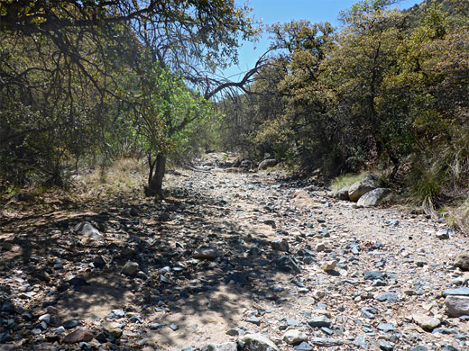
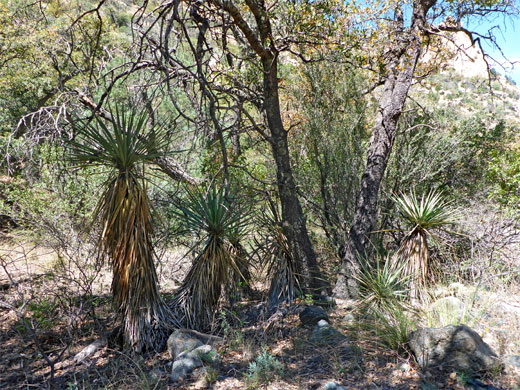
The first few hundred feet are along the 0.4 mile (loop) Stronghold Nature Trail, beginning with a wooden bridge over the dry wash of Park Canyon. Notices identify some of the common plants, such as beargrass, sotol, Schott's yucca and agave. The Cochise Trail branches off halfway along the loop, climbing above the trees, briefly into more open terrain, then down into the larger drainage of Stronghold Canyon - across the wide, stony, usually dry streambed and southwards along the far side. This section is in shade in the morning, both from the trees and the steep slopes of Jones Mountain to the east. Away from the creek bed, the slopes are generally dry and there are few wildflowers hereabouts.
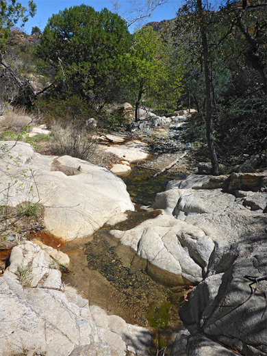
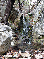
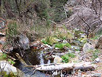
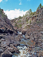
The trail crosses back to the east side of the wash, through a gate marked by the half mile notice, and rises a little way above, over open, gently sloping land, past a junction with a lesser used path to Middlemarch Canyon, and close to the first outcrop of granite boulders, before moving down again, into a narrower tributary drainage. A small stream usually flows here, originating at Cochise Spring, and there are a number of pools and cascades where the creek trickles over bare rock. This section is one mile from the trailhead.
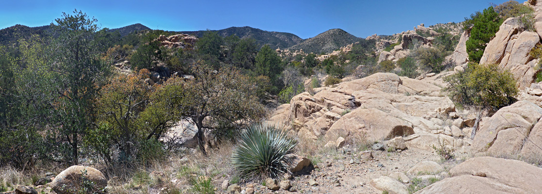
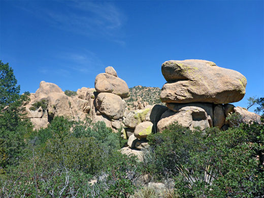
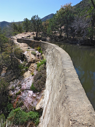
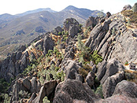
The next stretch climbs gently through cool woodland on the south side of the drainage, which is now rather smaller, up to some more piles of the photogenic brown boulders. The path becomes fairly level around the 1.5 mile mark, then returns to light woodland, and the surroundings stay similar up to the 2 mile point, where another open area allows the first good views of the main group of formations to the north. Flowing water becomes audible again as the path descends slightly to Halfmoon Tank, a small but fairly deep lake formed by a concrete dam. Seeps at the base sustain clumps of yellow monkeyflowers, and several other floral species. The trail is now heading northwest, skirting the south edge of the Cochise Stronghold boulder field, about one mile from the highest elevation region, with the biggest rocks. It ascends gently across mostly treeless slopes, and reaches a high point of 5,970 feet, en route giving the best views of the contrasting surroundings - smooth grassy hills to the south, jumbled rocks to the north. The summit is 3 miles from the trailhead and is a good destination for shorter hike, as beyond, the final 1.5 miles are steep, involving about the same elevation change as the preceding 3 miles. The path traverses round the hillside a way, over a streambed, and drops down through wooded land via many short switchbacks, ending by traversing again and a final, shorter descent to the isolated, little-used western trailhead.
The scenery along the route is a mix of shallow, partly wooded ravines and open slopes, accompanied by a great variety of plant life, reflecting the diverse habitats of the Sonoran Desert to the west, the Chihuahuan Desert to the east and the Dragoon Mountains themselves, one of Arizona's sky islands. Also of interest are Cochise Spring, which sustains a short, pretty section of pools and flowing water, and Halfmoon Tank, a small lake formed by a concrete dam.
Cochise Trailheads
The trail crosses the mountains, and can be accessed from either side. The main western approach is along Stronghold Canyon Road, forking off Hwy 90 at St David, but the last few miles are rough and may require 4WD, so almost all people choose the eastern approach, Ironwood Road from Sunsites on US 191. This crosses flat grassland then enters the wooded canyon of Cochise Creek, ending at the USFS-managed Cochise Stronghold Campground, a tranquil place shaded by oak and pine trees. The limited number of parking places for the hike are at the far end, either side of some restrooms, and a fee of $5 is charged for parking ($10 if camping). The trail is cairned in a few places and is generally easy to follow, well used and not steep apart from the westernmost 1.5 miles, on the far side of the mountain crest. Notices give distances every half mile.
Start of the Trail
The first few hundred feet are along the 0.4 mile (loop) Stronghold Nature Trail, beginning with a wooden bridge over the dry wash of Park Canyon. Notices identify some of the common plants, such as beargrass, sotol, Schott's yucca and agave. The Cochise Trail branches off halfway along the loop, climbing above the trees, briefly into more open terrain, then down into the larger drainage of Stronghold Canyon - across the wide, stony, usually dry streambed and southwards along the far side. This section is in shade in the morning, both from the trees and the steep slopes of Jones Mountain to the east. Away from the creek bed, the slopes are generally dry and there are few wildflowers hereabouts.
Cochise Spring
The trail crosses back to the east side of the wash, through a gate marked by the half mile notice, and rises a little way above, over open, gently sloping land, past a junction with a lesser used path to Middlemarch Canyon, and close to the first outcrop of granite boulders, before moving down again, into a narrower tributary drainage. A small stream usually flows here, originating at Cochise Spring, and there are a number of pools and cascades where the creek trickles over bare rock. This section is one mile from the trailhead.
Cochise Strongold
The next stretch climbs gently through cool woodland on the south side of the drainage, which is now rather smaller, up to some more piles of the photogenic brown boulders. The path becomes fairly level around the 1.5 mile mark, then returns to light woodland, and the surroundings stay similar up to the 2 mile point, where another open area allows the first good views of the main group of formations to the north. Flowing water becomes audible again as the path descends slightly to Halfmoon Tank, a small but fairly deep lake formed by a concrete dam. Seeps at the base sustain clumps of yellow monkeyflowers, and several other floral species. The trail is now heading northwest, skirting the south edge of the Cochise Stronghold boulder field, about one mile from the highest elevation region, with the biggest rocks. It ascends gently across mostly treeless slopes, and reaches a high point of 5,970 feet, en route giving the best views of the contrasting surroundings - smooth grassy hills to the south, jumbled rocks to the north. The summit is 3 miles from the trailhead and is a good destination for shorter hike, as beyond, the final 1.5 miles are steep, involving about the same elevation change as the preceding 3 miles. The path traverses round the hillside a way, over a streambed, and drops down through wooded land via many short switchbacks, ending by traversing again and a final, shorter descent to the isolated, little-used western trailhead.
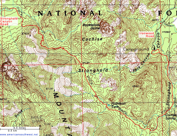
Topo Map
Cochise Trail - Similar Hikes
All Contents © Copyright The American Southwest | Comments and Questions | Contribute | Affiliate Marketing Disclosure | Site Map