Highlights:
Large city park bordering Saguaro National Park to the south, containing half of the Tucson Mountains, a rugged range covered with many cacti. Easily accessed, and crossed by a good network of trails, over 60 miles
Nearby town:
Tucson, 10 miles
Management:
Location:
Gates Pass Road (east entrance)
Seasons:
All year, though very hot in summer
Rating (1-5):
★★★★★
Weather:


Featured Hotel
JW Marriott Starr Pass Resort
 Five star resort in the eastern Tucson Mountain foothills, surrounded by pristine Sonoran Desert landscapes; includes a golf course and pool complex
Check Rates
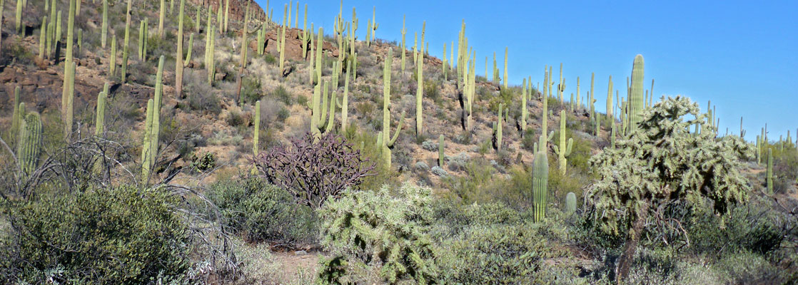
Tucson Mountain Park is one of the largest city preserves in the US, around 30,000 acres in area, containing most of the southern half of the Tucson Mountains; the northern portion, where the peaks are generally higher in elevation, is protected as the west section of Saguaro National Park. The two parks are adjacent, sharing a 6 mile border, and they have similar scenery, typical of the Sonoran Desert, though the saguaro cacti grow more densely in some parts of the national park. Both preserves are free to enter, and both are very popular.
The mountain park is crossed by two main vehicle routes, Kinney Road, running northwest-southeast (continuing into the national park), linking with Gates Pass Road from the east, this the main access from Tucson. There are over 60 miles of trails, all well maintained and easy to follow.
The mountain park is crossed by two main vehicle routes, Kinney Road, running northwest-southeast (continuing into the national park), linking with Gates Pass Road from the east, this the main access from Tucson. There are over 60 miles of trails, all well maintained and easy to follow.
Tucson Mountain Park Table of Contents
- Map of the park
- Photographs
- Introduction
- The mountain park; regions and trailheads
- Featured hikes; Brown Mountain Trail and Star Pass Loop
- Nearby places
- Similar places
Location
Map of Tucson Mountain Park.
Photographs
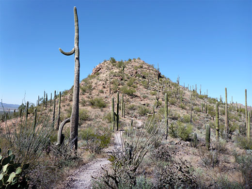
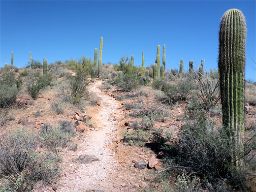
Brown Mountain Trail.
Introduction
The east side of the park extends right up to the city suburbs so tends to be busier than areas to the west and center. Most visitors are local residents; others are more likely to see the more famous national park just to the north. The main activities are hiking, photography, wildlife viewing, horse riding, mountain biking and hunting (archery only). Facilities include an education center, a 135-site RV/rent campground, and three picnic areas with bbq grills. Also within the park, near its northern edge, is the excellent Arizona-Sonora Desert Museum.
The park was established in 1929 as a result of the efforts of CB Brown (1899-1979) who, when working as an agricultural extension agent for Pima County, sought to protect the Tucson Mountains from mining and settlement. Brown was for a while the park superintendent, at a time when facilities were limited to a few dirt tracks.
The Mountain Park
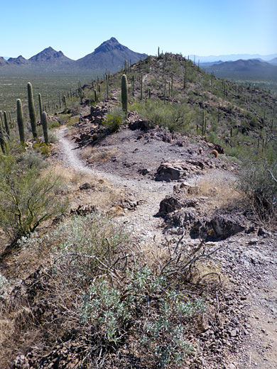
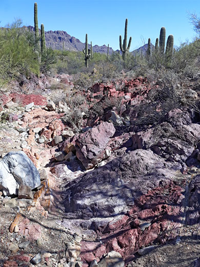
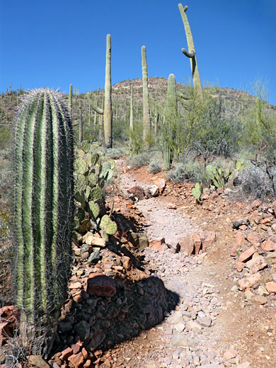
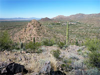
Within Tucson Mountain Park are over 40 designated trails (see map), many intersecting, and so offering numerous options for loop hikes, long and short. The highest terrain is at the center of the park, and this has fewer trails - most are concentrated to the east and west, where the peaks are lower, and are surrounded by desert flats. The westernmost section, beyond Kinney Road, has just one significant peak, Brown Mountain, explored by a 4 mile loop. South of here are various trails across the open desert, mostly used by mountain bikes. West of Kinney Road and north of Gates Pass Road is the least visited section of the park, with only a few paths, including the Orcut Trail that leads into Saguaro National Park, and a ridgeline path to Peak 4063, starting at the pass. Most hikes are east of Kinney Road and south of Gates Pass Road, some looping around the various peaks, the highest being 4,288 foot Golden Gate Mountain (and one route to the summit), others crossing the lowlands. There are many trailheads, some at the end of residential streets in the Tucson suburbs. Within the mountain park are four small preserves, each with a set of connected paths; Feliz Paseos Park, Painted Hills Trails Park, Enchanted Hills Trails Park and Robles Pass Trails Park.
Tucson Mountain Park - Hiking
Brown Mountain Trail
★★★★★
★★★★★
4 miles, 370 feet (loop)
Loop up and along a narrow ridge with far-reaching views, returning via rocky land below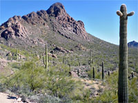
Starr Pass Loop
★★★★★
★★★★★
6.3 miles, 220 feet (loop)
Circuit of peaks, slopes and plains towards the east side of the park, involving parts of the Sarasota, Starr Pass, Yetman, Little Cat and Explorer trailsTucson Mountain - Nearby Places
- Arizona-Sonora Desert Museum (adjacent) - varied collection of Sonoran Desert animals and plants
- Saguaro National Park (west) (adjacent) - beautiful desert landscapes
Tucson Mountain - Similar Places
- San Tan Mountain Regional Park - rocky hills and desert flats southeast of Phoenix
- Tortolita Mountains - isolated but scenic range north of Tucson
All Contents © Copyright The American Southwest | Comments and Questions | Contribute | Affiliate Marketing Disclosure | Site Map