Starr Pass Loop
Circuit of peaks, slopes and plains towards the east side of Tucson Mountain Park, involving parts of the Sarasota, Starr Pass, Saguaro Rib, Yetman, Little Cat and Explorer trails. Varied plants and long-distance views
Length: 6.3 miles (round trip)
Elevation change: 220 feet
Difficulty: Moderate
Type: Loop
Usage: Low to medium
Season: Fall to spring
Trailhead: North end of Sarasota Boulevard
Rating (1-5): ★★★★★
Elevation change: 220 feet
Difficulty: Moderate
Type: Loop
Usage: Low to medium
Season: Fall to spring
Trailhead: North end of Sarasota Boulevard
Rating (1-5): ★★★★★

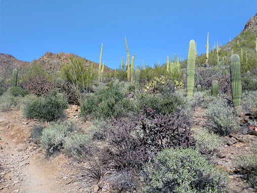
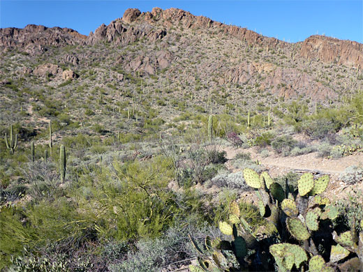
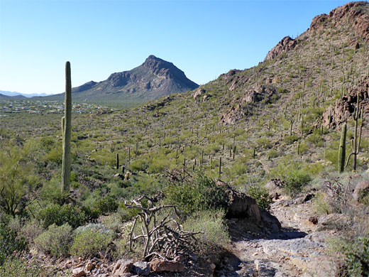
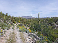
The eastern section of Tucson Mountain Park, closest to the city, is crossed by many intersecting trails, mostly fairly level and crossing similar terrain of desert plains, slopes and ridges, typically with long-distance views and always encountering many large and flourishing cacti. The various junctions allow for a variety of loop hikes, such as a 6.3 mile circuit in the Starr Pass area comprising parts of six trails - Sarasota, Starr Pass, Saguaro Rib, Yetman, Little Cat and Explorer - and passing through 13 intersections.
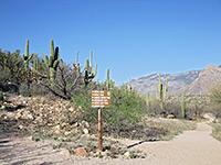
The hike begins from the Sarasota trailhead, at the edge of a residential estate, along the southwest edge of the park: just off Kinney Road, the main route through this region. The route climbs a south-facing slope, passes over a saddle then loops part way around a wide basin, returning via another saddle, on the north side of an intervening mountain, Peak 3310. The gradients are gentle, the paths easy to follow, just a bit rocky in places, and the walk can be completed in less than three hours.
Map of Tucson Mountain Park.
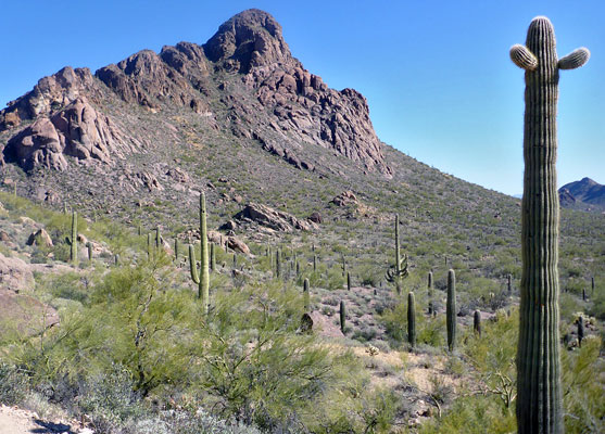
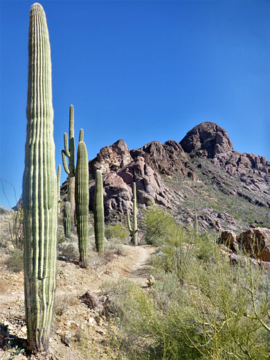
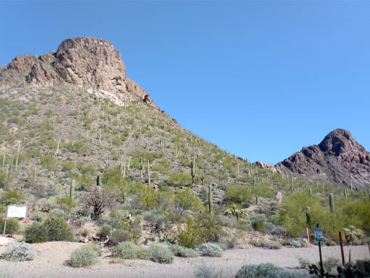
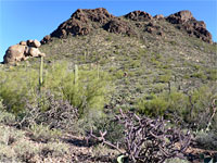
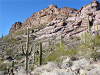
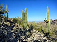
The trailhead appears not to be much used; it is at the north end of Sarasota Boulevard, below the south face off Peak 3310, the slopes of which are liberally covered with typical cacti of the Sonoran Desert, including saguaro, buckhorn cholla, strawberry hedgehog cactus and Engelmann's pricklypear. The path, the Sarasota Trail, rises via one switchback to the first intersection. Turning right, the same trail traverses eastwards, staying almost level, through increasingly rocky surrounds, meeting the Starr Pass Trail after 0.9 miles, just south of a 2,790 foot saddle between the peak and the larger Cat Mountain to the southeast. Ahead, the land becomes almost level - a wide basin flanked by low peaks, crossed by the path, which eventually terminates at a northern trailhead, besides the Starr Pass Marriott Resort.
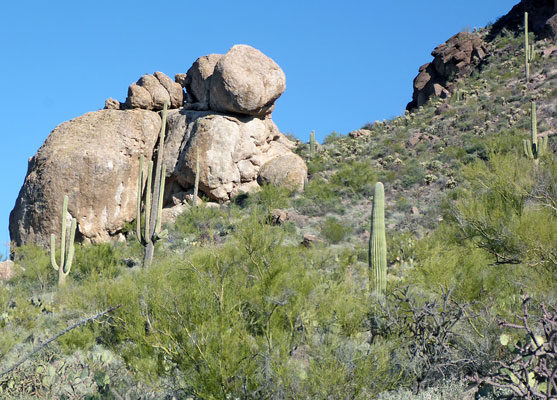
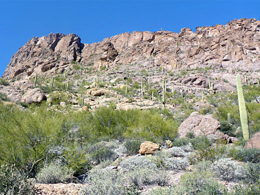
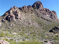
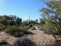
The loop however continues by forking left, 0.6 miles after the saddle (on the Saguaro Rib Trail), and turning left again soon after, now on the Yetman Trail, across a less interesting area, with more bushes and fewer cacti. Turning left once again, at the next intersection, the route is now the Little Cat Trail, the surroundings more scenic, as the path winds around the base of low hills and later bears right, ascending, through several more intersections to another saddle, 2,925 feet, on the north side of Peak 3310. The views now are to the west, towards Golden Gate Mountain and the vast flats of Avra Valley beyond. The final short component of the loop is left at another intersection, on a path that climbs a little then traverses, back to the initial junction with the Sarasota Trail.
The hike begins from the Sarasota trailhead, at the edge of a residential estate, along the southwest edge of the park: just off Kinney Road, the main route through this region. The route climbs a south-facing slope, passes over a saddle then loops part way around a wide basin, returning via another saddle, on the north side of an intervening mountain, Peak 3310. The gradients are gentle, the paths easy to follow, just a bit rocky in places, and the walk can be completed in less than three hours.
Location
Map of Tucson Mountain Park.
Sarasota and Starr Pass Trails
The trailhead appears not to be much used; it is at the north end of Sarasota Boulevard, below the south face off Peak 3310, the slopes of which are liberally covered with typical cacti of the Sonoran Desert, including saguaro, buckhorn cholla, strawberry hedgehog cactus and Engelmann's pricklypear. The path, the Sarasota Trail, rises via one switchback to the first intersection. Turning right, the same trail traverses eastwards, staying almost level, through increasingly rocky surrounds, meeting the Starr Pass Trail after 0.9 miles, just south of a 2,790 foot saddle between the peak and the larger Cat Mountain to the southeast. Ahead, the land becomes almost level - a wide basin flanked by low peaks, crossed by the path, which eventually terminates at a northern trailhead, besides the Starr Pass Marriott Resort.
Return Route
The loop however continues by forking left, 0.6 miles after the saddle (on the Saguaro Rib Trail), and turning left again soon after, now on the Yetman Trail, across a less interesting area, with more bushes and fewer cacti. Turning left once again, at the next intersection, the route is now the Little Cat Trail, the surroundings more scenic, as the path winds around the base of low hills and later bears right, ascending, through several more intersections to another saddle, 2,925 feet, on the north side of Peak 3310. The views now are to the west, towards Golden Gate Mountain and the vast flats of Avra Valley beyond. The final short component of the loop is left at another intersection, on a path that climbs a little then traverses, back to the initial junction with the Sarasota Trail.
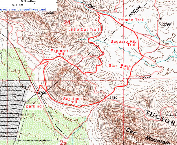
Topographic Map of the Starr Pass Loop
Starr Pass Wildflower
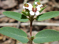 Head sandmat |
Starr Pass Loop - Similar Hikes
All Contents © Copyright The American Southwest | Comments and Questions | Contribute | Affiliate Marketing Disclosure | Site Map