Wild Burro and Alamo Springs Trails, Tortolita Mountains
Arizona > Tortolita Mountains > Wild Burro and Alamo Springs Trails
Wild Burro and Alamo Springs Trails
Varied loop along a bushy, rocky canyon to a seasonal spring, returning across higher, more undulating terrain. Plenty of cacti and wildflowers, and good views from the upper reaches
Length: 7.6 miles (round trip)
Elevation change: 1,070 feet
Difficulty: Moderate to strenuous
Type: Loop
Usage: Low
Season: Fall to spring
Trailhead: Parking lot along the road to the Ritz-Carlton resort
Rating (1-5): ★★★★★
Elevation change: 1,070 feet
Difficulty: Moderate to strenuous
Type: Loop
Usage: Low
Season: Fall to spring
Trailhead: Parking lot along the road to the Ritz-Carlton resort
Rating (1-5): ★★★★★

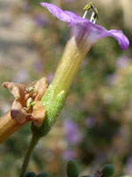
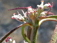
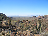
The most spectacular part of the Tortolita Mountains, a small range 15 miles north of Tucson, is along the southern edge, where the hills are bisected by three major canyons; Cochie, Wild Burro and Ruelas. Recreation is concentrated on the largest of these, Wild Burro, along and either side of which is a network of hiking trails, constructed in the 1970s, through beautiful Sonoran Desert scenery of rocky outcrops, sandy drainages, and grassy slopes, all liberally covered by wildflowers and cacti.
There are several options for all day, or half day, loop hikes; perhaps the best is the 7.6 mile circuit formed by the Alamo Springs Trail and the central portion of the Wild Burro Trail, starting from the main trailhead at the mouth of Wild Burro Canyon, right next to the Ritz-Carlton resort in the upscale community of Dove Mountain.
The hike starts along the Wild Burro Trail, following the canyon upstream for 3.2 miles, sometimes along the valley floor, in other places rising a little way up the enclosing slopes, to a short section of narrows and a seasonal spring. The return route is along the linked Alamo Spring Trail, climbing quite high to the southeast, across two ridges, into a tributary canyon, along another ridge and back down to Wild Burro Canyon.
Overall this is a good and varied hike with much plant life, encountering differing views, sites and terrain. It is strenuous in some places, but not excessively so.
26 views along the loop.
The trailhead for Wild Burro Canyon is along Secret Springs Drive, the road to the Ritz-Carlton resort, just past the guarded entrance station; visitors need to inform staff they are here for the trails rather than the hotel. There is no fee for parking, and the lot is large and level, accommodating 50 or more vehicles. The Drive is reached by Dove Mountain Road, a curvy route passing innumerable turnings to different parts of the Dove Mountain estates.
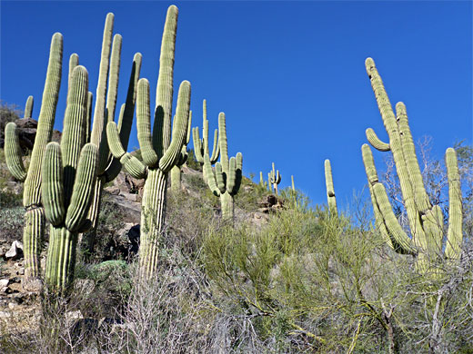
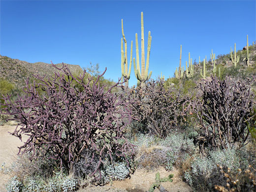
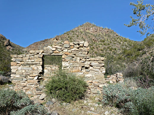
From the trailhead, the path very soon enters pristine cactus scenery, winding past many huge cholla and saguaro - the vegetation has an unusually high percentage of cacti compared with other plants. The route leads upstream, in or beside the sandy creekbed to an alternative access point, via a short link path from the hotel. This is close to another junction, to the south, with the Alamo Springs Trail, the return half of the loop hike. The Wild Burro path proceeds upstream as the canyon walls close in, and the vegetation seems even more spectacular, a verdant mix of trees, wildflowers and cacti including many more towering, healthy, multi-branched saguaro. The trail is now positioned a short distance north of the streambed, running beneath low cliffs and other rock formations, though returns to the wash at a four-way intersection, with the Lower Javelina Trail (another loop), then passes a couple of ruined stone cabins, relics from a ranch that was established here at the start of the 20th century.
Beyond the stone ruins, the path climbs to the north to avoid a rock-lined section of the creek with a dryfall, below a prominent cliff with white coloration; it rises nearly 400 feet before descending gently back to the creekbed, along this some more and then up again, this time on the south side, to bypass another rocky section. The climb, 200 feet, is followed by another descent, towards the second junction with the Alamo Springs Trail, which is shortly before a crossing of the creek, just downstream of a seasonal spring and immediately above a short section of narrows through an outcrop of whitish marble. The land now is much more open, the upper portion of the drainage winding across a wide, shallow basin ringed by low hills with noticeably fewer cacti, instead mostly long grass, scattered bushes and little trees.
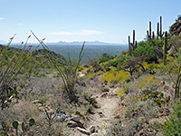
From the northern Wild Burro intersection, the Alamo Springs Trail ascends slightly, up to a ridge, and a junction, with the little-used Ridgeline Trail, then bends to the south, crossing another ridge and entering a valley. It traverses a slope, below high ground to the east, and reaches another junction, with a connecting route back down to Wild Burro Canyon, which could be used to make a shorter loop. Ahead, the main path turns away from the canyon and climbs by 400 feet to another ridge, a steep and bendy section, where much of the surface is covered by small stones, making hiking rather slow. Eventually the trail arrives at a divide, and drops down the far side into a bigger drainage, sheltering many tall saguaro. The path crosses the streambed a few times before veering away, on the north side, as the ravine starts to descend more steeply, with a few sheer drops - the route now follows a ridge, topped by some unusual, eroded rock formations. Along the way are two benches with interpretive notices, one about birds, the other about the rocks. Next is a gradual slope down to a saddle, in front of a little conical peak, and finally a sharp descent of the south side of Wild Burro Canyon, back to the earlier trail, as the Dove Mountain suburbs come prominently into view to the south.
There are several options for all day, or half day, loop hikes; perhaps the best is the 7.6 mile circuit formed by the Alamo Springs Trail and the central portion of the Wild Burro Trail, starting from the main trailhead at the mouth of Wild Burro Canyon, right next to the Ritz-Carlton resort in the upscale community of Dove Mountain.
The hike starts along the Wild Burro Trail, following the canyon upstream for 3.2 miles, sometimes along the valley floor, in other places rising a little way up the enclosing slopes, to a short section of narrows and a seasonal spring. The return route is along the linked Alamo Spring Trail, climbing quite high to the southeast, across two ridges, into a tributary canyon, along another ridge and back down to Wild Burro Canyon.
Overall this is a good and varied hike with much plant life, encountering differing views, sites and terrain. It is strenuous in some places, but not excessively so.
Photographs
26 views along the loop.
Wild Burro Trailhead
The trailhead for Wild Burro Canyon is along Secret Springs Drive, the road to the Ritz-Carlton resort, just past the guarded entrance station; visitors need to inform staff they are here for the trails rather than the hotel. There is no fee for parking, and the lot is large and level, accommodating 50 or more vehicles. The Drive is reached by Dove Mountain Road, a curvy route passing innumerable turnings to different parts of the Dove Mountain estates.
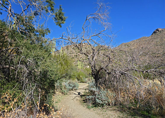
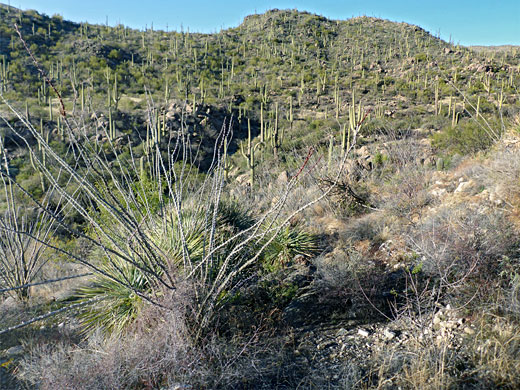
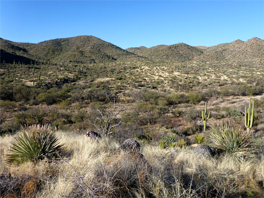
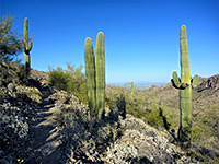
Start of the Trail
From the trailhead, the path very soon enters pristine cactus scenery, winding past many huge cholla and saguaro - the vegetation has an unusually high percentage of cacti compared with other plants. The route leads upstream, in or beside the sandy creekbed to an alternative access point, via a short link path from the hotel. This is close to another junction, to the south, with the Alamo Springs Trail, the return half of the loop hike. The Wild Burro path proceeds upstream as the canyon walls close in, and the vegetation seems even more spectacular, a verdant mix of trees, wildflowers and cacti including many more towering, healthy, multi-branched saguaro. The trail is now positioned a short distance north of the streambed, running beneath low cliffs and other rock formations, though returns to the wash at a four-way intersection, with the Lower Javelina Trail (another loop), then passes a couple of ruined stone cabins, relics from a ranch that was established here at the start of the 20th century.
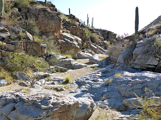
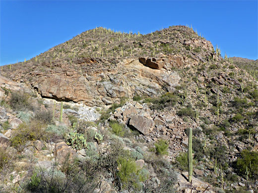
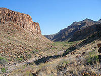
Wild Burro Trail
Beyond the stone ruins, the path climbs to the north to avoid a rock-lined section of the creek with a dryfall, below a prominent cliff with white coloration; it rises nearly 400 feet before descending gently back to the creekbed, along this some more and then up again, this time on the south side, to bypass another rocky section. The climb, 200 feet, is followed by another descent, towards the second junction with the Alamo Springs Trail, which is shortly before a crossing of the creek, just downstream of a seasonal spring and immediately above a short section of narrows through an outcrop of whitish marble. The land now is much more open, the upper portion of the drainage winding across a wide, shallow basin ringed by low hills with noticeably fewer cacti, instead mostly long grass, scattered bushes and little trees.
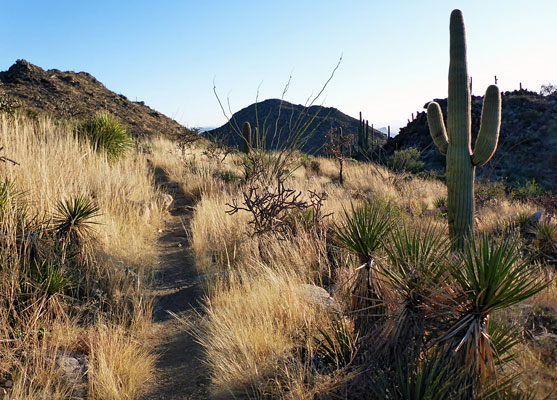
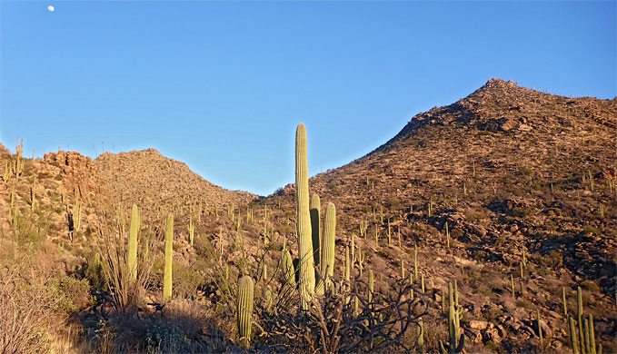
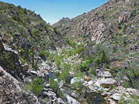
Alamo Springs Trail
From the northern Wild Burro intersection, the Alamo Springs Trail ascends slightly, up to a ridge, and a junction, with the little-used Ridgeline Trail, then bends to the south, crossing another ridge and entering a valley. It traverses a slope, below high ground to the east, and reaches another junction, with a connecting route back down to Wild Burro Canyon, which could be used to make a shorter loop. Ahead, the main path turns away from the canyon and climbs by 400 feet to another ridge, a steep and bendy section, where much of the surface is covered by small stones, making hiking rather slow. Eventually the trail arrives at a divide, and drops down the far side into a bigger drainage, sheltering many tall saguaro. The path crosses the streambed a few times before veering away, on the north side, as the ravine starts to descend more steeply, with a few sheer drops - the route now follows a ridge, topped by some unusual, eroded rock formations. Along the way are two benches with interpretive notices, one about birds, the other about the rocks. Next is a gradual slope down to a saddle, in front of a little conical peak, and finally a sharp descent of the south side of Wild Burro Canyon, back to the earlier trail, as the Dove Mountain suburbs come prominently into view to the south.
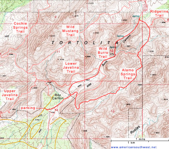
Topographic Map of the Trails
Wild Burro and Alamo Springs Trails - Similar Hikes
All Contents © Copyright The American Southwest | Comments and Questions | Contribute | Affiliate Marketing Disclosure | Site Map