Sabino Canyon Trail, Sabino Canyon Recreation Area
Arizona > Sabino Canyon Recreation Area > Sabino Canyon Trail
Sabino Canyon Trail
Starting at the end of the tram road, this trail climbs further up Sabino Canyon, staying quite high above the creek, giving fine views of the surrounding mountains. The path leads to a tributary stream (the East Fork), where two other routes branch off. Sabino Creek can be reached by a short off-trail hike
Length: 2.5 miles to the junction by the East Fork, 4.1 miles to Hutch's Pool
Elevation change: 500 feet
Difficulty: Easy to moderate - the initial section is steep. Following the creek, off-trail, is rather more testing
Type: One way, or part of a 17 mile loop with the adjacent Bear Canyon Trail
Usage: Medium
Season: Fall, winter, spring; very hot in summer
Trailhead: At the end of Sabino Canyon Road, reachable using the tram service
Rating (1-5): ★★★★★

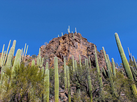
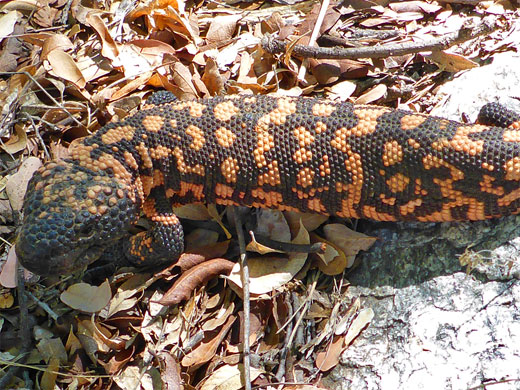
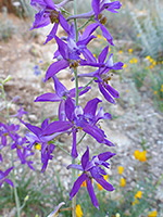
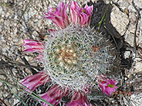
There are several deep, rocky valleys in Sabino Canyon Recreation Area, but the main one is of course Sabino Canyon, which contains flowing water all year, except during times of extended droughts, and is bordered by dramatic slopes covered by many types of cacti, wildflowers and other desert plants.
The lower portion of the canyon is accessed by a 3.7 mile road, used by hikers, cyclists and trams, which have operated since private vehicles were prohibited in the 1970s. Most visitors on the trams are here to explore some of the pools and cascades along the creek, or to ride part of the way and then walk back, or to descend the short trail that reaches a more secluded section of the creek right at the end of the road, though not so many people hike the Sabino Canyon Trail, which leads further upstream, higher into the foothills.
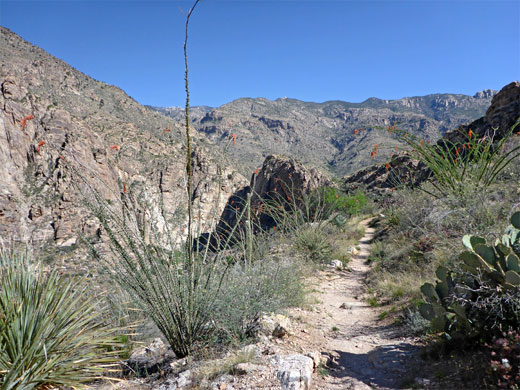
Like the last half mile of the road, the trail stays quite far above the creek - up to 450 feet, since the canyon narrows and the sides become steep. The water is glimpsed in a few places, but instead most of the views are of the surrounding slopes and summits of the Santa Catalina Mountains. After 2.5 miles, the path descends a little and crosses a tributary stream, the East Fork, which also contains water at some times of the year. From here, continuation hikes are possible either east along the East Fork Trail, which later intersects the Bear Canyon Trail to form a testing, 17 mile loop, or west, further up the main canyon. In this direction, Sabino Creek is reached after another three quarters of a mile, allowing exploration of some of its many pools and cascades, such as along a particularly pretty, partly enclosed section that lies just downstream, either side of the East Fork confluence.
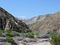
The Sabino Canyon Trail starts beside the tram stop (number nine) at the north end of the park road. Drinking water is provided at some points along the road, though not here - the nearest location is stop eight, half a mile back. The first section of the path is steep, climbing via a series of switchbacks, aiming for a bench above the steep-sided inner section of the canyon. Just over halfway up is an intersection with the Phoneline Trail that parallels the road through the lower section of the canyon, high above the creek bed; start for this hike is at the visitor center. The upper switchback on the Sabino Canyon Trail is a little less steep, and gives way to a more gentle, straight ascent to a rocky corner, the last place where the canyon downstream is visible - a different perspective is encountered beyond, as the valley winds its way higher into the mountains.
The trail is now over 400 feet above the creek, and stays fairly level for the next 1.5 miles. It soon passes a big boulder beside a shady tree, one of the few sheltered places along the otherwise exposed valley sides. The path proceeds across two wide, shallow basins separated by ridges, and descends slightly to a little tributary, which may hold a few residual pools after rainfall. Saguaro are scattered around, mixed with bushes, smaller cacti and a few large trees. After passing a few more hills and depressions, the trail nears the rim of the canyon of the East Fork, where a little side path climbs to the top of a knoll above the confluence; a good viewpoint, one marked by two, rather weathered saguaro.
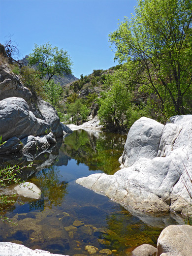
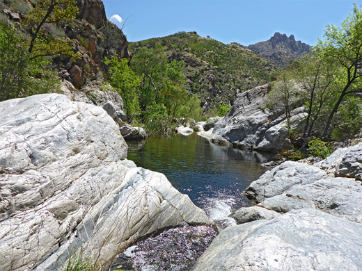
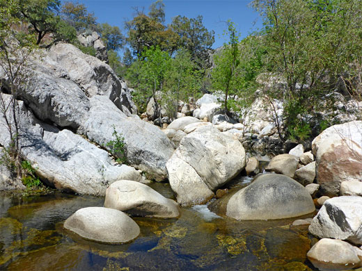
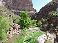
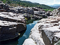
The path moves northeast, descending gently to the wide, white boulder-strewn streambed of the East Fork, which often contains a shallow, narrow, flowing stream, always smaller than the main creek. A junction at the far side marks the end of this section of the path; the East Fork Trail bears right (east) while the Sabino Canyon Trail - also known as the Arizona Trail - continues west, rising over two minor saddles and descending again towards the creek, levelling out across a wide part of the valley floor, which is covered by grass and flowers. Sabino Creek flows close by to the left, though is hidden by a corridor of trees, bushes and boulders (composed of the banded gneiss that is exposed all along the canyon), not becoming properly visible for another half mile, as the path crosses to the south side and later comes close to a deep, permanently flooded section known as Hutch's Pool (4.1 miles from the trailhead).
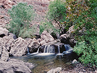
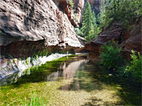
The creek is still easily reached before this, however, by a short cross-country walk (starting at any point more than half a mile from the East Fork crossing), and one option for a continuation hike is to follow the canyon back downstream, either all the way to the trailhead - a difficult, strenuous hike that requires wading or even swimming in some places, and much boulder hopping - or just as far as the vicinity of the East Fork, returning to the trail by climbing the valley sides (to the saguaro knoll) or following the East Fork streamway to the trail crossing. Around the confluence, the main fork of the creek has many big pools, slickrock cliffs and little waterfalls; beautiful scenery, only slightly spoilt by the dull brown color of the water (caused by dissolved tannin and algae), so the scenery is not quite as pretty as some other Sonoran Desert waterways such Agua Fria, Tonto Creek, Aravaipa and Fish Creek.
Pools and cascades near the East Fork confluence (0:46 min).
The lower portion of the canyon is accessed by a 3.7 mile road, used by hikers, cyclists and trams, which have operated since private vehicles were prohibited in the 1970s. Most visitors on the trams are here to explore some of the pools and cascades along the creek, or to ride part of the way and then walk back, or to descend the short trail that reaches a more secluded section of the creek right at the end of the road, though not so many people hike the Sabino Canyon Trail, which leads further upstream, higher into the foothills.
Like the last half mile of the road, the trail stays quite far above the creek - up to 450 feet, since the canyon narrows and the sides become steep. The water is glimpsed in a few places, but instead most of the views are of the surrounding slopes and summits of the Santa Catalina Mountains. After 2.5 miles, the path descends a little and crosses a tributary stream, the East Fork, which also contains water at some times of the year. From here, continuation hikes are possible either east along the East Fork Trail, which later intersects the Bear Canyon Trail to form a testing, 17 mile loop, or west, further up the main canyon. In this direction, Sabino Creek is reached after another three quarters of a mile, allowing exploration of some of its many pools and cascades, such as along a particularly pretty, partly enclosed section that lies just downstream, either side of the East Fork confluence.
Start of the Sabino Canyon Trail
The Sabino Canyon Trail starts beside the tram stop (number nine) at the north end of the park road. Drinking water is provided at some points along the road, though not here - the nearest location is stop eight, half a mile back. The first section of the path is steep, climbing via a series of switchbacks, aiming for a bench above the steep-sided inner section of the canyon. Just over halfway up is an intersection with the Phoneline Trail that parallels the road through the lower section of the canyon, high above the creek bed; start for this hike is at the visitor center. The upper switchback on the Sabino Canyon Trail is a little less steep, and gives way to a more gentle, straight ascent to a rocky corner, the last place where the canyon downstream is visible - a different perspective is encountered beyond, as the valley winds its way higher into the mountains.
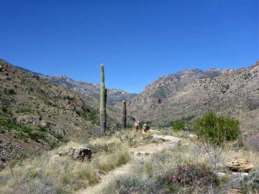
A Level Section
The trail is now over 400 feet above the creek, and stays fairly level for the next 1.5 miles. It soon passes a big boulder beside a shady tree, one of the few sheltered places along the otherwise exposed valley sides. The path proceeds across two wide, shallow basins separated by ridges, and descends slightly to a little tributary, which may hold a few residual pools after rainfall. Saguaro are scattered around, mixed with bushes, smaller cacti and a few large trees. After passing a few more hills and depressions, the trail nears the rim of the canyon of the East Fork, where a little side path climbs to the top of a knoll above the confluence; a good viewpoint, one marked by two, rather weathered saguaro.
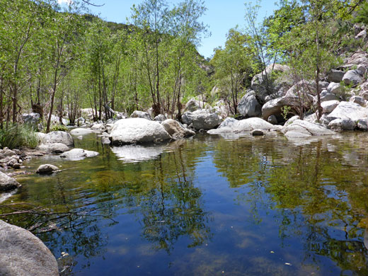
East Fork
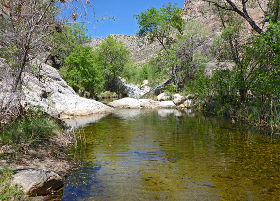
The path moves northeast, descending gently to the wide, white boulder-strewn streambed of the East Fork, which often contains a shallow, narrow, flowing stream, always smaller than the main creek. A junction at the far side marks the end of this section of the path; the East Fork Trail bears right (east) while the Sabino Canyon Trail - also known as the Arizona Trail - continues west, rising over two minor saddles and descending again towards the creek, levelling out across a wide part of the valley floor, which is covered by grass and flowers. Sabino Creek flows close by to the left, though is hidden by a corridor of trees, bushes and boulders (composed of the banded gneiss that is exposed all along the canyon), not becoming properly visible for another half mile, as the path crosses to the south side and later comes close to a deep, permanently flooded section known as Hutch's Pool (4.1 miles from the trailhead).
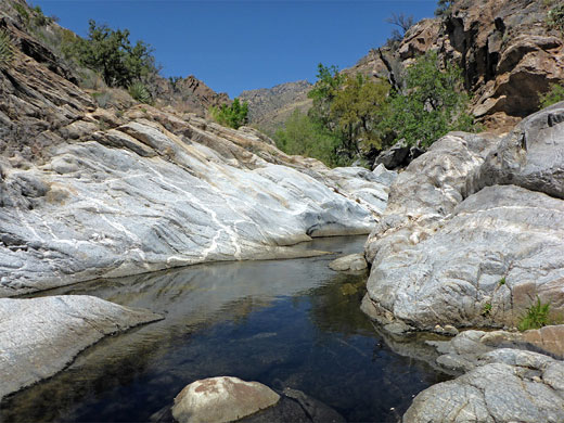
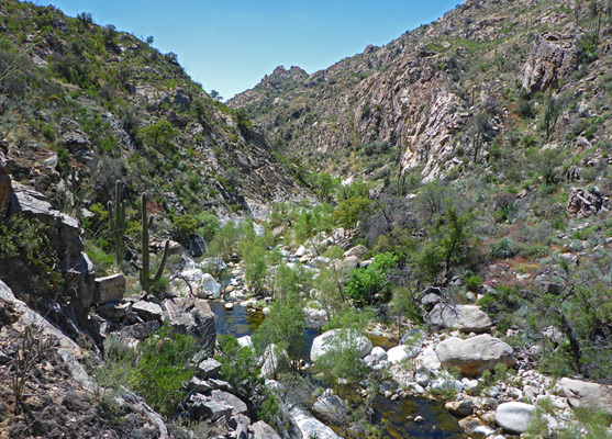
Sabino Creek
The creek is still easily reached before this, however, by a short cross-country walk (starting at any point more than half a mile from the East Fork crossing), and one option for a continuation hike is to follow the canyon back downstream, either all the way to the trailhead - a difficult, strenuous hike that requires wading or even swimming in some places, and much boulder hopping - or just as far as the vicinity of the East Fork, returning to the trail by climbing the valley sides (to the saguaro knoll) or following the East Fork streamway to the trail crossing. Around the confluence, the main fork of the creek has many big pools, slickrock cliffs and little waterfalls; beautiful scenery, only slightly spoilt by the dull brown color of the water (caused by dissolved tannin and algae), so the scenery is not quite as pretty as some other Sonoran Desert waterways such Agua Fria, Tonto Creek, Aravaipa and Fish Creek.
Video
Pools and cascades near the East Fork confluence (0:46 min).
Sabino Canyon Trail - Similar Hikes
All Contents © Copyright The American Southwest | Comments and Questions | Contribute | Affiliate Marketing Disclosure | Site Map