Highlights:
Ruins of the largest and most advanced ancient villages in the Southwest, built along the floor of a shallow, sheer-walled canyon, in a remote part of the high desert of northwest New Mexico. Some have hundreds of rooms, up to five storeys high
Nearby town:
Bloomfield, 55 miles
Management:
Location:
Seasons:
All year
Rating (1-5):
★★★★★

Chaco Culture NHP is part of the Indian Lands and New Mexico Highlights itineraries
Chaco Culture - Scenic Drive

One-way, eight mile paved loop drive past eight major groups of ruins and various smaller sites, plus trailheads for paths to three backcountry areas
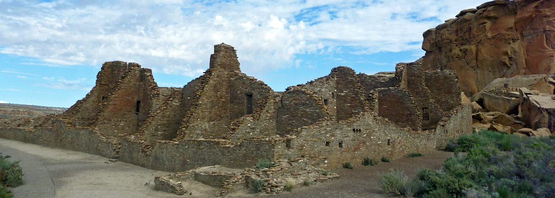
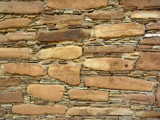
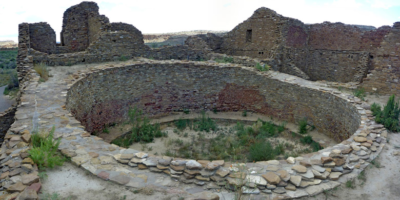
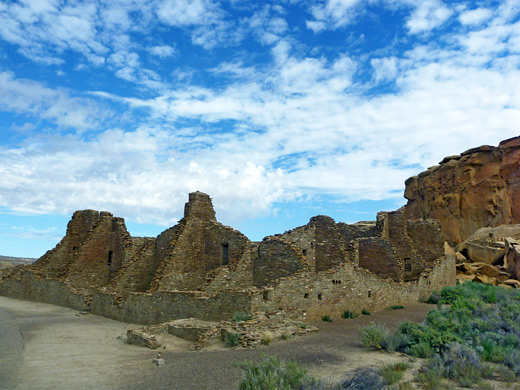
The very remote Chaco site of northwest New Mexico has the largest, best preserved and architecturally advanced of all ancient Southwestern villages, equal in importance to Mesa Verde in Colorado and although lacking the dramatic cliff alcove setting, the ruins here are made more evocative by the great desolation and emptiness of the surrounding countryside. This part of the state is mostly flat, sandy desert crossed by only a few little-used tracks, very sparsely settled and with no prominent geographical feature for many miles.
Only a few low gorges and mesas interrupt the general flatness, and the prevailing aridity plus the long winters experienced by this relatively high location (6,200 feet) make this an odd place for what was a large and advanced civilization to develop. But for 300 years the Anasazi Chacoan villages - most based on a single walled enclosure with hundreds of inter-linked rooms known as a great house, were at the center of a network of roads and outlying settlements that extended 100 miles to the south, west and north, and include a few others also well preserved today like Aztec Ruins near Farmington.
Only a few low gorges and mesas interrupt the general flatness, and the prevailing aridity plus the long winters experienced by this relatively high location (6,200 feet) make this an odd place for what was a large and advanced civilization to develop. But for 300 years the Anasazi Chacoan villages - most based on a single walled enclosure with hundreds of inter-linked rooms known as a great house, were at the center of a network of roads and outlying settlements that extended 100 miles to the south, west and north, and include a few others also well preserved today like Aztec Ruins near Farmington.
Chaco Culture Table of Contents
- Map of the NHS
- Photographs
- Access roads
- The scenic drive
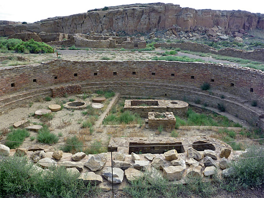
- Chaco Canyon
- History of the canyon
- Wildflowers
- Trails of Chaco Culture NHS
- Nearby places
- Similar places
Location
Map of Chaco Culture National Historical Park.
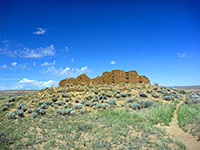
Photographs
General views, Pueblo Alto Trail.
Chaco Culture NHP Access Roads
There is only one main road to Chaco Culture National Historical Park, though this is not the one shown on most maps - for many years access was along state route 57, an unpaved road that leaves US 550 at Blanco Trading Post (and is still used to reach the Ah-Shi-Sle-Pah badlands), but this is now replaced by CR 7900 and 7950, starting further south along US 550 near Nageezi. The drive to the park is 21 miles, along bumpy, often heavily graded gravel or dirt tracks with several T-junctions, which luckily are well signposted, and past just a few Indian houses amidst sandy, arid mesas and scrubland - part of the Navajo Reservation. In recent years the last 4 miles have become rather rough due to lack of maintenance, especially either side of Escavada Wash, and may be impassable after rain, but any vehicle driven with care can usually reach the park.
Chaco Canyon
Road 7950 descends into a shallow canyon (Gallo Wash) becoming paved at the park boundary, passes the campground and a few small ruins then enters a deeper valley up to one mile wide. This is Chaco Canyon, where all the important ruins are found; ten major sites, most of which are right next to the 8 mile (one way) loop road running beneath the crumbling, yellow/brown sandstone cliffs that enclose the valley. It is a short drive but there is a lot to see, and about half a day is needed to explore the closer villages or a full day including hikes to some of the more distant sites on top of the adjacent mesa. There is one other way into the park from the south, along sandy road 57 that runs quite straight through more empty, wide-open desert land for 19 miles to the next paved highway, Indian Route 9. This is less maintained that the northern approach, bumpy in places but still generally quite good, though not advisable during wet weather when the surface becomes too muddy. In addition to ruins within the main unit, the park includes three outlying sites (Pueblo Pintado, Kin Bineola and Kin Ya'a), the last two of which generally need a 4WD vehicle to reach.
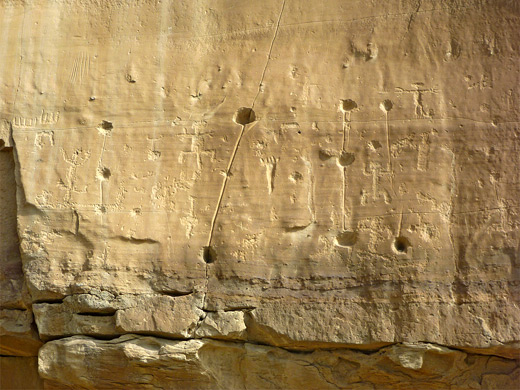
History of Chaco Canyon
| Chaco Culture - one of the 20 least visited national parks and monuments in the West |
Chaco Culture Wildflowers
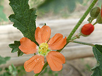
Photographs and descriptions of flowering plants found in the national historical park
Trails of Chaco Culture NHS
All trails in Chaco Canyon
Featured Chaco Trails
Pueblo Alto Trail
★★★★★
★★★★★
5.1 miles, 270 feet (loop)
Varied route to two ruins and several other ancient sites, plus elevated views of Chaco Canyon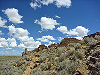
South Mesa Trail
★★★★★
★★★★★
3.6 miles, 450 feet (loop)
The remote, backcountry, mesatop ruins of Tsin Kletsin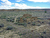
Wijiji Trail
★★★★★
★★★★★
1.5 miles, 20 feet
Level trail downstream along the floor of Chaco Canyon to a less-visited ruinChaco Culture - Nearby Places
- Ah-Shi-Sle-Pah Wilderness (13 miles) - hoodoos, badlands and other eroded rocks
- Bisti Wilderness (25 miles) - amazing rock formations and petrified wood
- Lybrook Badlands (20 miles) - remote region with many large hoodoos
Chaco Culture - Similar Places
- Aztec Ruins National Monument, New Mexico - large walled settlement dating from the 12th century
- Lunar Crater - volcanic formations in a very remote part of central Nevada
- Tuzigoot National Monument, Arizona - Sinagua Indian ruin on a small hill, in the Verde River valley
All Contents © Copyright The American Southwest | Comments and Questions | Contribute | Affiliate Marketing Disclosure | Site Map