Highlights:
Well preserved ruins of a large, walled settlement dating from the 12th century; almost 400 rooms and a dozen kivas, one completely reconstructed. An easily reached location, in the small town of Aztec
Nearby town:
Bloomfield, 9 miles
Management:
Location:
Seasons:
All year
Rating (1-5):
★★★★★
Weather:


Aztec Ruins NM is part of the Indian Lands itinerary
Featured Hotel
Best Western Plus Territorial Inn
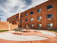 Adobe-style hotel along US 550 in the center of Bloomfield, within walking distance from shops and restaurants; the Aztec Ruins are ten miles north
Check Rates
Like Montezuma Castle in Arizona, the Aztec Ruins were mistakenly thought by early white explorers to be relics of the great 15th century central Mexican civilisation, though as with most other ancient settlements of the Southwest they actually date from around the 12th century and were built by tribes indigenous to this region. In this case the people were probably related to the Mesa Verde group in Colorado though they also had close ties with Chaco culture, the center of which was 55 miles south.
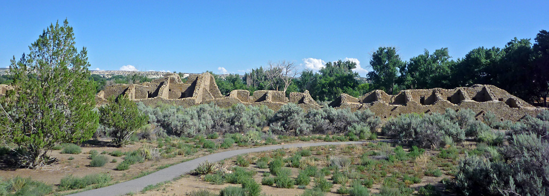
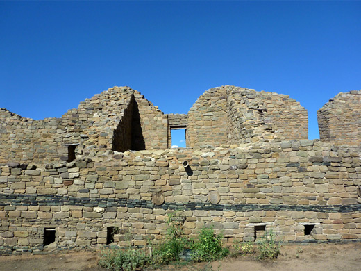
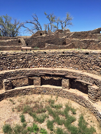
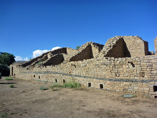
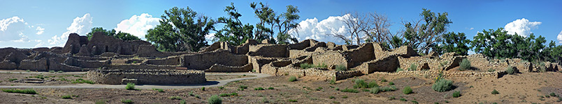
What remains today is a walled village with almost 400 rooms on three levels, over a dozen kivas (circular ceremonial areas), and which since excavation and limited reconstruction may be toured in a very good state of preservation.
What remains today is a walled village with almost 400 rooms on three levels, over a dozen kivas (circular ceremonial areas), and which since excavation and limited reconstruction may be toured in a very good state of preservation.
Aztec Ruins Table of Contents
Aztec Ruins Plan
Photographs
15 views of Aztec Ruins National Monument.
Location
Aztec Ruins National Monument is just 2 miles from the center of Aztec, a bustling town near Farmington in the far northwest of New Mexico, and close to busy US 550 that leads to Durango in Colorado. The countryside nearby is partially farmed using water from the Animas River though most is an unproductive expanse of dry sandy washes between low limestone mesas and has been drilled quite extensively for oil. The main ruined village is now part of a 27 acre complex that also contains several smaller unexplored sites, the visitor center and a picnic area. The Aztec suburbs now extend as far as the edge of the monument and include three Indian arts and crafts shops, catering for the relatively large number of visitors - the site seems quite popular, presumably as access is so convenient.
The Ruins
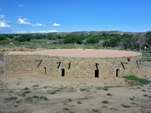
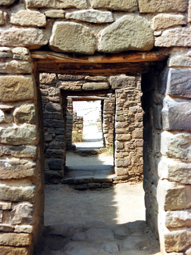
The visitor center has the usual small bookshop, museum and video presentation plus information about local wildlife and plants. Unusually for an NPS property, there is no charge to visit, as of 2018 when the previous $5 entry fee was scrapped. Most of the rooms in the main village (the 'West Ruins') and all the rest of the site are closed to the public; admission allows tourists to walk a short, self-guiding trail through selected areas, which takes around 30-40 minutes depending on the number of stops. It first leads to a high viewpoint of the village, then follows along the outside of the west walls to a small separate structure, the Hubbard tri-wall site, which has partially buried remains of an unusual kiva-like building with three concentric circular walls. The trail then returns to the main ruin and passes through several ground floor rooms which still have complete roofs, into the main plaza and past several other rooms, finally returning to the visitor center via the reconstructed Great Kiva - almost 50 feet wide, this was rebuilt in 1934 by archaeologist Earl H. Morris (who originally excavated the whole site, between 1916 and 1922) and gives a good impression of what life was like in these villages, though some aspects of its construction are based on guesswork, such as the height of the roof. In addition to the West Ruins there are four separate archaeological sites to the east that are unexcavated and likely to remain so, unless NPS policy changes.
Background to the Aztec Ruins
| Aztec Ruins - one of the 20 least visited national monuments in the West |
Aztec Ruins - Nearby Places
- Bisti Wilderness (60 miles) - remote and amazingly colorful desert landscape
- Navajo Lake State Park (30 miles) - scenic lake on the San Juan River
- Shiprock (55 miles) - starkly beautiful volcanic peak
Aztec Ruins - Similar Places
- Chaco Culture National Historical Park, New Mexico - more extensive collection of walled villages
- Hovenweep National Monument, Utah/Colorado - scattered ruins in a very remote location
All Contents © Copyright The American Southwest | Comments and Questions | Contribute | Affiliate Marketing Disclosure | Site Map