Highlights:
Volcanic formations in a very remote part of central Nevada, including cinder cones, lava flows, elongated fissures, ash hills, and the 430 foot deep Lunar Crater
Nearby town:
Tonopah, 84 miles
Management:
BLM
Location:
38.384, -116.068 (the crater)
Seasons:
Spring, summer fall
Rating (1-5):
★★★★★

Lunar Crater is part of the Great Basin Desert itinerary
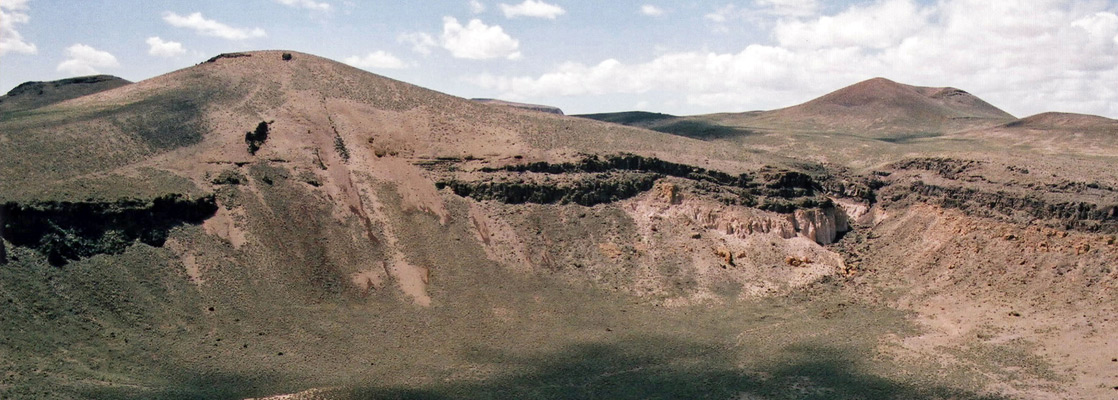
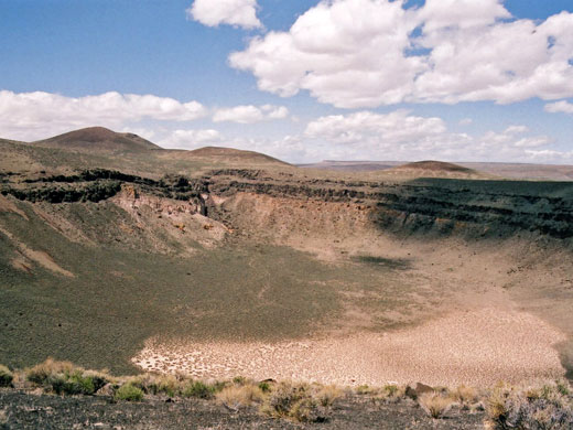
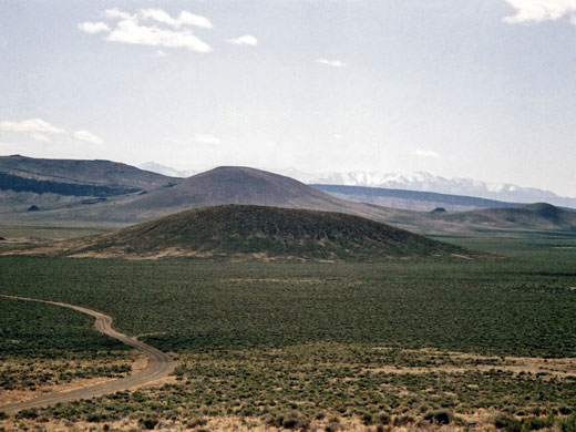
Nevada has over a dozen volcanic areas, less well known than similar sites in Arizona and California since they are located away from main travel routes, in remote areas of the Great Basin Desert. The best is the Lunar Crater Volcanic Field, a zone of volcanism covering over 100 square miles at the southern end of the Pancake Range, and comprising cinder cones, outcrops of lava, elongated fissures, ash hills and, most visibly, the 430 foot deep Lunar Crater - an impressive and rather unexpected site in an otherwise isolated, windswept location.
The crater is designated a National Natural Landmark, one of six in Nevada, and is situated 75 miles east of Tonopah near the center of the state. It is geologically termed a 'maar', the name given to a shallow, broad crater formed by explosive eruptions close to ground level, usually caused by heating of subterranean water.
The crater is designated a National Natural Landmark, one of six in Nevada, and is situated 75 miles east of Tonopah near the center of the state. It is geologically termed a 'maar', the name given to a shallow, broad crater formed by explosive eruptions close to ground level, usually caused by heating of subterranean water.
Lunar Crater Table of Contents
Lunar Crater Access
One unpaved road (the Lunar Crater Back Country Byway) passes by the crater, and the usual approach is from the north, starting from US 6. The junction is marked by a BLM signpost, from which it is a 8 mile drive to the crater's edge. The journey from the south is longer, lonelier and not signposted; this route begins from NV 375, 'The Extraterrestrial Highway', along a gravel side track that heads northeast, 16 miles south of Warm Springs. The first stage is 10 miles along the track, across the flat expanse of Railroad Valley, a typical Nevada basin with little to see apart from sagebrush, alkali seeps and, as the location is still at a relatively low elevation, occasional Joshua trees. A left turn at the first cross roads leads into the low hills that line the valley, the surface now less good - variously sandy or rocky - and enters the volcanic field after about 15 miles. Another left turn at the next junction leads to the crater and joins with the northern approach, where the road widens and improves.
Sites near the Lunar Crater
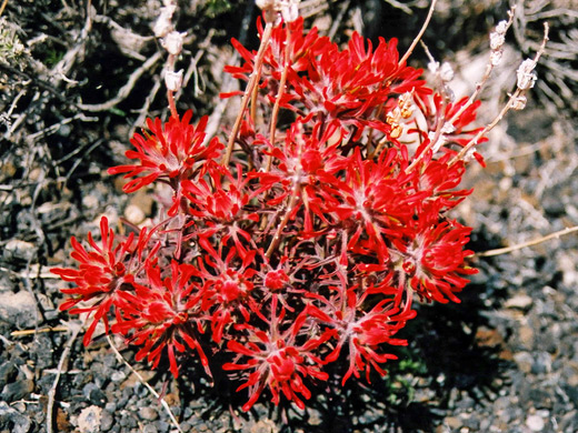
The circular crater is large and impressive, surrounded by dark grey-brown rocks topped by layers of black ash in which grow small but brightly colored wildflowers such as the deep red Indian paintbrush. The viewpoint on the east rim is higher than the surroundings, allowing for far reaching views in most directions, of grass-covered buttes, ridges and lava flows. There is no marked path into the crater though it looks easy enough to hike down, or walk around the rim. The overlook would be a good place to camp for the night, with very little chance of meeting anyone else.
Lunar Crater - Nearby Places
- Basin and Range National Monument (50 miles) - large area of undeveloped valleys, plains and mountains
- The Extraterrestrial Highway (28 miles) - lonely road through UFO territory
- Great Basin National Park (160 miles) - isolated mountain wilderness featuring varied climate zones
Lunar Crater - Similar Places
- Amboy Crater, California - volcanic area in the Mojave Desert
- Sunset Crater Volcano National Monument, Arizona - large expanses of lava and ash, with colorful cinder cones
- Ubehebe Crater, California - large crater in Death Valley
All Contents © Copyright The American Southwest | Comments and Questions | Contribute | Affiliate Marketing Disclosure | Site Map