American Southwest
Home | Categories | National Parks | Hotels | Site Map | Photographs | QTVR | Whats New? | More...
ARIZONA
Index | Introduction | Photographs | QTVR | Driving Distances | Map | Weather | Hotels


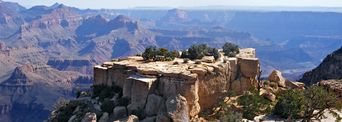
Moran Point, Grand Canyon National Park

Sites in Arizona

NPS - Landscapes
Canyon de Chelly
Chiricahua
Grand Canyon
Lake Mead
Organ Pipe
Petrified Forest
Saguaro
Sunset Crater

NPS - Historic Sites
Casa Grande Ruins
Coronado
Montezuma Castle
Pipe Spring
Tonto
Tumacacori
Tuzigoot
Walnut Canyon
Wupatki

Other Places
Apache Trail
Ironwood Forest NM
Meteor Crater
Route 66
Sedona
Sonoran Desert NM
Tonto NF
Vermilion Cliffs NM

Arizona Site Map

Site Search

Grand Canyon National Park > South Rim > Viewpoints > Moran Point


Moran Point
Along with Desert View, Grandview and Yaki, Moran is one of the most visited points on the east rim drive, and offers far reaching views along a wide section of the Grand Canyon, approximately between river miles 87 and 72. The point is due south of Cape Royal on the North Rim - just 8 miles away in a straight line but 215 miles by road. The promontory is reached by a short spur road and was named after the landscape painter Thomas Moran who came here for the first time in 1873 and helped popularize the canyon, leading eventually to its incorporation as a national monument in 1908 (and a national park in 1919). 
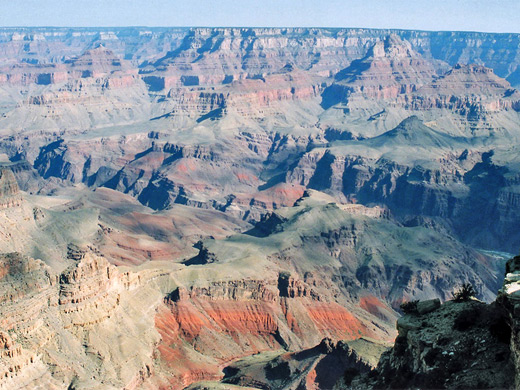
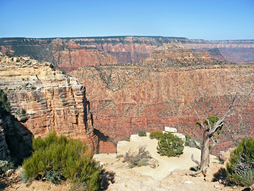
To the west, Coronado Butte blocks some of the southern cliffs but there are still fine views downriver over a succession of red ridges and ravines, as far as Yaki Point where the Colorado bends back south. The eastern aspect is more restricted, by Zuni Point and ridges below.
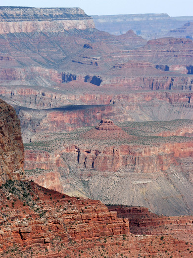
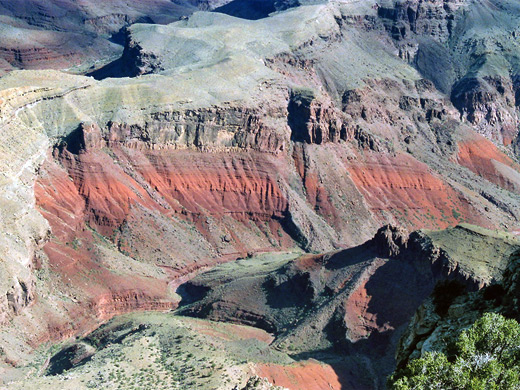


Cliffs west of Moran
Below Moran Point is Red Canyon, a very colorful tributary and especially so at the lower end where deep red/orange layered rocks are exposed, formed of Hakatai shale. This location is one of many unconformities in the strata of the canyon, where adjacent rocks are separated by long periods of geological time - here the flat, light colored plateau between Red Canyon and the next drainage north (Mineral Canyon) is formed of Bright Angel shale from the Cambrian era, and is over 600 million years younger then the pre-Cambrian Hakatai. The New Hance Trail runs along Red Canyon and meets the Escalante Route opposite Hance Rapids, which are just visible from the rim.

Next Points
West: Grandview Point
East: Zuni Point


The view northwest

Lower Red Canyon

Edge of the plateau


Back to Top

All contents © copyright John Crossley | Comments and questions
Arizona California Colorado Nevada New Mexico Texas Utah Wyoming Slot Canyons Travelogue