Taggart Lake and Bradley Lake, Grand Teton National Park
Wyoming > Grand Teton National Park > Hiking > Taggart Lake and Bradley Lake
Taggart Lake and Bradley Lake
Two large lakes right at the foot of the mountains, reached by a well used trail through mixed scenery of forest, grassland and a rocky ravine
Length: 4.5 miles, round trip
Elevation change: 400 feet
Difficulty: Easy
Type: Loop. Each lake can also be visited by shorter, one way trails
Usage: High to Taggart; medium to Bradley
Season: Spring, summer, fall
Trailhead: Along Teton Park Road
Rating (1-5): ★★★★★
Elevation change: 400 feet
Difficulty: Easy
Type: Loop. Each lake can also be visited by shorter, one way trails
Usage: High to Taggart; medium to Bradley
Season: Spring, summer, fall
Trailhead: Along Teton Park Road
Rating (1-5): ★★★★★

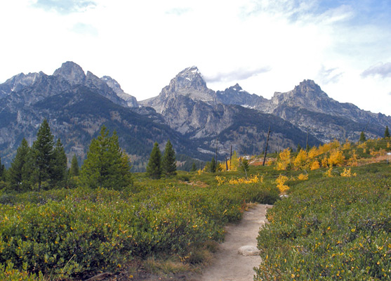
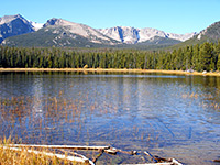
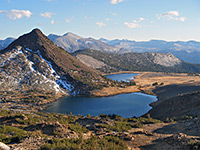
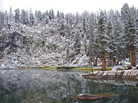
Taggart and Bradley are two quite large lakes set directly beneath the most scenic, central section of the Teton Range - the east shores are bordered by thick pine/fir forest but the land rises very steeply by 5,500 feet just to the west, and both destinations provide less-visited alternatives to Jenny Lake for visitors wanting to experience the archetypal Grand Teton scenery of high rocky peaks towering above a tranquil lake.
The lakes may be reached by an easy hike of 1.6 miles (Taggart) or 2 miles (Bradley); alternatively, both can be seen by a 4.5 mile loop, that crosses mostly wooded, shady terrain and gains just 400 feet in elevation.
Trail map for Grand Teton National Park.
8 views of Taggart and Bradley Lakes.
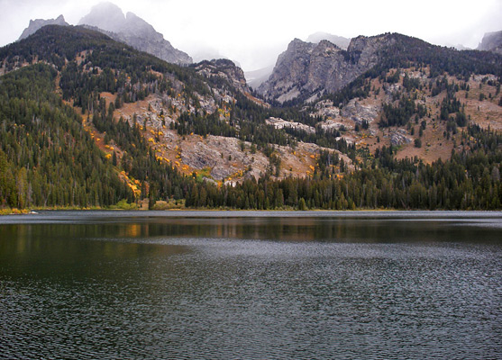
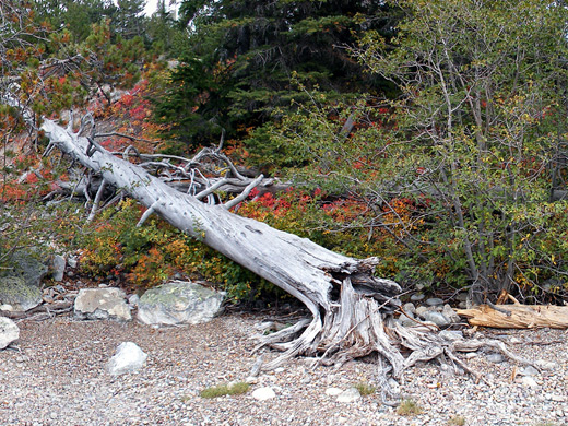
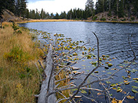
The well maintained trail to the lakes starts from a large parking area along Teton Park Road, 2.8 miles from the Grand Teton National Park headquarters at the Craig Thomas visitor center. The surroundings are treeless as the level path sets off perpendicular to the road and soon reaches a junction in front of a low, wooded hillside. Both branches lead to Taggart Lake but the right fork is shorter, by 0.7 miles; this enters the forest, climbs a little and crosses Taggart Creek, flowing swiftly over a jumble of granite boulders and broken tree stumps. After a second, smaller stream, the path turns west and ascends a little more steeply up the edge of a glacial moraine, through the same low, bushy forest, and soon emerges into a flat, grassy area without any trees - the result of a big wildfire in 1985. Now for the first time the Tetons are in full view, though not yet Taggart Lake as that is hidden by a thicket of young pine trees, growing along the eastern shore. Another ten minutes walking is needed; the path forks left at a junction (right leads to Bradley Lake), descends gently through the trees and emerges by the south edge of the lake, where it meets the longer alternative route from the trailhead. All the lake is surrounded by thick forest, with the pines extending right to the clear water's edge, but the west shore is dominated by steep-sided Avalanche Canyon, a trailless ravine between two 11,000 foot peaks (Mount Wister and Nez Perce).
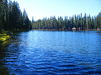
The continuation path to Bradley Lake follows the edge of Taggart Lake northwards, climbs a partly wooded ridge that gives steadily better views of the landscape, then drops down the far side a short distance to the south shore. Like Taggart, Bradley is fed by a stream from one of the major valleys of the Tetons (Garnet Canyon), originating from a glacier next to Middle Teton, 5,000 feet above. The scenery around the two is similarly impressive but Bradley receives fewer visitors so is more peaceful. The path runs beside the east shore, passing two pretty ponds before climbing another 400 feet and joining the trail to Amphitheater Lake/Garnet Canyon. The shortest route back to the Taggart Lake trailhead is to use a cut-off trail, heading south from Bradley Lake and rejoining the original path at the open area near the glacial stream - the round trip is 4.5 miles and can take less than 2 hours, though between 3 and 4 hours is more typical.
The lakes may be reached by an easy hike of 1.6 miles (Taggart) or 2 miles (Bradley); alternatively, both can be seen by a 4.5 mile loop, that crosses mostly wooded, shady terrain and gains just 400 feet in elevation.
Location
Trail map for Grand Teton National Park.
Photographs
8 views of Taggart and Bradley Lakes.
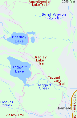
Map of the Taggart and Bradley Lake Trails

Taggart Lake
The well maintained trail to the lakes starts from a large parking area along Teton Park Road, 2.8 miles from the Grand Teton National Park headquarters at the Craig Thomas visitor center. The surroundings are treeless as the level path sets off perpendicular to the road and soon reaches a junction in front of a low, wooded hillside. Both branches lead to Taggart Lake but the right fork is shorter, by 0.7 miles; this enters the forest, climbs a little and crosses Taggart Creek, flowing swiftly over a jumble of granite boulders and broken tree stumps. After a second, smaller stream, the path turns west and ascends a little more steeply up the edge of a glacial moraine, through the same low, bushy forest, and soon emerges into a flat, grassy area without any trees - the result of a big wildfire in 1985. Now for the first time the Tetons are in full view, though not yet Taggart Lake as that is hidden by a thicket of young pine trees, growing along the eastern shore. Another ten minutes walking is needed; the path forks left at a junction (right leads to Bradley Lake), descends gently through the trees and emerges by the south edge of the lake, where it meets the longer alternative route from the trailhead. All the lake is surrounded by thick forest, with the pines extending right to the clear water's edge, but the west shore is dominated by steep-sided Avalanche Canyon, a trailless ravine between two 11,000 foot peaks (Mount Wister and Nez Perce).
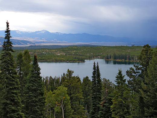
Bradley Lake
The continuation path to Bradley Lake follows the edge of Taggart Lake northwards, climbs a partly wooded ridge that gives steadily better views of the landscape, then drops down the far side a short distance to the south shore. Like Taggart, Bradley is fed by a stream from one of the major valleys of the Tetons (Garnet Canyon), originating from a glacier next to Middle Teton, 5,000 feet above. The scenery around the two is similarly impressive but Bradley receives fewer visitors so is more peaceful. The path runs beside the east shore, passing two pretty ponds before climbing another 400 feet and joining the trail to Amphitheater Lake/Garnet Canyon. The shortest route back to the Taggart Lake trailhead is to use a cut-off trail, heading south from Bradley Lake and rejoining the original path at the open area near the glacial stream - the round trip is 4.5 miles and can take less than 2 hours, though between 3 and 4 hours is more typical.
Taggart Lake and Bradley Lake - Similar Hikes
All Contents © Copyright The American Southwest | Comments and Questions | Contribute | Affiliate Marketing Disclosure | Site Map