Canyon Overlook Trail, Zion National Park
Utah > Zion National Park > Hiking > Canyon Overlook Trail


Canyon Overlook Trail
One of only two official trails in the southeast section of Zion National Park, along UT 9; traverses scenic, rocky terrain to a high viewpoint of the grand canyon of Pine Creek, a major tributary of the Virgin River
Length: 0.5 miles
Elevation change: 160 feet
Difficulty: Easy
Type: One way
Usage: Medium
Season: All year
Trailhead: Pullout along UT 9, near the east end of the tunnel
Rating (1-5): ★★★★★
Elevation change: 160 feet
Difficulty: Easy
Type: One way
Usage: Medium
Season: All year
Trailhead: Pullout along UT 9, near the east end of the tunnel
Rating (1-5): ★★★★★


The Great Arch is a huge, arch-shaped cavity in the sandstone cliffs on the south-facing side of the East Temple, one of the mountains that tower over the Pine Creek tributary of Zion Canyon. The road through this part of the canyon (UT 9) passes beneath the arch when approaching the west entrance to the Zion-Mt Carmel tunnel, while an alternative view awaits those who walk the half mile Canyon Overlook Trail, which starts just outside the east entrance to the tunnel.
The path leads to the most easily accessible high elevation viewpoint in the national park, facing an impressive vista of red cliffs topped by whitish domes and plateaux, while 700 feet underneath the park road twists and turns along the valley floor; similar visitas in the main canyon require ascending 1,500 feet or more.
The trailhead has a small parking area, near the tunnel entrance, though this often fills up early and there is no room for RVs. Often vehicles have to be left up to half a mile away along the highway, parked at roadside pull-outs, and on busy times these too are full. The path begins with a short flight of steps cut into the rock face, opposite the car park, and the first half mile is mostly up and along the side of a cliff, across a footbridge at one point, through one huge overhang and past a cool side-ravine. Below, the canyon tapers to a thin crevice - the Pine Creek narrows, where the rock walls become only a few feet apart but still hundreds of feet deep.
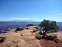
The second half of the Canyon Overlook Trail crosses more level, rockier land. The overlook at the end is situated right at the edge of a vertical cliff, fenced off for safety, and has a panorama board identifying all the prominent peaks on view. The round trip is easy, a good hike for children, with only a 160 foot elevation gain to the overlook, and should take less than an hour. A brochure available at the trailhead describes 20 points of botanical and geological interest along the route, such as a natural water seep from the boundary between two rock strata, around which ferns and a variety of wildflowers grow.
The path leads to the most easily accessible high elevation viewpoint in the national park, facing an impressive vista of red cliffs topped by whitish domes and plateaux, while 700 feet underneath the park road twists and turns along the valley floor; similar visitas in the main canyon require ascending 1,500 feet or more.

Start of the Trail
The trailhead has a small parking area, near the tunnel entrance, though this often fills up early and there is no room for RVs. Often vehicles have to be left up to half a mile away along the highway, parked at roadside pull-outs, and on busy times these too are full. The path begins with a short flight of steps cut into the rock face, opposite the car park, and the first half mile is mostly up and along the side of a cliff, across a footbridge at one point, through one huge overhang and past a cool side-ravine. Below, the canyon tapers to a thin crevice - the Pine Creek narrows, where the rock walls become only a few feet apart but still hundreds of feet deep.

The Viewpoint
The second half of the Canyon Overlook Trail crosses more level, rockier land. The overlook at the end is situated right at the edge of a vertical cliff, fenced off for safety, and has a panorama board identifying all the prominent peaks on view. The round trip is easy, a good hike for children, with only a 160 foot elevation gain to the overlook, and should take less than an hour. A brochure available at the trailhead describes 20 points of botanical and geological interest along the route, such as a natural water seep from the boundary between two rock strata, around which ferns and a variety of wildflowers grow.
Nearby Canyons