Paria Box, Grand Staircase-Escalante National Monument
Utah > Grand Staircase-Escalante National Monument > Paria Box
Paria Box
A short enclosed section of the Paria River, through angled strata, with cliffs up to 300 feet tall; viewed along an easy trail that ends at an elevated viewpoint
Length: 1.8 miles
Elevation change: 400 feet
Difficulty: Easy through the narrows; just a bit strenuous climbing to the viewpoint. Several river crossings
Type: One way
Usage: Low
Season: Spring, summer, fall - during dry weather, as rain makes the access road impassable, and the narrows potentially dangerous
Trailhead: Along Cottonwood Canyon Road, 34 miles south of Cannonville, 11.8 miles north of US 89
Rating (1-5): ★★★★★

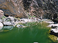
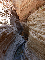
The Paria Box is a short, cliff-lined section of the Paria River, some 15 miles upstream of the famous extended narrows to the south; for the most part, the upper Paria flows across open terrain, with this the one major exception. At the Box it is enclosed for less than a mile, as the river cuts through the East Kaibab Monocline (or the Cockscomb), a long ridge of upturned strata that parallels many miles of Cottonwood Canyon Road, which affords easy access to the Paria box canyon.
The narrows are explored by a 1.8 mile trail which crosses a grassy flat then leads through the narrows, fording the river a few times, and ends by climbing a slope, rising 400 feet to a fine viewpoint, looking upstream towards the Chinle badlands around the site of the Paria ghost town.
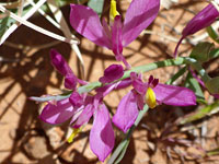
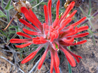
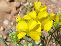
In comparison to the main Paria narrows, which extend for many miles, the Paria Box hike is rather tame, but it is well worth the hour or two required. The cliffs have interesting geology - the river passes six different rock layers over the course of just half a mile, the final viewpoint is quite spectacular, and the latter portion of the path encounters many flowering plants in early summer. The water in the Paria is usually just a few inches deep, though the hike is of course not suitable during times of flood.
20 views of the Paria Box.
Paria Box has an official trailhead, on a short track to the west of Cottonwood Canyon Road, 34 miles south of Cannonville, and 11.8 miles north of US 89. This hike is rather less popular than the similar though rather longer Hackberry Canyon, 2 miles north. The narrow but seemingly well-used path heads west, through a willow thicket, to the edge of the Paria River, on the inside of a bend, where the water flows swiftly, below a sandbank. The trail follows the river upstream, out of the willows and across a large, dusty flat, frequented by cattle, a rather uninspiring scene. Cottonwood Creek joins on the right, then soon after are the first set of cliffs, quite far apart, composed of the Paria River and Thousand Pockets members of the Carmel Formation, followed by more bushy flats and then the start of the proper narrows. Here the path crosses the river for the first time, alongside a cattle fence.
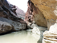
Ahead are a series of shapely cliffs enclosing the river on both sides, now formed of Navajo Sandstone. One such cliff, to the southwest side, is undercut, and the floodwaters have eroded several deep, cave-like alcoves. Three more crossings follow quick succession but soon the canyon widens and the cliffs recede, the rocks now are the Kayenta Formation and the Springdale Sandstone members of the Moenave Formation, while ahead, after another mile or so, are reddish badlands of the Chinle Formation, around the old Paria townsite.
The trail leaves the Paria canyon on the northeast side, starting beside an old wooden gate; it climbs a bench, inclined at about a 30 degree angle, before moving on to more undulating, less steep ground, good habitat for cacti and wildflowers. A path continues for another half mile, moving out-of-sight of the canyon and gradually fading away, passing several big rocks but seemingly not leading to any particular destination. Instead an obvious target for the end of the hike is left a little to the brink of a lesser cliff, of grey brown rock, overlooking the upper Paria canyon, 300 feet above the streamway. The views now extend a long way south, downstream towards the trailhead, west across distant red peaks and ridges, and north along several miles as the Paria valley, to the point when it gradually narrows, in the vicinity of Starlight Canyon.
The narrows are explored by a 1.8 mile trail which crosses a grassy flat then leads through the narrows, fording the river a few times, and ends by climbing a slope, rising 400 feet to a fine viewpoint, looking upstream towards the Chinle badlands around the site of the Paria ghost town.
In comparison to the main Paria narrows, which extend for many miles, the Paria Box hike is rather tame, but it is well worth the hour or two required. The cliffs have interesting geology - the river passes six different rock layers over the course of just half a mile, the final viewpoint is quite spectacular, and the latter portion of the path encounters many flowering plants in early summer. The water in the Paria is usually just a few inches deep, though the hike is of course not suitable during times of flood.
Photographs
20 views of the Paria Box.
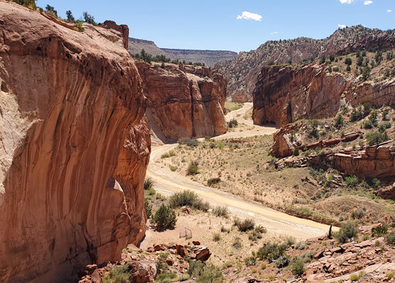
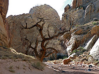
Path to the Narrows
Paria Box has an official trailhead, on a short track to the west of Cottonwood Canyon Road, 34 miles south of Cannonville, and 11.8 miles north of US 89. This hike is rather less popular than the similar though rather longer Hackberry Canyon, 2 miles north. The narrow but seemingly well-used path heads west, through a willow thicket, to the edge of the Paria River, on the inside of a bend, where the water flows swiftly, below a sandbank. The trail follows the river upstream, out of the willows and across a large, dusty flat, frequented by cattle, a rather uninspiring scene. Cottonwood Creek joins on the right, then soon after are the first set of cliffs, quite far apart, composed of the Paria River and Thousand Pockets members of the Carmel Formation, followed by more bushy flats and then the start of the proper narrows. Here the path crosses the river for the first time, alongside a cattle fence.
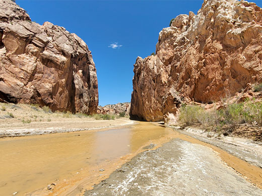
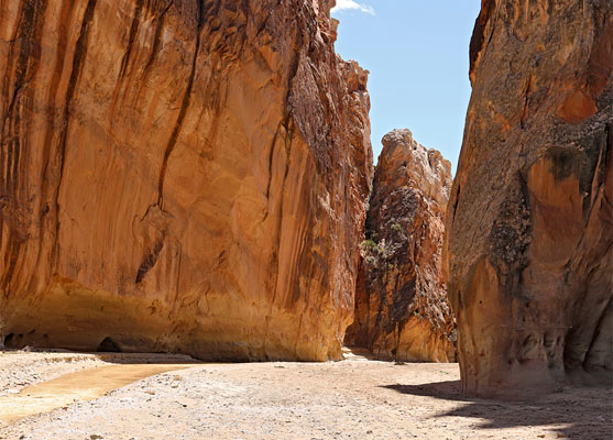
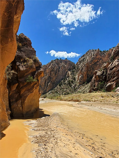
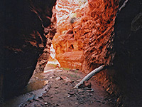
The Box
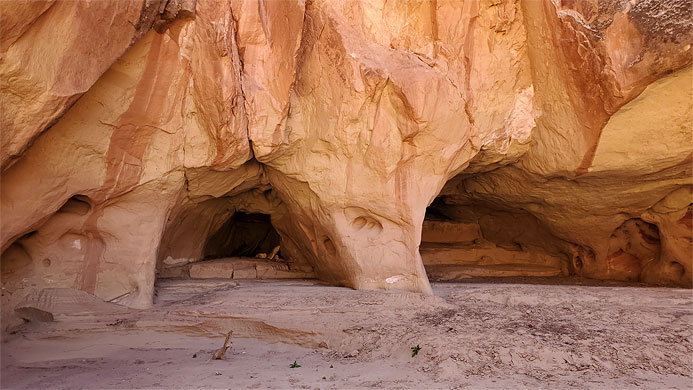
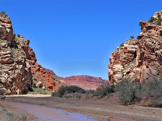
Ahead are a series of shapely cliffs enclosing the river on both sides, now formed of Navajo Sandstone. One such cliff, to the southwest side, is undercut, and the floodwaters have eroded several deep, cave-like alcoves. Three more crossings follow quick succession but soon the canyon widens and the cliffs recede, the rocks now are the Kayenta Formation and the Springdale Sandstone members of the Moenave Formation, while ahead, after another mile or so, are reddish badlands of the Chinle Formation, around the old Paria townsite.
The Viewpoint
The trail leaves the Paria canyon on the northeast side, starting beside an old wooden gate; it climbs a bench, inclined at about a 30 degree angle, before moving on to more undulating, less steep ground, good habitat for cacti and wildflowers. A path continues for another half mile, moving out-of-sight of the canyon and gradually fading away, passing several big rocks but seemingly not leading to any particular destination. Instead an obvious target for the end of the hike is left a little to the brink of a lesser cliff, of grey brown rock, overlooking the upper Paria canyon, 300 feet above the streamway. The views now extend a long way south, downstream towards the trailhead, west across distant red peaks and ridges, and north along several miles as the Paria valley, to the point when it gradually narrows, in the vicinity of Starlight Canyon.

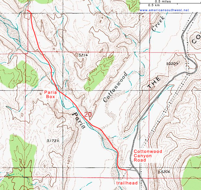
Topo Map of the Paria Box Trail

Paria Box - Similar Hikes
All Contents © Copyright The American Southwest | Comments and Questions | Contribute | Affiliate Marketing Disclosure | Site Map