Mill Creek Falls, Lassen Volcanic National Park
California > Lassen Volcanic National Park > Hiking > Mill Creek Falls
Mill Creek Falls
The highest waterfall in the park, along a small stream reached by a pleasant trail that crosses floral meadows and patches of pine forest
Length: 1.5 miles
Elevation change: 300 feet
Difficulty: Easy
Type: One way. Trail continues to Crumbaugh Lake
Usage: Medium
Season: Late spring to late summer
Trailhead: Beside the visitor center at the park's south entrance
Rating (1-5): ★★★★★
Elevation change: 300 feet
Difficulty: Easy
Type: One way. Trail continues to Crumbaugh Lake
Usage: Medium
Season: Late spring to late summer
Trailhead: Beside the visitor center at the park's south entrance
Rating (1-5): ★★★★★

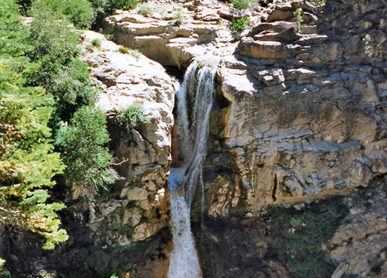
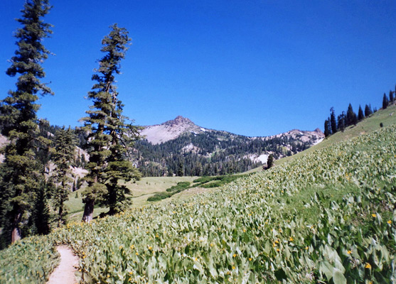
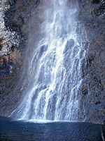
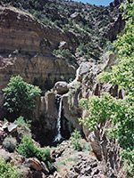
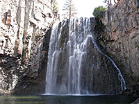
Mill Creek Falls is the highest waterfall in Lassen Park, as here the stream (East Sulphur Creek) drops over 70 feet as it flows along a narrow valley, eventually joining the Sacramento River. The falls are reached by a 1.5 mile foot path, starting close to the campground at the southwest park entrance, that encounters no volcanic features, just pretty meadows with wildflowers and varied vegetation, pine/fir woods and small hills.
The trail crosses several streams and has a few steep sections, but without much overall elevation change. Near the start, the path passes a large field of sunflower-type plants (mule's ears) on a sunny hillside, typical of the scenery of this area.
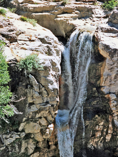
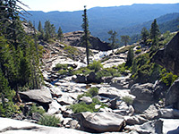
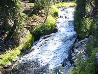
The tall, narrow falls are first visible from a viewpoint at the edge of a cliff opposite, 1.3 miles from the trailhead. The path beyond curves down to the very edge of the noisy cascading water from where one can see for some distance along the steep V-shaped valley downstream. It is almost possible to jump over the river just above the falls, where the watercourse narrows and flows through a deep channel, but it can be crossed in safety by fording the creek about 20 meters upstream. On the far side, a small stream joins just above the falls and from the rocks near here one can see that the water actually drops about a third of the way into a rocky pool, cut into the cliffs, then spills out and falls to the canyon floor. The water in the creek is quite acidic, resulting from sulphur contamination upstream in the thermal area where the water originates (Little Hot Springs Valley). Past the falls, the trail continues west, climbing by 800 feet and reaching Crumbaugh Lake after another 1.7 miles.
The trail crosses several streams and has a few steep sections, but without much overall elevation change. Near the start, the path passes a large field of sunflower-type plants (mule's ears) on a sunny hillside, typical of the scenery of this area.
The Falls
The tall, narrow falls are first visible from a viewpoint at the edge of a cliff opposite, 1.3 miles from the trailhead. The path beyond curves down to the very edge of the noisy cascading water from where one can see for some distance along the steep V-shaped valley downstream. It is almost possible to jump over the river just above the falls, where the watercourse narrows and flows through a deep channel, but it can be crossed in safety by fording the creek about 20 meters upstream. On the far side, a small stream joins just above the falls and from the rocks near here one can see that the water actually drops about a third of the way into a rocky pool, cut into the cliffs, then spills out and falls to the canyon floor. The water in the creek is quite acidic, resulting from sulphur contamination upstream in the thermal area where the water originates (Little Hot Springs Valley). Past the falls, the trail continues west, climbing by 800 feet and reaching Crumbaugh Lake after another 1.7 miles.
Mill Creek Falls - Similar Hikes
All Contents © Copyright The American Southwest | Comments and Questions | Contribute | Affiliate Marketing Disclosure | Site Map