Highlights:
Wooded section of Oak Creek south of Sedona, along which are several short trails, through the riparian areas and over the arid hills on the east side. Good views of the red rocks to the north
Nearby town:
Sedona, 9 miles
Management:
Location:
Seasons:
All year
Rating (1-5):
★★★★★
Weather:


Featured Hotel
Hampton Inn Sedona
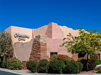 Popular hotel in downtown Sedona along Hwy 89A, close to many restaurants and shops including a large supermarket; 7 miles from Red Rock State Park
Check Rates
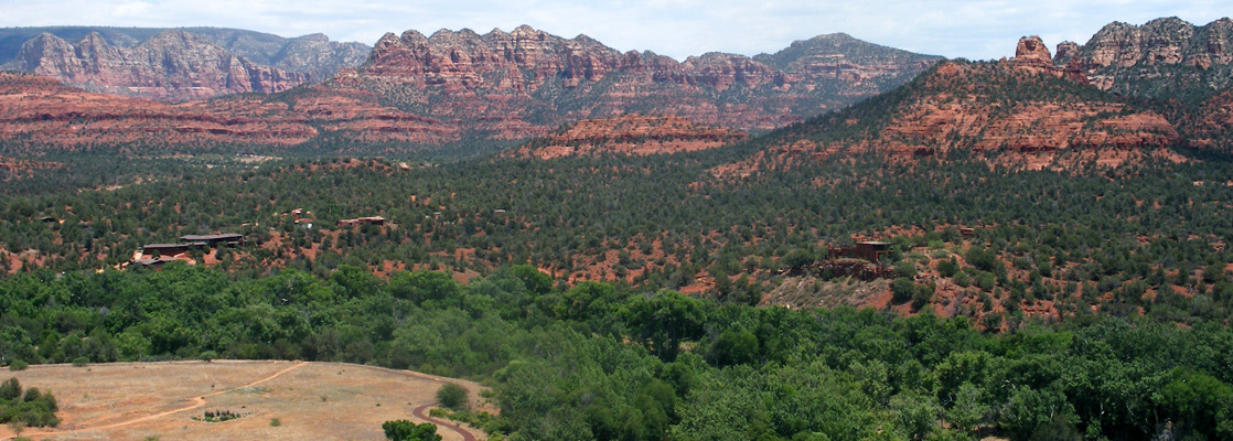
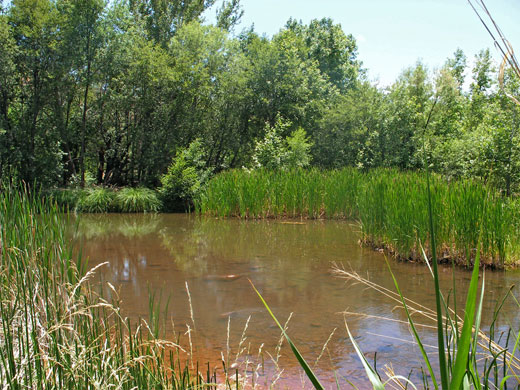
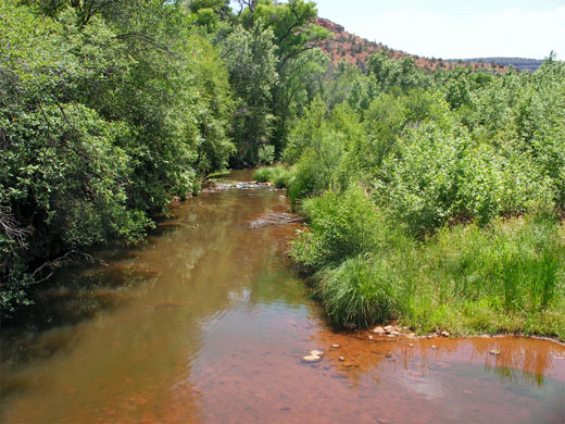
There is no shortage of places in Arizona that could form a Red Rock State Park, but the chosen location is a few miles southwest of Sedona alongside Oak Creek, where the year-round stream flows through a low valley at the center of a flourishing riparian environment. The waterless hillsides 50 feet above the creek are quite different, covered by bushes, cacti and coarse grass, and while not especially scenic themselves, the hills afford good views of the much higher red rock cliffs to the north and east.
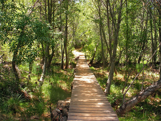
The popular park has a visitor center, picnic areas and over 5 miles of easy, inter-connecting trails along the stream or over the desert, and although not one of the top attractions of Sedona it is a nice place to visit for a few hours, to take a cool, shady walk on a hot summer's day.
The popular park has a visitor center, picnic areas and over 5 miles of easy, inter-connecting trails along the stream or over the desert, and although not one of the top attractions of Sedona it is a nice place to visit for a few hours, to take a cool, shady walk on a hot summer's day.
Red Rock Table of Contents
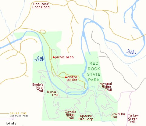
Map of Red Rock State Park
The State Park
Red Rock State Park is reached by a 7 mile loop road off US 89A (see Sedona Map), the middle part of which is unpaved though fine for all vehicles. Only the western entrance is signposted. The road curves around the south side of Scheurman Mountain, passing through bushy, red, rocky land that shelters quite a few houses, nestled in clearings in the trees or on top of small hills. Entry to the state park (2024) is $7 for adults, $4 for children (7 to 13; free for under 7), for day use only - the nearest official campgrounds are along the main road. Opportunities for free camping near Sedona are rather limited since the introduction of the Red Rock Pass system, but the nearest place is along side tracks leading into the Coconino National Forest, a few miles southwest along US 89A towards Cottonwood. In the park a short road leads past two picnic areas to the main parking lot and visitor facilities, built on a bluff overlooking the wooded, quite overgrown valley of Oak Creek. The hills to the south rise gradually to 5,127 foot House Mountain though are not nearly so dramatic as the deep red, sheer sided peaks to the north of Sedona. The park has quite a few restrictions, to protect the natural habitats, including no swimming, no wading, no off trail hiking and no pets. The rangers at the park offer a range of interpretive programs such as moonlight hikes, birding walks and school field trips.
Trails of Red Rock State Park
The main activity is hiking. Nine trails form a network of routes, mostly on the south side of Oak Creek. All are well marked, with signs and trail maps at each junction. Three cross the stream and its wide flood plain - heavy rains occasionally cause great floods down the valley, such as in 2005. For most of the length of the park the creek is spilt into two channels, and running parallel to part of it is a third, a drainage ditch built early last century to irrigate a nearby ranch. Of the paths into the hills, the Eagles Nest Trail is perhaps the best, a 1.7 mile loop with 300 feet of elevation gain that rises above the creek to a summit then curves around a small valley beyond. In the southeast corner, the Coyote Ridge, Apache Fire and Yavapai Ridge Trails also cross the desert hillsides, and link with longer routes outside the park, to the top of House Mountain (Turkey Creek Trail) as well as a track to Oak Creek Village.
Red Rock - Nearby Places
- Sedona (9 miles) - world famous red rock landscapes
- Tuzigoot National Monument (20 miles) - ancient ruins in the Verde Valley
Red Rock - Similar Places
- Lost Maples State Park - pleasant, wooded river canyon in the Texas Hill Country
- Palmetto State Park, Texas - varied watery environments along the San Marcos River
- Red Rock Canyon State Park, California - similar in name only, this is a dry, desert canyon with badlands and eroded formations
All Contents © Copyright The American Southwest | Comments and Questions | Contribute | Affiliate Marketing Disclosure | Site Map