Waterman Peak Trail, Ironwood Forest National Monument
Arizona > Ironwood Forest National Monument > Waterman Peak Trail
Waterman Peak Trail
Short, enjoyable route up a shallow ravine to a saddle, then over colorful, rocky, cactus-covered slopes to the highest point in the Waterman Mountains, for long distance views over a large area of southern Arizona
Length: 0.9 miles
Elevation change: 1,150 feet
Difficulty: Easy to moderate
Type: One way
Usage: Low
Season: All year, though very hot in summer
Trailhead: Parking place along Johnstone Mine Road
Rating (1-5): ★★★★★
Elevation change: 1,150 feet
Difficulty: Easy to moderate
Type: One way
Usage: Low
Season: All year, though very hot in summer
Trailhead: Parking place along Johnstone Mine Road
Rating (1-5): ★★★★★

3,808 foot Waterman Peak is the highest point of the Waterman Mountains, a small range in the middle of Ironwood Forest National Monument - the main part of the hills extends 5 miles west to east, and the peak is at the center. A semi-maintained trail leads to the summit, one of only two recognized hikes in the monument, the other being the rather more strenuous route to Ragged Top Peak, in the Silver Bell Mountains a few miles north.
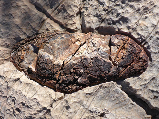
The Waterman Peak Trail is 0.9 miles in length, gaining 1,150 feet, a fairly continuous ascent but without any particularly steep sections. Loose stones and sharp rocks are the only possible hazards; the mountains are primarily formed of sedimentary rocks from the Paleozoic era including limestone, quartzite and dolostone, the surfaces of which have weathered and eroded to have sharp, irregular textures.
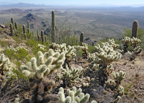
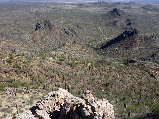
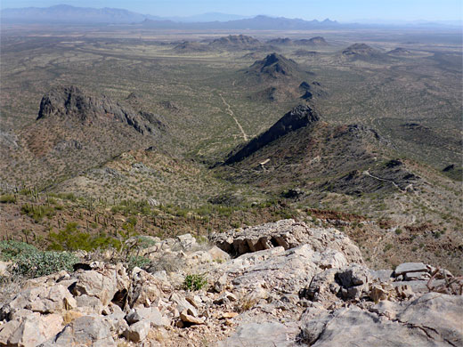
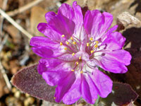
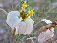
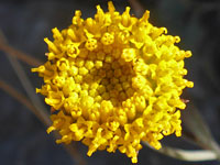
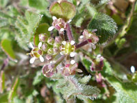
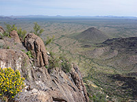
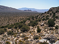
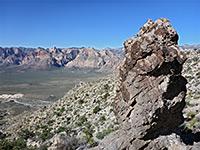
The slopes of the peak are covered with a dense array of most of the familiar Sonoran Desert cactus species, most abundant being saguaro, hedgehog cactus and teddy-bear cholla, plus a good variety of wildflowers. The best aspect of the hike are the views, wide-ranging right from the start, and from the higher reaches incorporating many of the southern Arizona ranges, up to 50 miles distant.
The trailhead is reached by a paved road, and there are several places for free primitive camping in the vicinity. The trail can be hiked all year; although very hot in summer the ascent is relatively short and not too strenuous.
21 views along the trail.
Ironwood Forest map.
The Waterman Peak trailhead is 17 miles from Marana, mostly along Avra Valley Road, then turning left (south) on Johnstone Mine Road, shortly before the other route reaches Silver Bell Mine, and continuing for 1.5 miles to a gravel parking lot. Just beyond, the road is blocked a gate, the entrance to Johnstone Mine, while a short distance north, a side track reaches the Titan Missile Silo 570-3 Interpretive Site, one of 18 locations in the Arizona desert where intercontinental ballistic missiles were stationed during the Cold War. Descriptive panels give information about the facility, though virtually all structures have been removed, and the land returned to a natural state; only some concrete foundations remain.
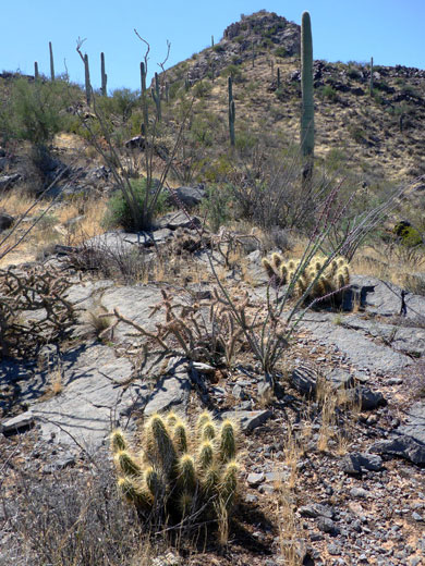
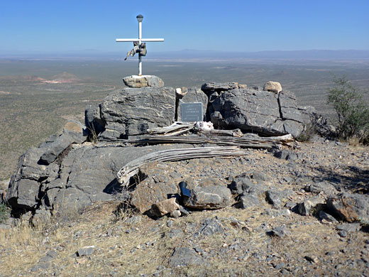
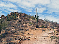
From the elevated trailhead, already high enough for good views to the north, the well-used but unsignposted path heads up a little ravine, close to a dry streambed, to a saddle, the first place where lands to the south come into view. After here the path narrows, curving to the southeast and ascending a more exposed slope dotted with jagged outcrops of rocks of varying colors, white, grey, brown and red, all quite photogenic. The trail reaches a minor promontory, climbs further, past two Public Lands signs to another flat area, covered by loose stones. The next section climbs to a third point and then a fourth, a bigger level area, at the north end of which is a monument to helicopter pilot Loren Leonberger, who was killed here by a crash in January 2011. The memorial includes a cross, a plaque and several personal items, and is illuminated at night by a solar-powered light. Nearby is a red hill covered by a very dense strand of the teddy-bear cholla.
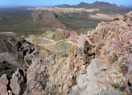
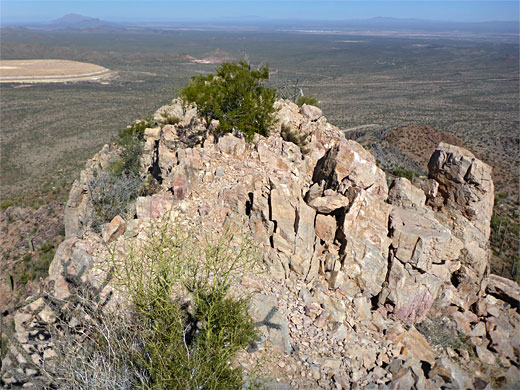
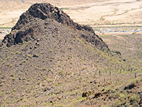
The final section of the climb is through light grey rocks, up another 200 feet to the narrow, elongated summit, three separate little peaks with a palo verde tree in between two of them. Views in the foreground include the colorful spoil heaps of Johnstone Mine just below, the larger Silver Bell Mine to the north, the Silver Bell Mountains beyond, and the more distant Ragged Top Peak.
The Waterman Peak Trail is 0.9 miles in length, gaining 1,150 feet, a fairly continuous ascent but without any particularly steep sections. Loose stones and sharp rocks are the only possible hazards; the mountains are primarily formed of sedimentary rocks from the Paleozoic era including limestone, quartzite and dolostone, the surfaces of which have weathered and eroded to have sharp, irregular textures.
The slopes of the peak are covered with a dense array of most of the familiar Sonoran Desert cactus species, most abundant being saguaro, hedgehog cactus and teddy-bear cholla, plus a good variety of wildflowers. The best aspect of the hike are the views, wide-ranging right from the start, and from the higher reaches incorporating many of the southern Arizona ranges, up to 50 miles distant.
The trailhead is reached by a paved road, and there are several places for free primitive camping in the vicinity. The trail can be hiked all year; although very hot in summer the ascent is relatively short and not too strenuous.
Photographs
21 views along the trail.
Location
Ironwood Forest map.
Waterman Peak Trailhead
The Waterman Peak trailhead is 17 miles from Marana, mostly along Avra Valley Road, then turning left (south) on Johnstone Mine Road, shortly before the other route reaches Silver Bell Mine, and continuing for 1.5 miles to a gravel parking lot. Just beyond, the road is blocked a gate, the entrance to Johnstone Mine, while a short distance north, a side track reaches the Titan Missile Silo 570-3 Interpretive Site, one of 18 locations in the Arizona desert where intercontinental ballistic missiles were stationed during the Cold War. Descriptive panels give information about the facility, though virtually all structures have been removed, and the land returned to a natural state; only some concrete foundations remain.
The Trail
From the elevated trailhead, already high enough for good views to the north, the well-used but unsignposted path heads up a little ravine, close to a dry streambed, to a saddle, the first place where lands to the south come into view. After here the path narrows, curving to the southeast and ascending a more exposed slope dotted with jagged outcrops of rocks of varying colors, white, grey, brown and red, all quite photogenic. The trail reaches a minor promontory, climbs further, past two Public Lands signs to another flat area, covered by loose stones. The next section climbs to a third point and then a fourth, a bigger level area, at the north end of which is a monument to helicopter pilot Loren Leonberger, who was killed here by a crash in January 2011. The memorial includes a cross, a plaque and several personal items, and is illuminated at night by a solar-powered light. Nearby is a red hill covered by a very dense strand of the teddy-bear cholla.
The Summit
The final section of the climb is through light grey rocks, up another 200 feet to the narrow, elongated summit, three separate little peaks with a palo verde tree in between two of them. Views in the foreground include the colorful spoil heaps of Johnstone Mine just below, the larger Silver Bell Mine to the north, the Silver Bell Mountains beyond, and the more distant Ragged Top Peak.
Waterman Peak Trail - Similar Hikes
All Contents © Copyright The American Southwest | Comments and Questions | Contribute | Affiliate Marketing Disclosure | Site Map