| TEXAS | Index | Maps | Driving Distances | Introduction | National Parks | State Parks | Weather | Photographs | QTVR | Hotels |
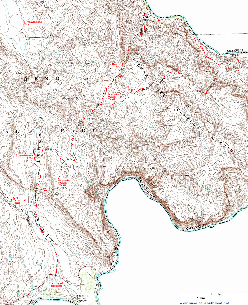
Topographic Map of the Marufo Vega Trail, Big Bend National Park | |
Sites in Texas NPS Units Alibates Flint Quarries Amistad Big Bend Fort Davis Guadalupe Mountains Lake Meredith Padre Island San Antonio Missions Other Places Big Bend Ranch Black Gap Caprock Canyons Davis Mountains Dinosaur Valley Enchanted Rock Fort Leaton Franklin Mountains Hueco Tanks Langtry Lost Maples Monahans Sandhills Odessa Meteor Crater Palmetto Palo Duro Canyon Pedernales Falls Texas Site Map Site Search Photograph Search |
Big Bend National Park > The Southeast > Hiking > Marufo Vega Trail > Topo Map![]() |
| Back to Top | |
Arizona | California | Colorado | Nevada | New Mexico | Oregon | Texas | Utah | Wyoming | Slot Canyons | Travelogue | SOUTHWEST |
|