Middle Water Holes Canyon - East of US 89 (Upstream)
Slot Canyons > Page > Water Holes Canyon > East of US 89
Middle Water Holes Canyon
The middle section of Water Holes Canyon, immediately east of the US 89 bridge - relatively shallow narrows, still pretty, and quite easy to follow. This is the section usually visited on guided tours
Length: 1.3 miles, to the upper end of the narrows
Trailhead: Parking area on the east side of US 89
Rating (1-5): ★★★★★
Trailhead: Parking area on the east side of US 89
Rating (1-5): ★★★★★

The following description relates to the time when unaccompained hiking to Water Holes Canyon was permitted after purchase of a $5 permit, but as of May 2018 even the section immediately east of US 89 may only be seen as part of a guided tour, cost around $70 per person.
Topographic map of Water Holes Canyon.
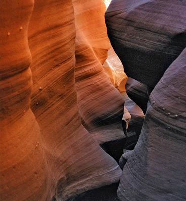
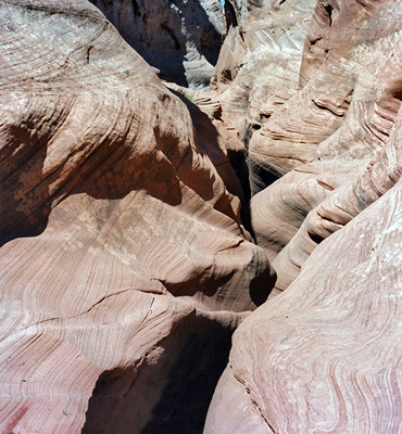
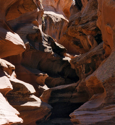
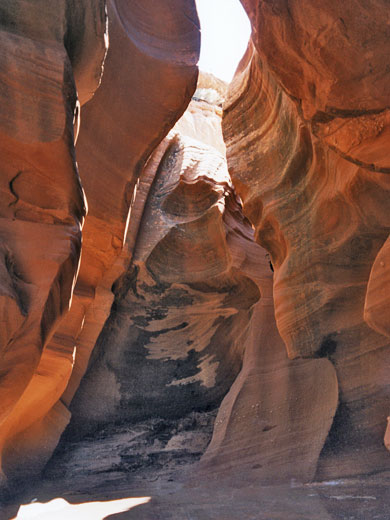
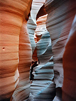
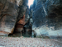
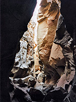
Views of lower and middle Water Holes Canyon.
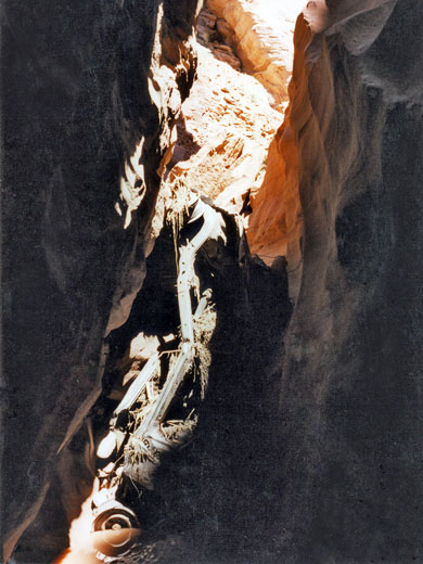
There are two possible routes down from the north rim of Water Holes Canyon either side of US 89. The easiest is the official entrance, on the east side of the road, used by the guided tours. The other is down a steep gully a short distance west of the highway, leading to an open section of the canyon; upstream is a short narrow passage that becomes quite dark and enclosed, with pools and several other minor obstacles. The road bridge crosses high above, and directly below, the canyon is blocked by the remains of a car, wedged vertically between the rock walls; when the canyon was open to unaccompained hiking this was quite useful as the canyon floor beyond is about ten feet higher, and the car assisted when climbing up.
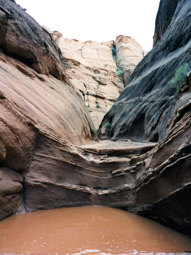
Above the car wreck, Water Holes is less deep and much more open. The official entrance is down a slope to the left, after which there is another narrowish section then for the next half mile or so the streamway is wider, relatively shallow and fully exposed to the sun. There are short, water-worn channels a few feet deep interspersed with wider stony areas, and following recent floods, many patches of soft mud and pools up to 2 feet deep. The weathered sandstone walls are usually around 5-10 meters high, with frequent climb-out routes. Occasional short side canyons join from both sides.
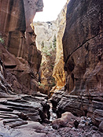
The best stretch of narrows is reached after 20 minutes walking, extends for around 150 meters and ends at a deep pool beneath a 15 foot vertical rock face. This section of the canyon is often only a few feet wide and has many rock hollows filled with muddy water; much scrambling up rock faces and around tight corners is necessary. There is no way to climb up at the large pool but there is a route up the cliff walls a little way back down the passageway, on the south side.
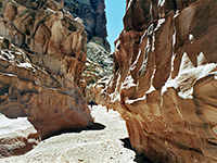
The canyon can be rejoined after walking along a ledge and back down to the streambed just above the dryfall. The narrows do not extend much further, however, as the ravine becomes wide, with sand banks and pebbles. After a few hundred meters, beneath some powerlines, the canyon divides. The right fork emerges from another dark, twisting section of narrows with more nice swirling rock formations, with 4 vertical drops of around 5 feet, just high enough to make progress a little difficult. This passage marks the end of the narrows of the lower canyon as the cliffs are soon replaced by sandy hills and the streamway spreads out and meanders across the flat desert, although much further up the left fork, several other slot sections are found, which are described in the upper middle fork and upper west fork sections.
See the narrows on a Navajo guided tour - the only way to visit the canyon.
Map
Topographic map of Water Holes Canyon.
Photographs
Views of lower and middle Water Holes Canyon.
Route Description
There are two possible routes down from the north rim of Water Holes Canyon either side of US 89. The easiest is the official entrance, on the east side of the road, used by the guided tours. The other is down a steep gully a short distance west of the highway, leading to an open section of the canyon; upstream is a short narrow passage that becomes quite dark and enclosed, with pools and several other minor obstacles. The road bridge crosses high above, and directly below, the canyon is blocked by the remains of a car, wedged vertically between the rock walls; when the canyon was open to unaccompained hiking this was quite useful as the canyon floor beyond is about ten feet higher, and the car assisted when climbing up.
The Canyon
Above the car wreck, Water Holes is less deep and much more open. The official entrance is down a slope to the left, after which there is another narrowish section then for the next half mile or so the streamway is wider, relatively shallow and fully exposed to the sun. There are short, water-worn channels a few feet deep interspersed with wider stony areas, and following recent floods, many patches of soft mud and pools up to 2 feet deep. The weathered sandstone walls are usually around 5-10 meters high, with frequent climb-out routes. Occasional short side canyons join from both sides.
The Best Narrows
The best stretch of narrows is reached after 20 minutes walking, extends for around 150 meters and ends at a deep pool beneath a 15 foot vertical rock face. This section of the canyon is often only a few feet wide and has many rock hollows filled with muddy water; much scrambling up rock faces and around tight corners is necessary. There is no way to climb up at the large pool but there is a route up the cliff walls a little way back down the passageway, on the south side.
Above the Dryfall
The canyon can be rejoined after walking along a ledge and back down to the streambed just above the dryfall. The narrows do not extend much further, however, as the ravine becomes wide, with sand banks and pebbles. After a few hundred meters, beneath some powerlines, the canyon divides. The right fork emerges from another dark, twisting section of narrows with more nice swirling rock formations, with 4 vertical drops of around 5 feet, just high enough to make progress a little difficult. This passage marks the end of the narrows of the lower canyon as the cliffs are soon replaced by sandy hills and the streamway spreads out and meanders across the flat desert, although much further up the left fork, several other slot sections are found, which are described in the upper middle fork and upper west fork sections.
Tours of Secret Canyon
See the narrows on a Navajo guided tour - the only way to visit the canyon.
Middle Water Holes Canyon - Similar Hikes
All Contents © Copyright The American Southwest | Comments and Questions | Contribute | Affiliate Marketing Disclosure | Site Map