Wolf Lake Trail, Yellowstone National Park
Wyoming > Yellowstone National Park > The Northwest > Hiking > Wolf Lake Trail
Wolf Lake Trail
Lightly traveled path through meadows and new growth woodland to a peaceful lake, partly lined with lily pads, near the upper end of the Gibbon River. The trail crosses the river at two places, one just above the cascade of Little Gibbon Falls
Length: 3.5 miles
Elevation change: 250 feet
Difficulty: Easy to moderate
Type: One way
Usage: Low
Season: Summer, fall
Trailhead: Grand Loop Road, near Virginia Meadows
Rating (1-5): ★★★★★
Elevation change: 250 feet
Difficulty: Easy to moderate
Type: One way
Usage: Low
Season: Summer, fall
Trailhead: Grand Loop Road, near Virginia Meadows
Rating (1-5): ★★★★★

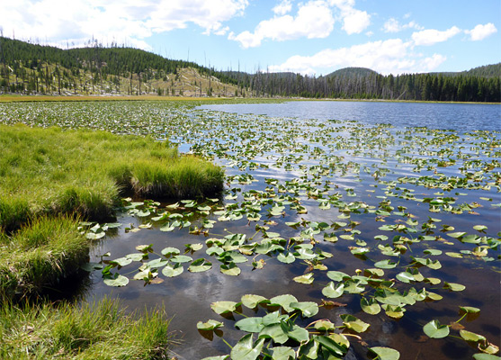
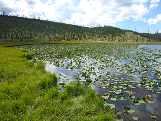
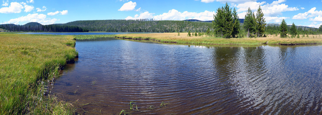
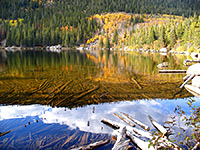
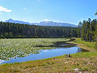
The 3.5 mile Wolf Lake Trail is a good choice for a quiet half day hike in Yellowstone National Park, with an above average chance of spotting wildlife, while not seeing any other people. Along with Ice and Grebe, Wolf is one of three lakes along the upper reaches of the Gibbon River, here flowing between the north edge of the Solfatara Plateau and the south end of the Washburn Range, and it presents a tranquil appearance, mostly lined by a wide belt of moist grassland, with lily pads growing in the shallow margins, and peaks rising above the forest to the north. A primitive campsite is situated close by, in a little group of trees, and there are several more along the continuation trail, to Grebe Lake.
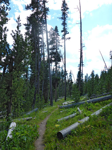
The path to Wolf Lake crosses the Gibbon River twice, the first occasion just above the whitewater cascade of Little Gibbon Falls, and runs near the start along the edge of a meadow, but is mostly through woodland, the majority of which was burnt in the 1988 wildfires and so contains relatively small, closely spaced trees. Apart from a few dormant vents there are no thermal features along the way, and while the middle section is somewhat monotonous, the hike as a whole is quite varied. The round trip takes about three hours.
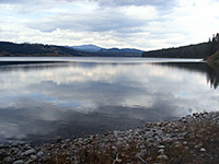
The path to Wolf Lake starts along the Grand Loop Road 3.8 miles east of Norris Junction; the small parking lot is on the south side of the road, overlooking Virginia Meadows 50 feet below - this is a grassy area along the Gibbon River, a little way upstream of the Virginia Cascades. The trail sees rather fewer visitors than that for Ice Lake, half a mile west.
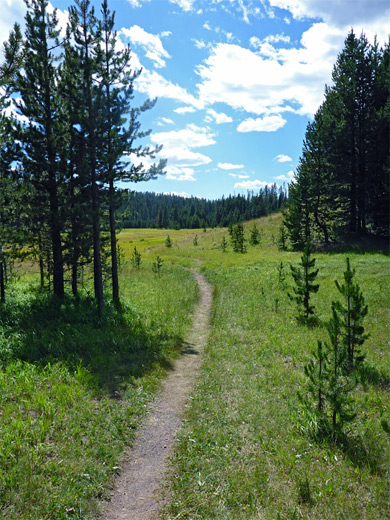
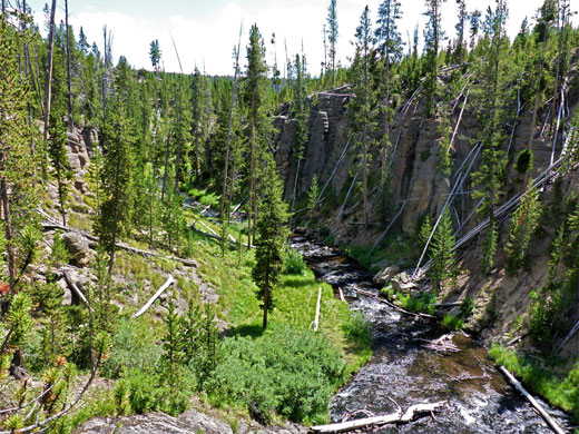
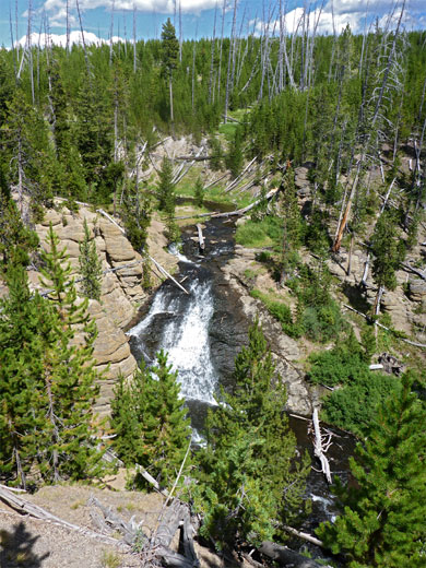
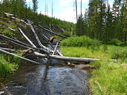
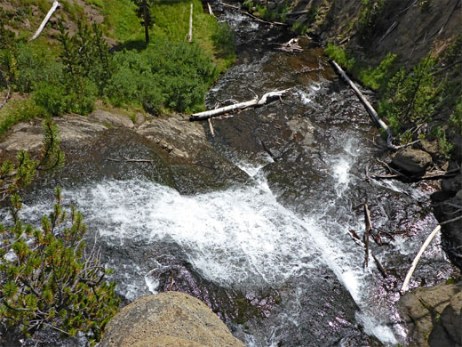
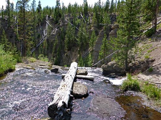
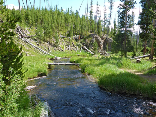
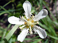
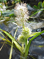
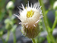
The lightly used trail begins on the opposite side of the road and is not obvious since there is no signpost, just a narrow opening between two trees. An information board for the hike is a few yards along, with a map, route description and the usual warnings about entering bear country. The route starts in a small patch of old-growth forest, running a little way above the Gibbon River to the east, then follows the edge of a meadow, as the land flattens out; ahead is dry grassland, containing a few scattered trees. The ground rises slightly to the brink of the canyon of the Gibbon River, and Little Gibbon Falls comes into view; this is a pretty cascade, and provides a suitable destination for a shorter hike (0.7 miles). The path descends to the river, fording it just above the falls via some fallen logs, a crossing that is usually easy but may be more problematic during the high water levels of early summer. The canyon is pretty, quite sheltered, not too deep, lined by light grey rocks and filled with many fallen, barkless trees from the 1988 fires, while along the stream is a selection of riparian plants.
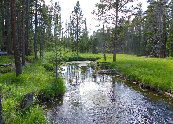
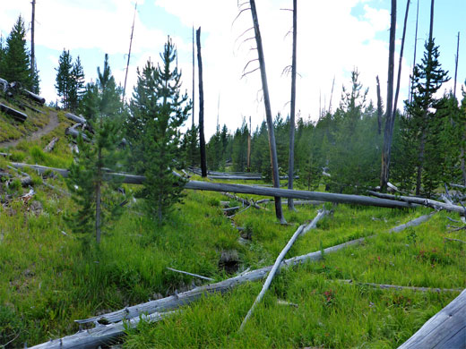
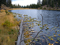
After the river crossing, the trail gradually rises, up a dry, fire-damaged slope that becomes relatively treeless on top, where the views open out to reveal the hills of the Washburn Range ahead. A short descent reaches a junction with a path from Ice Lake, the east end of which is just 0.4 miles away. The Wolf Lake Trail continues northeastwards, over a tiny tributary stream and gradually up again, through a longer stretch of similar-looking, new growth woods. Around the high point are a few unvegetated reddish patches and shallow holes, indicative of a dormant thermal region. The path eventually slopes down steeply and meets the Gibbon River for a second time, now flowing through a wider and deeper valley, containing larger trees undamaged by the fires. Reeds grow in the slow-moving waters, and the location is peaceful and scenic.
The trail runs along the far side of the Gibbon River a short distance, through a moist environment, then rises up a dry slope, passes over a ridge and drops down towards Wolf Lake, coming close only at the southern tip, location of the primitive campsite, in an isolated patch of trees. In other places, the lake is surrounded by a broad strip of marshy grass, which to the east continues a long way, towards the next lake upstream, Grebe. The path that leads to Grebe Lake, 1.3 miles away, resumes on the far side of the Gibbon River, which here is usually about 80 feet wide and at least a foot deep, hence wading is required if proceeding further.
The path to Wolf Lake crosses the Gibbon River twice, the first occasion just above the whitewater cascade of Little Gibbon Falls, and runs near the start along the edge of a meadow, but is mostly through woodland, the majority of which was burnt in the 1988 wildfires and so contains relatively small, closely spaced trees. Apart from a few dormant vents there are no thermal features along the way, and while the middle section is somewhat monotonous, the hike as a whole is quite varied. The round trip takes about three hours.
Wolf Lake Trailhead
The path to Wolf Lake starts along the Grand Loop Road 3.8 miles east of Norris Junction; the small parking lot is on the south side of the road, overlooking Virginia Meadows 50 feet below - this is a grassy area along the Gibbon River, a little way upstream of the Virginia Cascades. The trail sees rather fewer visitors than that for Ice Lake, half a mile west.
Little Gibbon Falls
The lightly used trail begins on the opposite side of the road and is not obvious since there is no signpost, just a narrow opening between two trees. An information board for the hike is a few yards along, with a map, route description and the usual warnings about entering bear country. The route starts in a small patch of old-growth forest, running a little way above the Gibbon River to the east, then follows the edge of a meadow, as the land flattens out; ahead is dry grassland, containing a few scattered trees. The ground rises slightly to the brink of the canyon of the Gibbon River, and Little Gibbon Falls comes into view; this is a pretty cascade, and provides a suitable destination for a shorter hike (0.7 miles). The path descends to the river, fording it just above the falls via some fallen logs, a crossing that is usually easy but may be more problematic during the high water levels of early summer. The canyon is pretty, quite sheltered, not too deep, lined by light grey rocks and filled with many fallen, barkless trees from the 1988 fires, while along the stream is a selection of riparian plants.
Path to the Second River Crossing
After the river crossing, the trail gradually rises, up a dry, fire-damaged slope that becomes relatively treeless on top, where the views open out to reveal the hills of the Washburn Range ahead. A short descent reaches a junction with a path from Ice Lake, the east end of which is just 0.4 miles away. The Wolf Lake Trail continues northeastwards, over a tiny tributary stream and gradually up again, through a longer stretch of similar-looking, new growth woods. Around the high point are a few unvegetated reddish patches and shallow holes, indicative of a dormant thermal region. The path eventually slopes down steeply and meets the Gibbon River for a second time, now flowing through a wider and deeper valley, containing larger trees undamaged by the fires. Reeds grow in the slow-moving waters, and the location is peaceful and scenic.
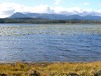
The Lake
The trail runs along the far side of the Gibbon River a short distance, through a moist environment, then rises up a dry slope, passes over a ridge and drops down towards Wolf Lake, coming close only at the southern tip, location of the primitive campsite, in an isolated patch of trees. In other places, the lake is surrounded by a broad strip of marshy grass, which to the east continues a long way, towards the next lake upstream, Grebe. The path that leads to Grebe Lake, 1.3 miles away, resumes on the far side of the Gibbon River, which here is usually about 80 feet wide and at least a foot deep, hence wading is required if proceeding further.
Wolf Lake Trail - Similar Hikes
All Contents © Copyright The American Southwest | Comments and Questions | Contribute | Affiliate Marketing Disclosure | Site Map