The Northwest, Yellowstone National Park: West Yellowstone, Madison and Norris
Wyoming > Yellowstone National Park > The Northwest
Highlights:
The northwest section of Yellowstone National Park - West Yellowstone, Norris, Madison and Gibbon Geyser Basin, with a good selection of trails, including to several backcountry thermal areas

Most visitors enter Yellowstone National Park from the west along highway US 20, as this links with major cross-country routes from the south and west (I-15 and I-84). For 20 miles or more before the park boundary, the road passes through several small villages and much commercial development - many lodges, holiday homes and rustic shops, culminating, after a brief empty section across the continental divide, in the small but busy town of West Yellowstone, just before the national park boundary.
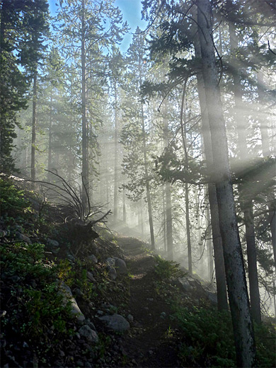
The town provides every conceivable facility including an airport, IMAX theater and a good selection of hotels. But the surroundings are very different once inside the park since there are no buildings of any kind for the 12 miles to Madison Junction, as the road follows the meandering Madison River, at first over a flat valley then into a wooded canyon, through land still recovering from the great wildfires of 1988. The few trails in this region of the park include Harlequin Lake and Purple Mountain.
The town provides every conceivable facility including an airport, IMAX theater and a good selection of hotels. But the surroundings are very different once inside the park since there are no buildings of any kind for the 12 miles to Madison Junction, as the road follows the meandering Madison River, at first over a flat valley then into a wooded canyon, through land still recovering from the great wildfires of 1988. The few trails in this region of the park include Harlequin Lake and Purple Mountain.
Northwest Yellowstone Table of Contents

Photographs
Norris Geyser Basin and the west, Monument Geyser Basin, Purple Mountain Trail, Sylvan Springs.
Videos
Artist Paint Pots, Monument Geyser Basin, Sylvan Springs.
Madison
At Madison Junction, the Madison River splits into two tributaries, the Gibbon and Firehole Rivers. Also at this point the road forks; right (south) is towards the Upper, Middle & Lower Geyser Basins including Old Faithful and the largest concentration of thermal features in the park, while straight on (east) leads to the Monument, Gibbon and Norris Geyser Basins. The road eastwards parallels the Gibbon River, through a shallow valley that constricts after a few miles, where the river cascades over the 84 foot Gibbon Falls, then shortly beyond opens out into Gibbon Meadows. Near Madison are three short trails.
Yellowstone Tours
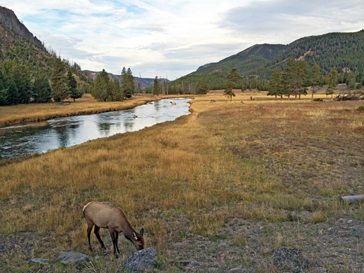
Explore the Lamar Valley, home of much wildlife.
Monument and Gibbon Geyser Basins
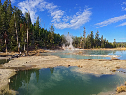
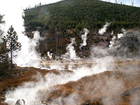
Two lesser known geyser regions are found just north of Gibbon Canyon. Monument Geyser Basin is tucked away in wooded land at the side of the hills, reached by a 1 mile trail that climbs steeply for 600 feet, though the place is now largely dormant. The basin has a few puffing vents and pools, but various cone-shaped geyser spouts show this was once much more active. Of more interest is Gibbon Geyser Basin, which has up to 8 separate groups of features arranged all around the edge of Gibbon Meadows, on both sides of the road. Only one has a trail leading to it - Artists Paintpots, which is a collection of small but colorful springs, mud pots and sporadically-erupting geysers. The other areas, including Geyser Creek, Gibbon Hill, Sylvan Springs and the Chocolate Pots, are up to 2 miles away from the road, mostly on the far side of the Gibbon River, and have no path. Some are quite dangerous, with unstable ground surrounding the active areas, so both care and determination is needed to visit them.
Norris Geyser Basin
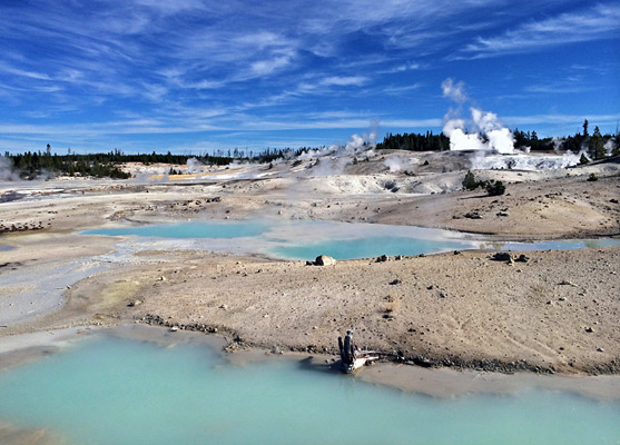
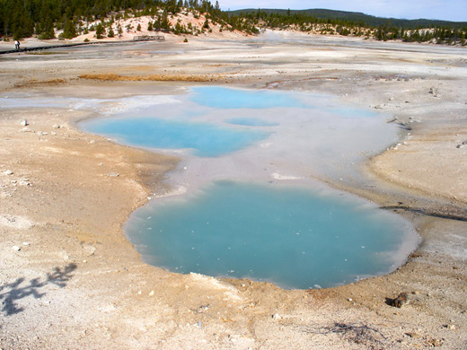
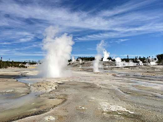
Norris Geyser Basin is the hottest and most changeable region in all of Yellowstone National Park, and presents the most alien and intimidating of spectacles. For half a mile the landscape is without any vegetation, just a seething expanse of pools, steam, geysers and white calcium deposits, in places stained bright colors by algae. The air is often filled with strong smells of sulphur and hydrogen sulphide, and the danger of the place is evident from occasional bleached white skeletons of deer and bison, who sometimes wander onto the unstable ground. But much of the basin is viewable in comfort by a network of boardwalks and paths, while various other trails explore the surrounding countryside.
Norris Map
Map of Norris Geyser Basin, showing all trails and named thermal features.
Thermal Features of Norris Geyser Basin
The basin has two loop trails. The shortest (0.75 miles) is around the northern part, Porcelain Basin, which is the most active area; this has over 30 named features, most notably Ledge Geyser, Whirligig Geyser, Pinwheel Geyser, Porcelain Springs and Blue Geyser, plus dozens more pools and vents, though in general this section is best appreciated from a distance, to give a wide perspective. In fact most is only viewable from afar, and the basin extends a long way out of sight to the north, a place known as One Hundred Spring Plain. The second, and longer loop path (1.5 miles) is through Back Basin to the south, a hilly, partially wooded area where the springs and geysers are more isolated, but the path approaches closer to them. Of the larger features, Steamboat Geyser is the tallest on Earth - up to 350 feet, though both times and power are unpredictable. Major eruptions happen only every year or so. Echinus Geyser was one of the most popular in the park, with lengthy, regular performances but it has declined recently. Cistern Spring is a pretty, deep blue pool in a constant state of flux, connected by underground passages to Steamboat Geyser. Pearl Geyser is another permanently bubbling pool that erupts infrequently to a height of 10 feet. Emerald Spring has clear, hot water, 27 feet deep, with a beautiful greenish blue tint. Veteran Geyser is moderately active most of the time, sometimes quiet but occasionally throws water up to 40 feet. The neat, circular vent of Vixen Geyser can spout every ten minutes or so, though as with many others, it is prone to long periods of dormancy.
Beyond Norris
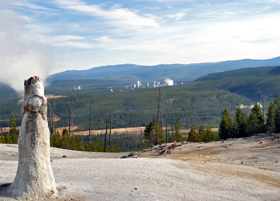
After the excitement of Norris Geyser Basin, the northwards Grand Loop Road stays mostly level as it follows a long valley, passing meadows, small lakes and several lesser-known thermal regions. First is a collection of roadside springs and vents around Nymph Lake, 2 miles north of Norris Junction, but with no particular central attraction. Next, the highway runs beneath Roaring Mountain, whose west face has many noisy vents emitting steam and sulphurous gases, which have declined in forcefulness since the feature was first named, in 1885. Near here is what is believed to be the most northerly geyser in Yellowstone - Semi Centennial Geyser, though this has not erupted since 1922. Five miles further, the road enters a narrower ravine (Obsidian Canyon), parts of one side of which are made of jet black obsidian, a shiny volcanic glass that was quarried by the native Shoshone Indians for arrow and spear heads. The steep canyon opens out to reveal a wide, grassy valley, site of one of the park's campgrounds (Indian Creek), plus picnic areas and several backcountry trailheads. At the north end of the valley, at Kingman Pass, the road drops steeply down into Golden Gate Canyon, past Bunsen Peak (an extinct volcano) towards Mammoth Hot Springs. Meanwhile, the main road east from Norris Geyser Basin follows a few more miles of the Gibbon River, which at one point tumbles town a steep slope forming the unusual Virginia Cascade, then crosses the Solfatara Plateau and leads on to Canyon Junction. En route are several quite short trails to backcountry lakes, including Ice Lake, Grebe Lake and Cascade Lake.
Hiking in Northwest Yellowstone
All trails in northwest Yellowstone
Featured Trails
Artists Paintpots
★★★★★
★★★★★
0.6 miles, 80 feet
Especially colorful and varied collection of hot pools, mudpots and small geysers, reached by an easy path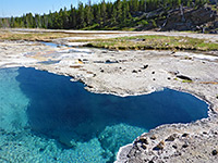
Gibbon Hill and Geyser Creek
★★★★★
★★★★★
3.6 miles, 300 feet (loop)
Off-trail hike to two backcountry thermal areas within Gibbon Geyser Basin, containing several active geysers, plus many pools, vents and mudpots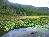
Harlequin Lake
★★★★★
★★★★★
0.4 miles, 100 feet
Harlequin is a minor, shallow lake at the foot of Purple Mountain, on the north side of the highway, 1.5 miles west of Madison Junction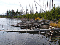
Ice Lake
★★★★★
★★★★★
0.3 miles, 30 feet
This very short trail leads to a pretty, tree-lined lake in fairly level land beside the Gibbon River, covered by fir and pine trees partly burned in 1988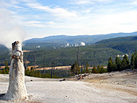
Monument Geyser Basin
★★★★★
★★★★★
1 mile, 600 feet
Monument is a largely extinct geyser basin on a hillside at the south edge of Gibbon Meadows, consisting of dormant white geyserite cones, a few of which occasionally emit puffs of steam
Purple Mountain
★★★★★
★★★★★
2.5 miles, 1560 feet
Trees partly obscure views from the summit of Purple Mountain, but much can still be seen, to the south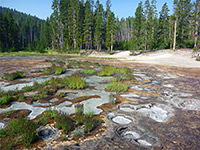
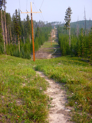
Solfatara Creek
★★★★★
★★★★★
6.5 miles, 430 feet
The longest and least-used trail in the Norris area is along Solfatara Creek, a tributary of the Gibbon River that crosses a hilly region containing a number of small hot springs and gas vents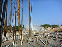
Sylvan Springs
★★★★★
★★★★★
2 miles, 170 feet
On the west edge of both Gibbon Meadows and Gibbon Geyser Basin, Sylvan Springs are a group of hot pools, bubbling springs and sulphurous fumaroles; explorable by off-trail hiking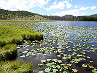
Wolf Lake
★★★★★
★★★★★
3.5 miles, 250 feet
Little-used path through woods and meadows along the upper reaches of the Gibbon River, leading to a peaceful lakeAll Contents © Copyright The American Southwest | Comments and Questions | Contribute | Affiliate Marketing Disclosure | Site Map