Crawford Wash
Short, scenic, north-side tributary of Paunuweap Canyon, moderately enclosed in its lower reaches. Accessed by an off-trail hike from Hwy 9; up a Clear Creek tributary, over a sandy saddle, then down over extensive slickrock
Length: 2.9 miles
Elevation change: 680 feet up, then 990 feet down
Difficulty: Moderate to strenuous
Type: One way, a route rather than a trail
Usage: Very low
Season: All year, though hot and exposed in summer
Trailhead: Pullout on the north side of Hwy 9
Rating (1-5): ★★★★★
Elevation change: 680 feet up, then 990 feet down
Difficulty: Moderate to strenuous
Type: One way, a route rather than a trail
Usage: Very low
Season: All year, though hot and exposed in summer
Trailhead: Pullout on the north side of Hwy 9
Rating (1-5): ★★★★★

Crawford Wash is one of over a dozen north-side tributaries of the East Fork of the Virgin River (Parunuweap Canyon), in and around Zion National Park; others include Misery Canyon, Poverty Wash and Mineral Gulch, all of which form slot canyons. Crawford though is only moderately enclosed, along its lower section, before it falls away at the confluence with Parunuweap, by 300 feet, a point reachable fairly easily by a 2.9 mile off-trail, cross-country hike that encounters no major obstacles.
Starting from Hwy 9, the route is across the usually dry streambed of Clear Creek, up a slickrock slope beside a seasonal waterfall (Cockeye Falls, an unofficial name), then along the partly wooded drainage above, later climbing more slickrock slopes, passing over a sandy saddle and descending to the upper end of the East Fork of Crawford Wash. This drops down steadily and meets the almost flat streambed of the lower canyon, which leads to Parunuweap.
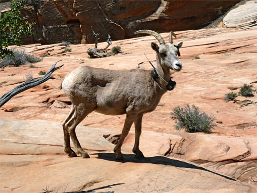
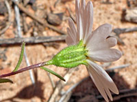
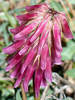
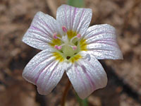
The route is not marked in any way, and the canyon is very rarely explored. The hike offers spectacular views all the way, initially of the white cliffs and domes of the Clear Creek drainage, later of the more uniformly red rock area around Crawford and Parunuweap. Bighorn sheep are often spotted, while little streams and seeps provide good habitat for wildflowers. The round-trip, just under 6 miles, takes from 4 to 5 hours or more.
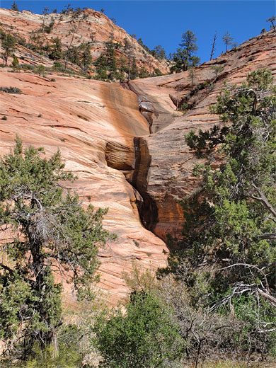
There are two possible parking places for the Crawford Wash hike, along Hwy 9 either side of Cockeye Falls, 1.7 miles from the Zion-Mt Carmel tunnel entrance - on the north side of the falls just to the west, or on the east side, around a bend. The falls, which flow properly only in the spring, are formed where an unnamed stream cascades 50 feet down a red slickrock slope, in several stages.
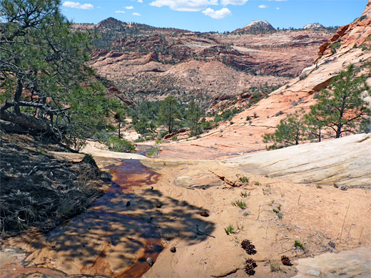
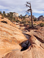
From the western parking place, a short hike on a path descends to the stony bed of Clear Creek, at the base of Cockeye Falls. The route up is via a steeply angled slope just east of the falls, a climb that is mostly easy, with just a few slightly steeper places that need more care. The gradient lessens, the smooth rock giving way to a sandy, bushy bench which leads southwards to the brink of the falls, at the mouth of a hanging canyon. For most of the year the stream is very shallow, its waters dark brown due to tannin. Beyond, the stream soon becomes enclosed, shaded by tall trees; the route now is up another slope to the east, just before the enclosed part, then traversing south into the shallower upper reaches of the canyon, which is still quite densely wooded around the streambed.
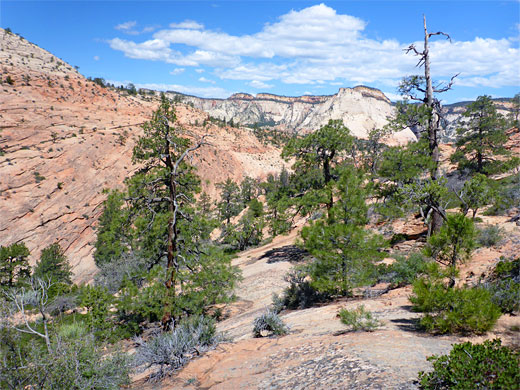
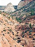
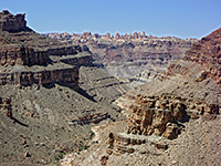
Another little stream joints from the west, flowing down bare rock slopes, not too steeply. This is followed for a while, soon turning south along a ravine, and later climbing a little to a lengthy, gently sloping ridge on the east side, leading eventually to a sandy saddle, at the divide between the Clear Creek and Parunuweap drainages. Ahead, the views are rather different to before, more open, with extensive undulating slickrock and the red cliffs of Parunuweap visible on the horizon.
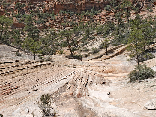
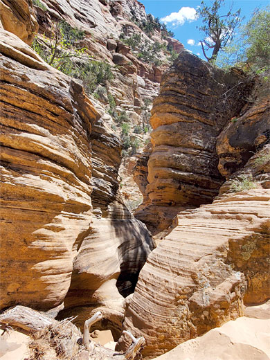
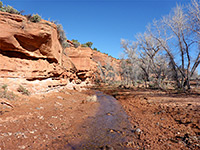
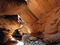
A sagebrush and manzanita flat extends to the south of the divide, and at the west edge is another shallow stream, with the same dark-colored water. This stream forms the East Fork of Crawford Wash; it soon reaches a cluster of pine trees and starts a big descent, steadily down in several stages, some steeper drops between more level sections. After a mile it meets the main fork of the canyon, joining below a sheer dryfall, passed to the left. The canyon then has a small drop and possible pool, after which it remains almost level for the final half mile to the Parunuweap confluence - a flat, tree-lined floor between tall striated cliffs on both sides, very pretty scenery. The floor is a mix of sandy patches and rock. Just before the end is a short, twisting slot containing a few potholes, as the drainage briefly splits into two channels - the main one is wider, and slopes down to another little slot at the brink of the 300 foot drop, often a very windy place. Parunuweap Canyon at this point is wide, quite overgrown below, lined by dark red walls, rather less spectacular than the confined section a few miles upstream.
Starting from Hwy 9, the route is across the usually dry streambed of Clear Creek, up a slickrock slope beside a seasonal waterfall (Cockeye Falls, an unofficial name), then along the partly wooded drainage above, later climbing more slickrock slopes, passing over a sandy saddle and descending to the upper end of the East Fork of Crawford Wash. This drops down steadily and meets the almost flat streambed of the lower canyon, which leads to Parunuweap.
The route is not marked in any way, and the canyon is very rarely explored. The hike offers spectacular views all the way, initially of the white cliffs and domes of the Clear Creek drainage, later of the more uniformly red rock area around Crawford and Parunuweap. Bighorn sheep are often spotted, while little streams and seeps provide good habitat for wildflowers. The round-trip, just under 6 miles, takes from 4 to 5 hours or more.

Crawford Wash Video
Parking
There are two possible parking places for the Crawford Wash hike, along Hwy 9 either side of Cockeye Falls, 1.7 miles from the Zion-Mt Carmel tunnel entrance - on the north side of the falls just to the west, or on the east side, around a bend. The falls, which flow properly only in the spring, are formed where an unnamed stream cascades 50 feet down a red slickrock slope, in several stages.
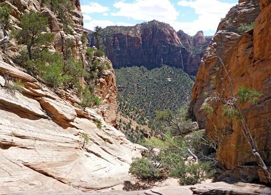
Cockeye Falls Canyon
From the western parking place, a short hike on a path descends to the stony bed of Clear Creek, at the base of Cockeye Falls. The route up is via a steeply angled slope just east of the falls, a climb that is mostly easy, with just a few slightly steeper places that need more care. The gradient lessens, the smooth rock giving way to a sandy, bushy bench which leads southwards to the brink of the falls, at the mouth of a hanging canyon. For most of the year the stream is very shallow, its waters dark brown due to tannin. Beyond, the stream soon becomes enclosed, shaded by tall trees; the route now is up another slope to the east, just before the enclosed part, then traversing south into the shallower upper reaches of the canyon, which is still quite densely wooded around the streambed.
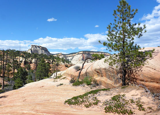
The Divide
Another little stream joints from the west, flowing down bare rock slopes, not too steeply. This is followed for a while, soon turning south along a ravine, and later climbing a little to a lengthy, gently sloping ridge on the east side, leading eventually to a sandy saddle, at the divide between the Clear Creek and Parunuweap drainages. Ahead, the views are rather different to before, more open, with extensive undulating slickrock and the red cliffs of Parunuweap visible on the horizon.
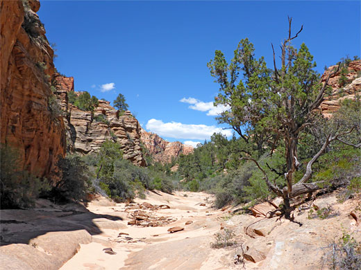
Crawford Wash
A sagebrush and manzanita flat extends to the south of the divide, and at the west edge is another shallow stream, with the same dark-colored water. This stream forms the East Fork of Crawford Wash; it soon reaches a cluster of pine trees and starts a big descent, steadily down in several stages, some steeper drops between more level sections. After a mile it meets the main fork of the canyon, joining below a sheer dryfall, passed to the left. The canyon then has a small drop and possible pool, after which it remains almost level for the final half mile to the Parunuweap confluence - a flat, tree-lined floor between tall striated cliffs on both sides, very pretty scenery. The floor is a mix of sandy patches and rock. Just before the end is a short, twisting slot containing a few potholes, as the drainage briefly splits into two channels - the main one is wider, and slopes down to another little slot at the brink of the 300 foot drop, often a very windy place. Parunuweap Canyon at this point is wide, quite overgrown below, lined by dark red walls, rather less spectacular than the confined section a few miles upstream.
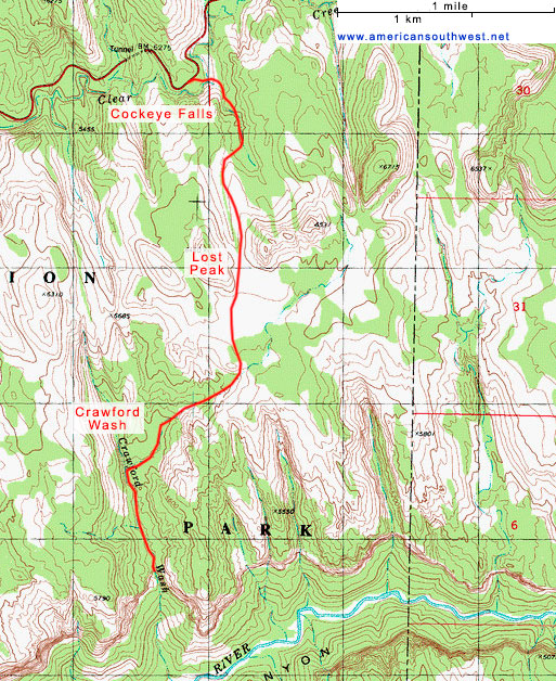
Topographic Map of Crawford Wash
Crawford Wash - Similar Hikes
All Contents © Copyright The American Southwest | Comments and Questions | Contribute | Affiliate Marketing Disclosure | Site Map