Highlights:
Extensive dunes of light-colored sand, popular mainly for camping and ORV recreation, but also quite scenic, especially where the sands rise up to a narrow ridge (Sand Mountain), the top of which gives good views over the adjacent Sevier Desert
Nearby town:
Nephi, 27 miles
Management:
Location:
Seasons:
All year
Rating (1-5):
★★★★★
Weather:


Little Sahara is part of the Great Basin Desert itinerary
Featured Hotel
Best Western Paradise Inn of Nephi
 Well-established hotel with indoor pool, on the south side of Nephi, beside I-15, one block from a restaurant. 29 miles from Little Sahara
Check Rates
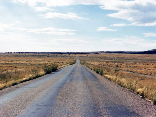
The western quarter of Utah is very desolate with few towns or paved roads - beyond I-15 at the foot of the central mountains the land becomes mostly flat interrupted only by occasional ranges of hills, part of the Great Basin Desert that stretches across Nevada.
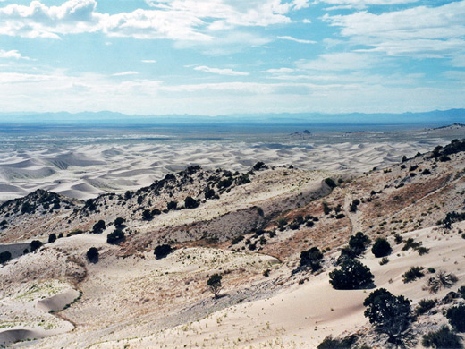
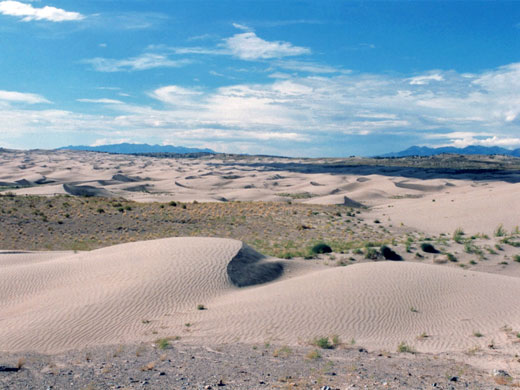
At the edge of this forgotten region lies the largest expanse of sand dunes in the state, contained within the Little Sahara Recreation Area (120 square miles), a BLM-managed location popular for camping, hiking, exploring and photography but which is mainly known as a center for off road vehicle use.
At the edge of this forgotten region lies the largest expanse of sand dunes in the state, contained within the Little Sahara Recreation Area (120 square miles), a BLM-managed location popular for camping, hiking, exploring and photography but which is mainly known as a center for off road vehicle use.
Location
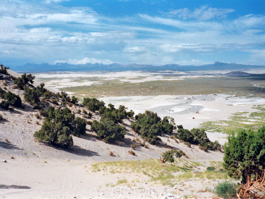
The nearest main road leading to the Little Sahara region is US 6 from Provo to US 93 in Nevada - one of only four paved routes that cross the state border. This skirts the edge of the Sevier Desert, part of a huge empty area of mud flats and salt plains which also includes the Great Salt Lake Desert; all this area was once under the waters of ancient Lake Bonneville. The entrance road to the Recreation Area leaves US 6 near Jericho, a lonely stop on the Union Pacific railway between Salt Lake City and Las Vegas. After a few miles it passes a visitor center and the entrance station (the entry fee, in 2020, is a rather steep $18, but this includes an overnight stay) and leads into the center of the dunes; the vegetation becomes more and more sparse and the road finally ends, White Sands National Monument style, in a large flat area of compressed sand with dunes all around.
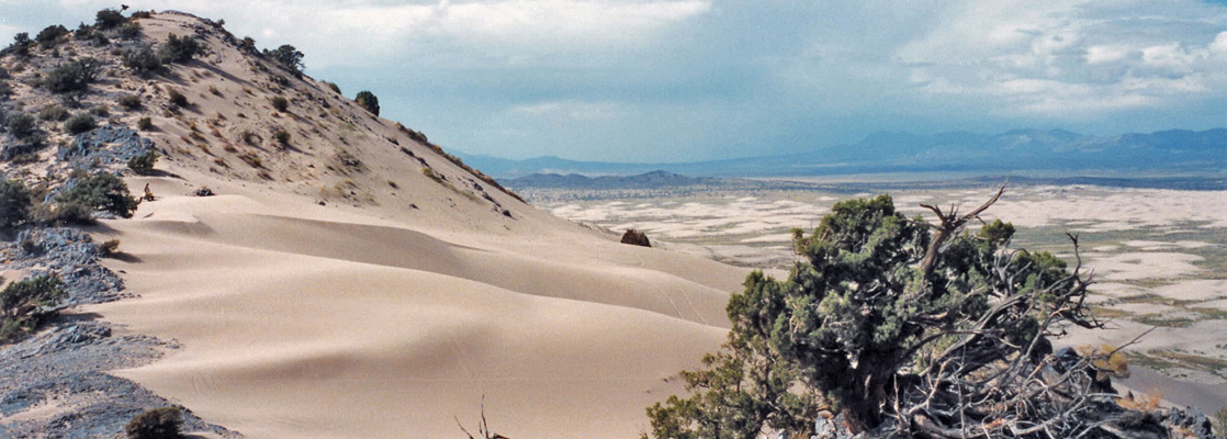
Sand Mountain
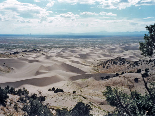
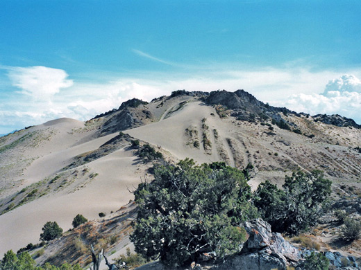
Little Sahara Recreation Area seems quite popular; many visitors bring large RVs with dune buggies or other off road vehicles in tow and stay for some time. There are four official campsites and dispersed camping is allowed anywhere away from the road. The most impressive location is Sand Mountain - an elongated ridge, highest point of which is almost 700 feet above the dunes with steep, smooth slopes of sand devoid of any plants; these represent the biggest challenge for the ORV crowd. The mountain can also be climbed on foot. This is difficult but rather fun, especially when sliding back down - the ascent takes half an hour but only a few minutes are needed to return. Some parts of the hillside have outcrops of weathered, bluish grey sandstone which help when scrambling up, and the ridge on top is formed by the same rock. From here there are great views over vast areas of undulating sand, stretching away to the southwest, a view only slightly spoiled by a power station a few miles away. The top is usually very windy with much airborne sand blown by the prevailing southerly winds - not a good place for expensive camera equipment.
Other Areas of Little Sahara
Most of the northwest corner of Little Sahara is off limits to all vehicles to provide a sheltered habitat for desert plants and wildlife, which includes mule deer, pronghorn antelope, snakes and birds of prey. This is designated the Rockwell Natural Area, and is a good place for backpacking trips. The highest peak in the main recreation area is 5,828 foot Black Mountain, another popular ORV location with many trails criss-crossing the grassy slopes.
Little Sahara - Nearby Places
- Nebo Loop Scenic Byway (40 miles) - winding road through the Wasatch Mountains
- Salt Lake Desert (110 miles) - great expanse of white desert
Little Sahara - Similar Places
- Great Sand Dunes National Park, Colorado - large sand dunes
- White Sands National Monument, New Mexico - many miles of pure white gypsum dunes
All Contents © Copyright The American Southwest | Comments and Questions | Contribute | Affiliate Marketing Disclosure | Site Map