


Highlights:
Badlands, hoodoos and small amounts of petrified wood along the convoluted edge of a broad, low, wooded plateau southwest of Cuba. Rocks are from the Nacimiento Formation; shale, mudstone and sandstone, generally rather dull in color
Nearby town:
Bernalillo, 69 miles
Management:
BLM
Location:
Along a short track off Hwy 197, 6 miles southwest of Cuba
Seasons:
All year
Rating (1-5):
★★★★★


Mesa de Cuba is a wooded plateau on the southwest side of Cuba in northwestern New Mexico, mostly within the Santa Fe National Forest, about 6 miles by 2 miles in extent. Rocks across the upper reaches are from the San Jose Formation, while those along the lower edges are from the Naciemento Formation, a mix of thin layers of shale, siltstone and sandstone, of differing colors and hardness. Along with the Fruitland Formation and the Kirtland Shale, the Naciemento is one of the principal strata of the many badland areas in this part of the state, also occurring for example at Bisti, the most well-known region.
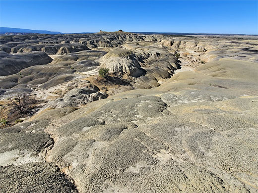
At Mesa de Cuba, most of the area is vegetated, but some good badland scenery is found along the lower south edge of the plateau, in particular a narrowish band at the southwestern tip, explored by an off-trail hike taking a few hours, over flats, mounds and small ridges. Like all the other New Mexico badlands, here are found hoodoos, multicolored rocks, and pieces of petrified wood, though in general there are not so many photogenic scenes here.
The Mesa de Cuba Badlands are easily accessed by a short drive along a unpaved track off Hwy 197 from Cuba.
At Mesa de Cuba, most of the area is vegetated, but some good badland scenery is found along the lower south edge of the plateau, in particular a narrowish band at the southwestern tip, explored by an off-trail hike taking a few hours, over flats, mounds and small ridges. Like all the other New Mexico badlands, here are found hoodoos, multicolored rocks, and pieces of petrified wood, though in general there are not so many photogenic scenes here.
The Mesa de Cuba Badlands are easily accessed by a short drive along a unpaved track off Hwy 197 from Cuba.
Mesa de Cuba Badlands Table of Contents
Location
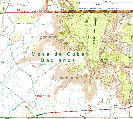
Map of badlands in the San Juan Basin.
Photographs
20 views of the Mesa de Cuba Badlands.
Access to Mesa de Cuba
Five miles southwest of Cuba, Hwy 197 passes a track with unlocked gate, on the south side, a good place for free primitive camping, as is an ungated track close by, on the north side; both are within sight of the edge of the badlands to the north. The main entrance is 1.2 miles further; a similarly dusty, clayish track, likely impassable if wet, heading north and after a short distance passing a flat area next to a pond, the usual parking place, though there are several other possible places further on. From the pond, walking northeast for a quarter of a mile, over the flats, reaches the edge of the band of formations; a promontory projecting southwest off the mesa.
Formations
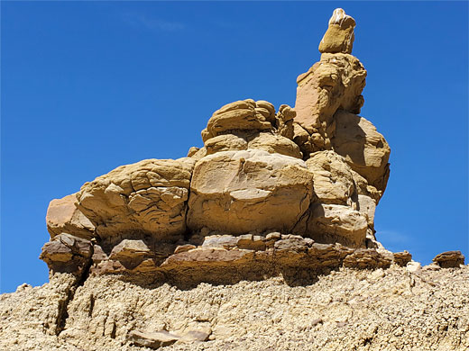
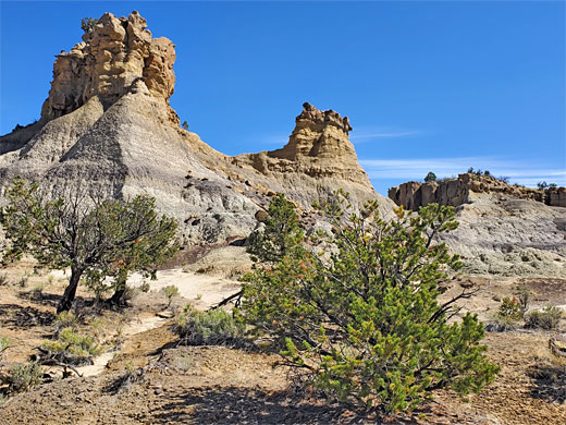
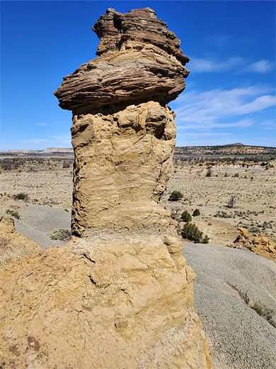
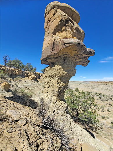
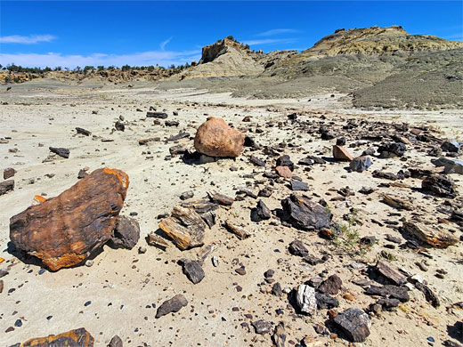
The badlands have a general appearance of undulating mounds at the lower level, colored pale shades of grey and purple, plus white, topped by a few Bisti-like striated structures, and containing a thin layer of petrified wood; the pieces though are not numerous and not particularly colorful. Above these lower strata is a layer of harder, darker brown sandstone which has the best hoodoos and eroded formations. Higher up, generally more towards the main body of the mesa, are bushy, boulder-covered slopes, not so distinctive. The best area seems to be about half a mile north, up and over a couple of minor ridges, separated by empty basins; here found a few larger and more impressive hoodoos. Beyond this, further north, the sides of the mesa seem to be more vegetated and the eroded rocks less spectacular.
Mesa de Cuba Badlands - Nearby Places
- San Jose Badlands (27 miles) - more badlands, just east of the continental divide
- Penistaja Mesa (13 miles) - grey badlands, rock formations and petrified wood
Mesa de Cuba Badlands - Similar Places
- Ah-Shi-Sle-Pah, New Mexico - hoodoos, badlands and other eroded rocks
- Ceja Pelon Mesa, New Mexico - branched ravines, pinnacles, balanced rocks and petrified wood
All Contents © Copyright The American Southwest | Comments and Questions | Contribute | Affiliate Marketing Disclosure | Site Map